Skip to content

The Atlas

Cities

A city is a local government of more built-up barangays, led by a mayor, a vice mayor and the Sangguniang Panlungsod, the city council.[1] Only Congress can make a city, by law, approved in a plebiscite. Since 2001 the law asks for an income of ₱100 million a year and either 100 km² of land or 150,000 people.[1, 2]

A city of 200,000 people and ₱50 million a year can be declared highly urbanized by the President, after a plebiscite.[1] Highly urbanized cities, and independent component cities whose voters do not vote for the province's officials, govern themselves apart from their province; a component city is part of it.[3]
Caloocan CityLas Piñas CityMakati CityMalabon CityMandaluyong CityManilaMarikina CityMuntinlupa CityNavotas CityParañaque CityPasay CityPasig CityQuezon CitySan Juan CityTaguig CityValenzuela CityTabuk CityBaguio CityBatac CityLaoag CityCandon CityVigan CitySan Fernando CityAlaminos CityDagupan CitySan Carlos CityUrdaneta CityTuguegarao CityCauayan CityIlagan CitySantiago CityBalanga CityBaliwag CityMalolos CityMeycauayan CitySan Jose Del Monte CityCabanatuan CityGapan CityScience City of MuñozPalayan CitySan Jose CityMabalacat CitySan Fernando CityTarlac CityAngeles CityOlongapo CityBatangas CityCalaca CityLipa CitySto. Tomas CityTanauan CityBacoor CityCarmona CityCavite CityDasmariñas CityGeneral Trias CityImus CityTagaytay CityTrece Martires CityBiñan CityCabuyao CityCalamba CitySan Pablo CitySan Pedro CitySanta Rosa CityTayabas CityAntipolo CityLucena CityCalapan CityPuerto Princesa CityLegazpi CityLigao CityTabaco CityIriga CityNaga CityMasbate CitySorsogon CityRoxas CityPassi CityIloilo CityBago CityCadiz CityEscalante CityHimamaylan CityKabankalan CityLa Carlota CitySagay CitySan Carlos CitySilay CitySipalay CityTalisay CityVictorias CityBais CityBayawan CityCanlaon CityDumaguete CityGuihulngan CityTanjay CityBacolod CityTagbilaran CityBogo CityCarcar CityDanao CityNaga CityTalisay CityToledo CityCebu CityLapu-Lapu CityMandaue CityBorongan CityBaybay CityOrmoc CityCalbayog CityCatbalogan CityMaasin CityTacloban CityDapitan CityDipolog CityPagadian CityIsabela CityZamboanga CityMalaybalay CityValencia CityOroquieta CityOzamiz CityTangub CityEl Salvador CityGingoog CityCagayan De Oro CityIligan CityPanabo CityIsland Garden City of SamalTagum CityDigos CityMati CityDavao CityKidapawan CityKoronadal CityTacurong CityGeneral Santos CityCabadbaran CityBayugan CitySurigao CityBislig CityTandag CityButuan CityLamitan CityMarawi CityCotabato City

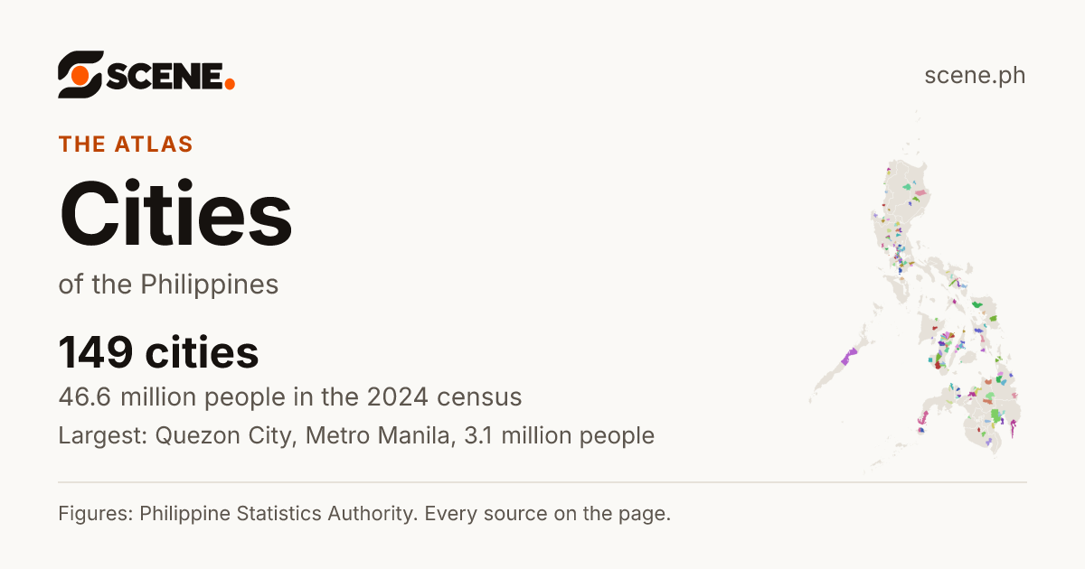
Map of the Philippines, every city in a colour of its own

Caloocan CityLas Piñas CityMakati CityMalabon CityMandaluyong CityManilaMarikina CityMuntinlupa CityNavotas CityParañaque CityPasay CityPasig CityQuezon CitySan Juan CityTaguig CityValenzuela CityTabuk CityBaguio CityBatac CityLaoag CityCandon CityVigan CitySan Fernando CityAlaminos CityDagupan CitySan Carlos CityUrdaneta CityTuguegarao CityCauayan CityIlagan CitySantiago CityBalanga CityBaliwag CityMalolos CityMeycauayan CitySan Jose Del Monte CityCabanatuan CityGapan CityScience City of MuñozPalayan CitySan Jose CityMabalacat CitySan Fernando CityTarlac CityAngeles CityOlongapo CityBatangas CityCalaca CityLipa CitySto. Tomas CityTanauan CityBacoor CityCarmona CityCavite CityDasmariñas CityGeneral Trias CityImus CityTagaytay CityTrece Martires CityBiñan CityCabuyao CityCalamba CitySan Pablo CitySan Pedro CitySanta Rosa CityTayabas CityAntipolo CityLucena CityCalapan CityPuerto Princesa CityLegazpi CityLigao CityTabaco CityIriga CityNaga CityMasbate CitySorsogon CityRoxas CityPassi CityIloilo CityBago CityCadiz CityEscalante CityHimamaylan CityKabankalan CityLa Carlota CitySagay CitySan Carlos CitySilay CitySipalay CityTalisay CityVictorias CityBais CityBayawan CityCanlaon CityDumaguete CityGuihulngan CityTanjay CityBacolod CityTagbilaran CityBogo CityCarcar CityDanao CityNaga CityTalisay CityToledo CityCebu CityLapu-Lapu CityMandaue CityBorongan CityBaybay CityOrmoc CityCalbayog CityCatbalogan CityMaasin CityTacloban CityDapitan CityDipolog CityPagadian CityIsabela CityZamboanga CityMalaybalay CityValencia CityOroquieta CityOzamiz CityTangub CityEl Salvador CityGingoog CityCagayan De Oro CityIligan CityPanabo CityIsland Garden City of SamalTagum CityDigos CityMati CityDavao CityKidapawan CityKoronadal CityTacurong CityGeneral Santos CityCabadbaran CityBayugan CitySurigao CityBislig CityTandag CityButuan CityLamitan CityMarawi CityCotabato City
Every city in a colour of its own, no two side by side alike.

At a glance

CitiesCity classA highly urbanized city or an independent component city governs itself apart from the province around it: its voters do not elect the governor. A component city is part of its province.More in the glossary
149[4]
33 highly urbanized, 5 independent component, 111 component
People, 2024CensusA count of every person in the country, all on one day. The 2024 census counted people as they were on 1 July 2024.More in the glossary
46,636,790[5]
About 41 of every 100 people in the country live in a city.
Land areaLand areaThe land inside the place's official boundary. A square kilometre is a square 1 km on each side, about the size of 140 football fields.More in the glossary
36,971.09 km²[6]
Each city's official area, added up.
Most people
Quezon City[5]
Metro Manila
3,084,270 people
Fewest people
Palayan City[5]
Nueva Ecija
47,883 people
Largest by landLand areaThe land inside the place's official boundary. A square kilometre is a square 1 km on each side, about the size of 140 football fields.More in the glossary
Davao City[6]
Davao del Sur
2,799.54 km²
Most crowdedPopulation densityHow crowded a place is on average: its people divided by its land area. 1,000 people per square kilometre is 10 people per hectare, a square of 100 by 100 metres.More in the glossary
Manila[6]
Metro Manila
45,430 people per km²
Fastest growingGrowth a yearHow fast the number of people changed each year between two censuses. 1% a year means about 1 more person for every 100 people, each year.More in the glossary
Biñan City[5]
Laguna
9.04% a year, 2020 to 2024
Fewer people than in 2020Growth a yearHow fast the number of people changed each year between two censuses. 1% a year means about 1 more person for every 100 people, each year.More in the glossary
13 cities[5]
The steepest fall: Imus City, −0.72% a year.

Each row is a city, with its 2024 census figures. Choose a column heading or a sort button to order the list, and choose it again to turn the order round. Narrow it with the menus.

149 cities, 1 to 50 shown, most people first.

Cities, most people
RankNamePeople, 2024People per km²Land areaGrowth, 2020–2024
1Quezon CityHighly urbanized city · Metro Manila3,084,27018,431167.34 km²0.99% a year
2ManilaHighly urbanized city · Metro Manila1,902,59045,43041.88 km²0.72% a year
3Davao CityHighly urbanized city · Davao del Sur1,848,9476602,799.54 km²0.96% a year
4Caloocan CityHighly urbanized city · Metro Manila1,712,94530,26956.59 km²0.73% a year
5Taguig CityHighly urbanized city · Metro Manila1,308,08530,22443.28 km²1.61% a year
6Zamboanga CityHighly urbanized city · Zamboanga del Sur1,018,8496631,537.50 km²1.01% a year
7Cebu CityHighly urbanized city · Cebu965,3323,293293.17 km²0.03% a year
8Antipolo CityComponent city · Rizal913,7127,502121.80 km²0.70% a year
9Pasig CityHighly urbanized city · Metro Manila853,05024,51334.80 km²1.46% a year
10Dasmariñas CityComponent city · Cavite744,5118,25890.16 km²1.38% a year
11Cagayan De Oro CityHighly urbanized city · Misamis Oriental741,6171,294573.29 km²0.43% a year
12Valenzuela CityHighly urbanized city · Metro Manila725,17315,98445.37 km²0.34% a year
13General Santos CityHighly urbanized city · South Cotabato722,0591,436502.80 km²0.84% a year
14Parañaque CityHighly urbanized city · Metro Manila703,24514,63648.05 km²0.46% a year
15San Jose Del Monte CityComponent city · Bulacan685,6882,433281.86 km²1.22% a year
16Bacoor CityComponent city · Cavite661,38114,42245.86 km²−0.12% a year
17Bacolod CityHighly urbanized city · Negros Occidental624,7873,888160.68 km²0.94% a year
18Las Piñas CityHighly urbanized city · Metro Manila615,54918,68732.94 km²0.36% a year
19Biñan CityComponent city · Laguna584,47914,86839.31 km²9.04% a year
20Calamba CityComponent city · Laguna575,0463,858149.07 km²1.53% a year
21Muntinlupa CityHighly urbanized city · Metro Manila552,22514,02339.38 km²0.39% a year
22Lapu-Lapu CityHighly urbanized city · Cebu497,8138,45358.89 km²0.01% a year
23Angeles CityHighly urbanized city · Pampanga483,4527,62263.43 km²1.05% a year
24General Trias CityComponent city · Cavite482,4535,62085.84 km²1.65% a year
25Imus CityComponent city · Cavite481,9498,97553.70 km²−0.72% a year
26Iloilo CityHighly urbanized city · Iloilo473,7286,04778.34 km²0.83% a year
27Marikina CityHighly urbanized city · Metro Manila471,32320,36823.14 km²0.79% a year
28Mandaluyong CityHighly urbanized city · Metro Manila465,90240,69011.45 km²2.18% a year
29Pasay CityHighly urbanized city · Metro Manila453,18625,02418.11 km²0.67% a year
30Santa Rosa CityComponent city · Laguna430,9207,69855.98 km²0.92% a year
31Tarlac CityComponent city · Tarlac401,8921,521264.21 km²1.01% a year
32Malabon CityHighly urbanized city · Metro Manila389,92923,41916.65 km²0.59% a year
33Lipa CityComponent city · Batangas387,3921,755220.68 km²0.92% a year
34Butuan CityHighly urbanized city · Agusan del Norte385,530557691.70 km²0.80% a year
35Cotabato CityIndependent component city · Maguindanao del Norte383,3832,178175.99 km²4.04% a year
36San Fernando CityComponent city · Pampanga377,5345,42569.59 km²1.51% a year
37Baguio CityHighly urbanized city · Benguet368,4266,40557.52 km²0.14% a year
38Iligan CityHighly urbanized city · Lanao del Norte368,132592621.70 km²0.33% a year
39Cabuyao CityComponent city · Laguna365,2028,63442.30 km²0.66% a year
40Mandaue CityHighly urbanized city · Cebu364,48214,13325.79 km²0.02% a year
41Batangas CityComponent city · Batangas358,2671,322271.07 km²0.46% a year
42San Pedro CityComponent city · Laguna348,96814,85623.49 km²1.65% a year
43Cabanatuan CityComponent city · Nueva Ecija343,6721,765194.73 km²1.18% a year
44Puerto Princesa CityHighly urbanized city · Palawan316,3841542,048.27 km²0.72% a year
45Makati CityHighly urbanized city · Metro Manila309,77013,81722.42 km²1.37% a year
46Mabalacat CityComponent city · Pampanga306,5941,838166.80 km²1.07% a year
47San Pablo CityComponent city · Laguna300,1661,615185.81 km²1.22% a year
48Tagum CityComponent city · Davao del Norte300,0421,610186.41 km²0.31% a year
49Lucena CityHighly urbanized city · Quezon280,3313,41182.18 km²0.12% a year
50Malolos CityComponent city · Bulacan269,8093,78271.34 km²0.78% a year

How it fits

Cities and municipalities are the local governments of the towns, each led by a mayor, a vice mayor and a council, and each made up of barangays. A municipality becomes a city by a law of Congress, once it earns enough and has enough people or land.

  1. Island groups3Luzon, the Visayas, Mindanao: a grouping, not a government
  2. Regions18Big areas that group provinces
  3. Provinces82Each led by a governor
  4. Cities and municipalities1,642Each led by a mayor
  5. Barangays42,010The smallest unit, led by a punong barangay (kapitan)

Sources

The list shows each place's own figures: people from the PSA's 2024 census, growth from its 2020 census, land areas from the Land Management Bureau's 2019 masterlist. Every figure's source is on its place's page; how Scene works out the rest.

  1. 1.Congress of the Philippines. Republic Act No. 7160: the Local Government Code of 1991. Published October 10, 1991. Read by Scene October 2, 2026. Philippine government work, no copyright (Republic Act No. 8293, Section 176.1). Open the source
  2. 2.Congress of the Philippines. Republic Act No. 9009: amending Section 450 of the Local Government Code, raising the income a municipality needs to become a component city. Published February 24, 2001. Read by Scene October 3, 2026. Philippine government work, no copyright (Republic Act No. 8293, Section 176.1). Open the source
  3. 3.1986 Constitutional Commission. The 1987 Constitution of the Republic of the Philippines. Published February 2, 1987. Read by Scene October 2, 2026. Philippine government work, no copyright (Republic Act No. 8293, Section 176.1). Open the source
  4. 4.Philippine Statistics Authority. Philippine Standard Geographic Code (PSGC), 2nd Quarter 2026: Publication Datafile. Published June 30, 2026. Read by Scene September 24, 2026. CC BY (PSA Terms of Use). Open the source
  5. 5.Philippine Statistics Authority. Population and Annual Population Growth Rate of the Philippines and its Regions, Provinces, and Highly Urbanized Cities Based on the 2010, 2015, 2020 and 2024 Population Census (OpenSTAT table 0211A6DAPG0). Published August 7, 2026. Read by Scene October 2, 2026. CC BY (PSA Terms of Use). Open the source
  6. 6.Philippine Statistics Authority, from the Land Management Bureau (DENR). Population, Land Area, Population Density, and Percent Change in Population Density by Region, Province/Highly Urbanized City, and City/Municipality: 2015, 2020, and 2024 (OpenSTAT table 0221A6DLPD0). Published August 7, 2026. Read by Scene October 2, 2026. CC BY (PSA Terms of Use). Open the source

Scene adds what the sources do not print themselves: growth rates, shares, barangay areas and densities, coordinates, neighbours and distances, each computed from the figures and borders above. How each is made.

See something wrong on this page? Write to hello@scene.ph with the page address. We check every report against the source.