The American era
From the war of 1898 to the eve of the Pacific War: the first surveys, the census atlases, the towns photographed. 135 pictures, 1898 to 1941.
Pictures, page 1 of 3
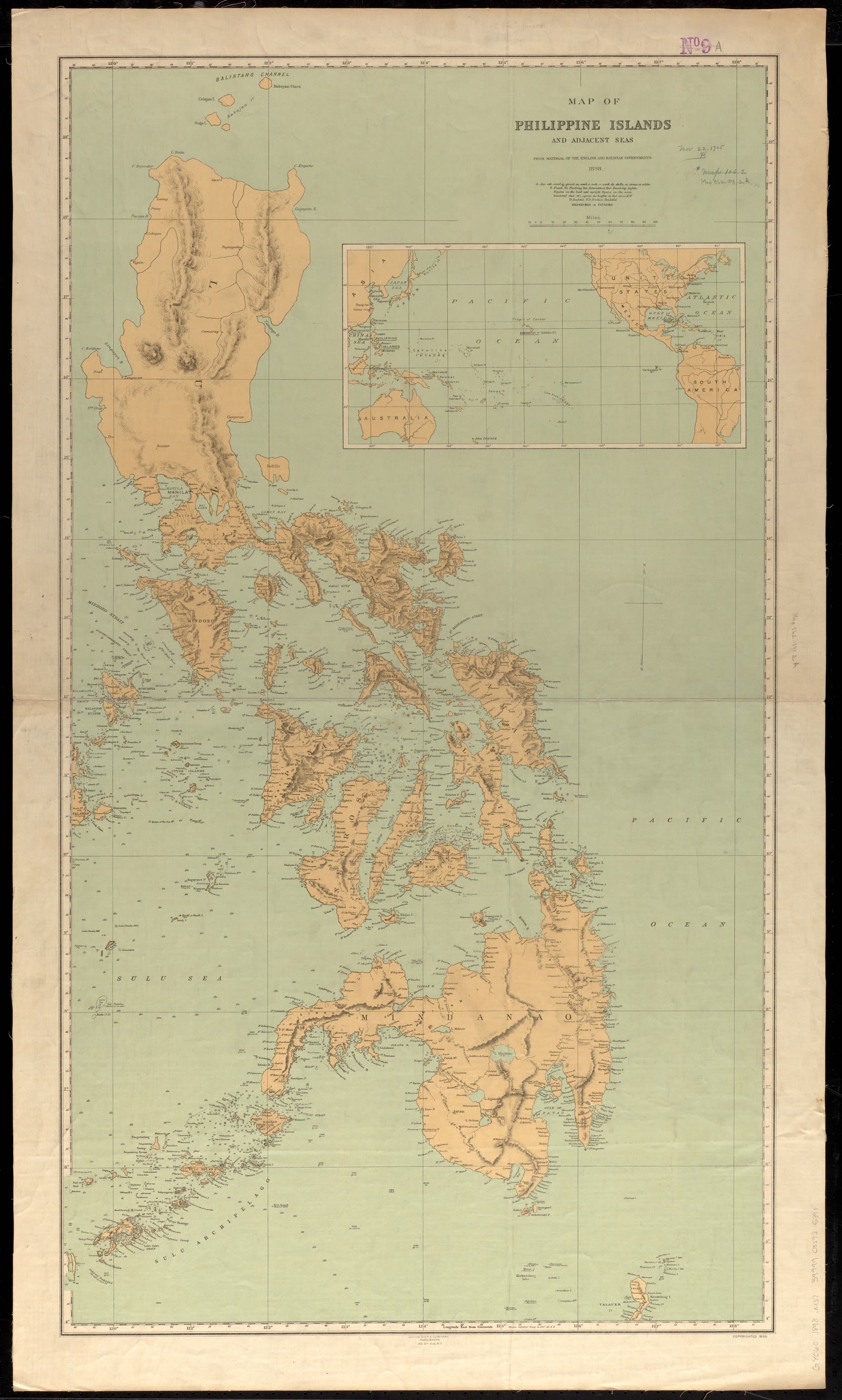
The Philippines
Map of Philippine Islands and adjacent seas : from material of the English and Batavian governments
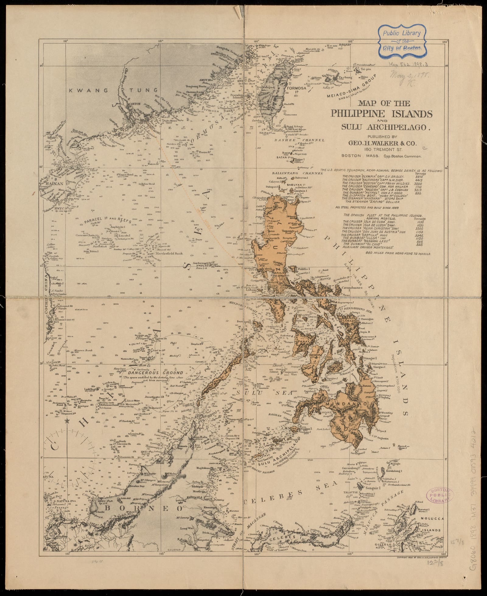
The Philippines
Map of the Philippine Islands and Sulu Archipelago
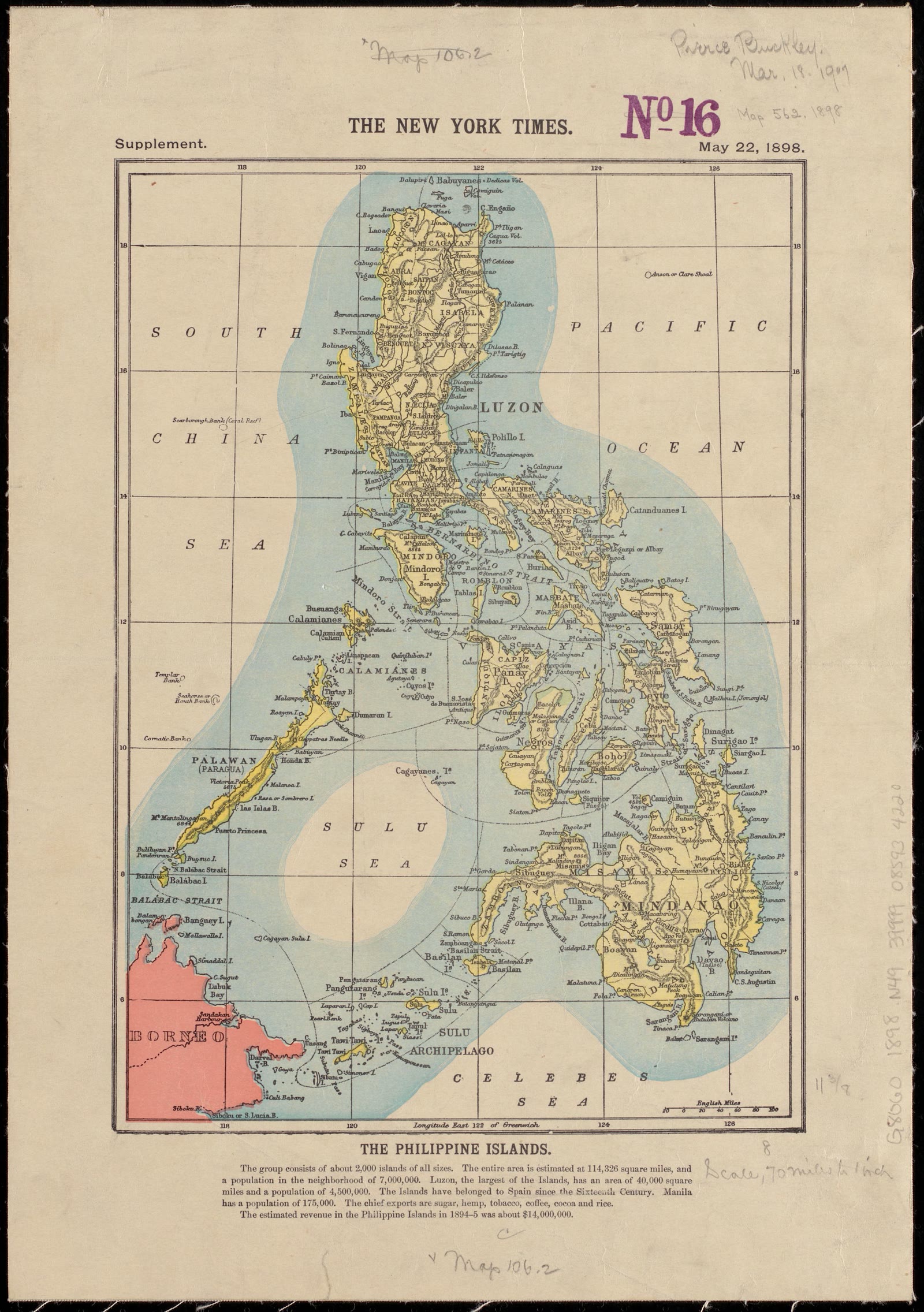
The Philippines
The Philippine Islands
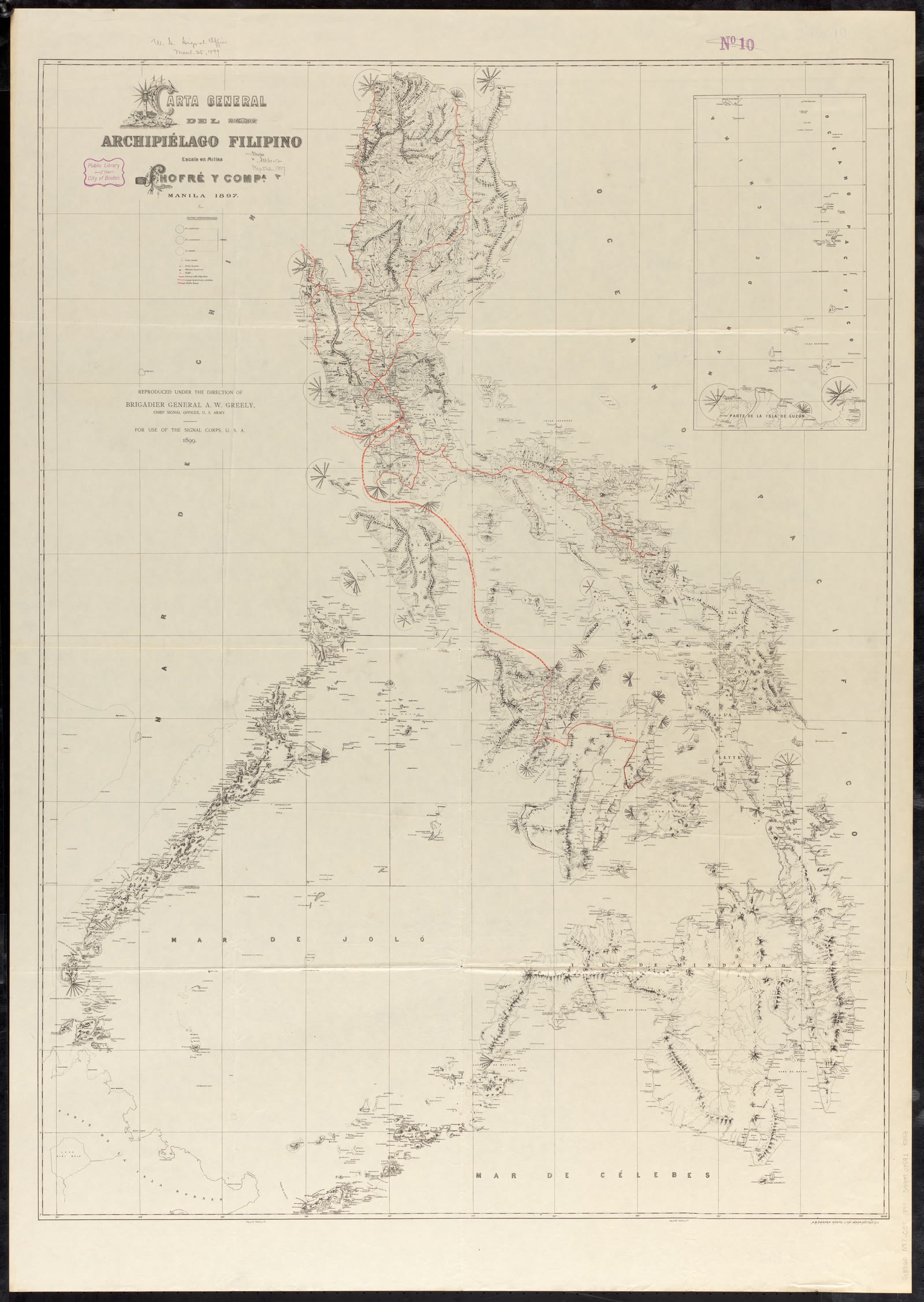
The Philippines
Carta general del Archipiélago Filipino
The Philippines
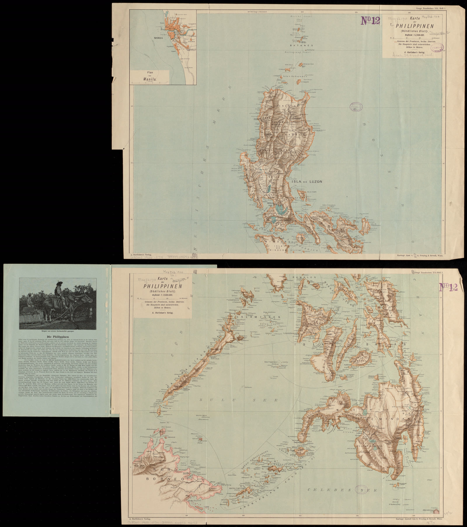
Karte der Philippinen : in zwei sectionen : nördliches und südliches blatt
The Philippines
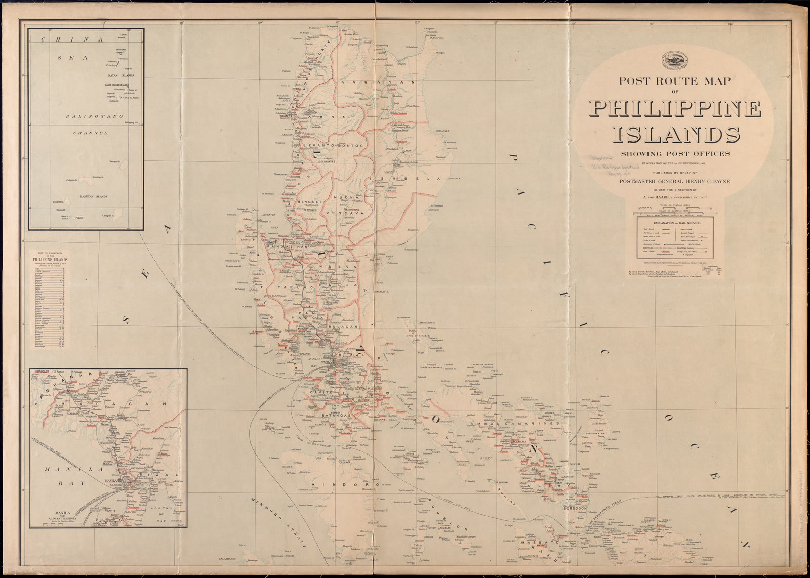
Post route map of Philippine Islands showing post offices in operation on the 1st of December, 1903
Luzon
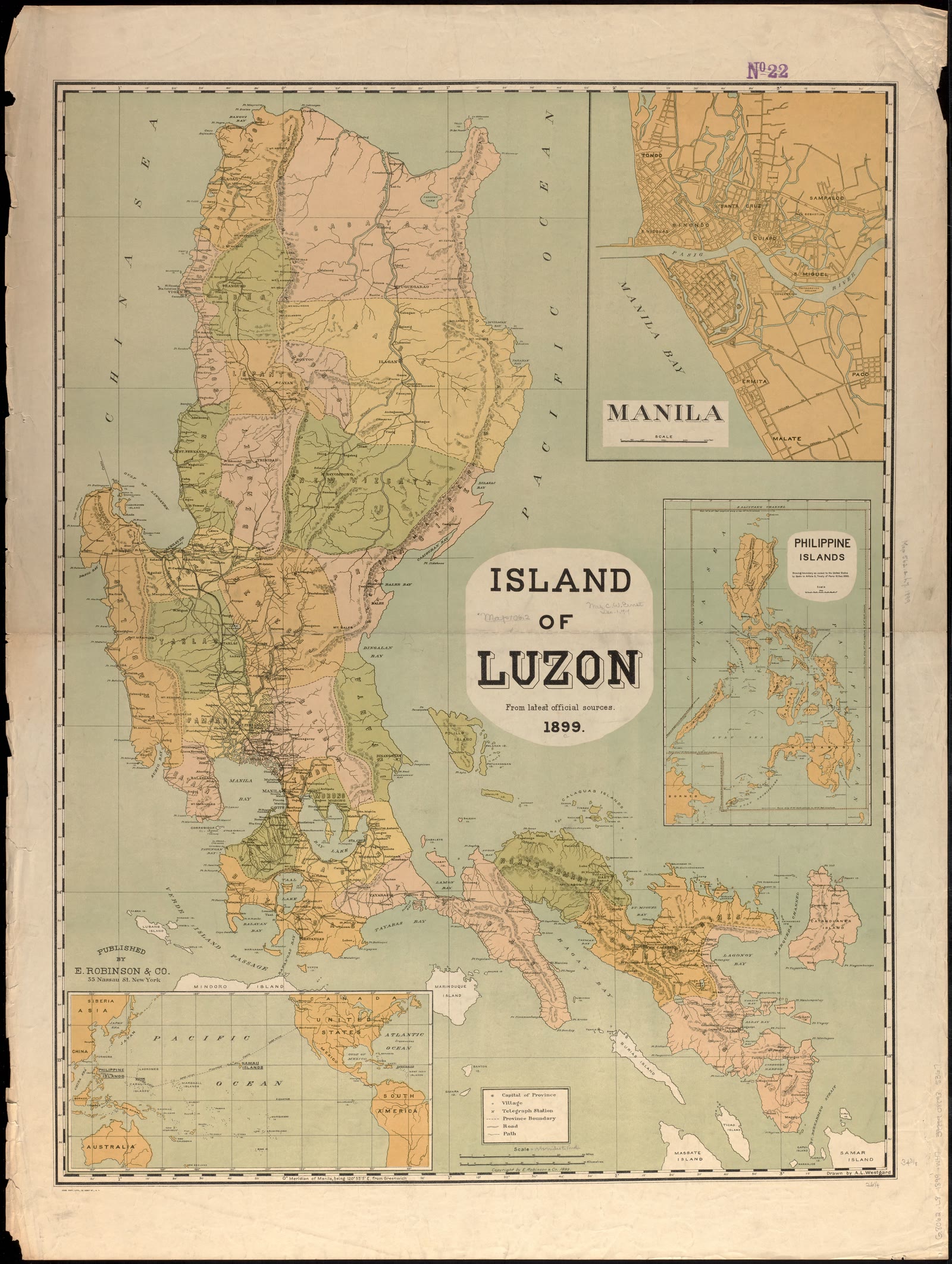
Island of Luzon : from the latest official sources
Luzon
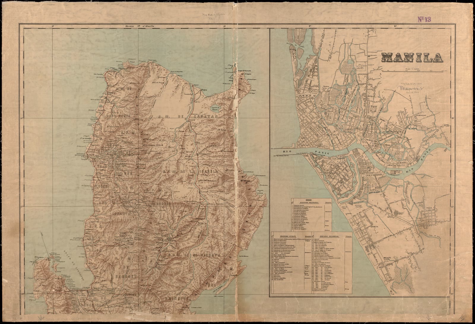
Military map of the isle of Luzon
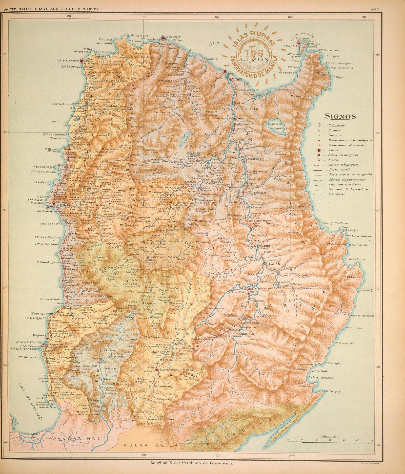
Luzon
Atlas of the Philippine Islands (Atlas de Filipinas), No. 7: Isla de Luzón [The island of Luzon]
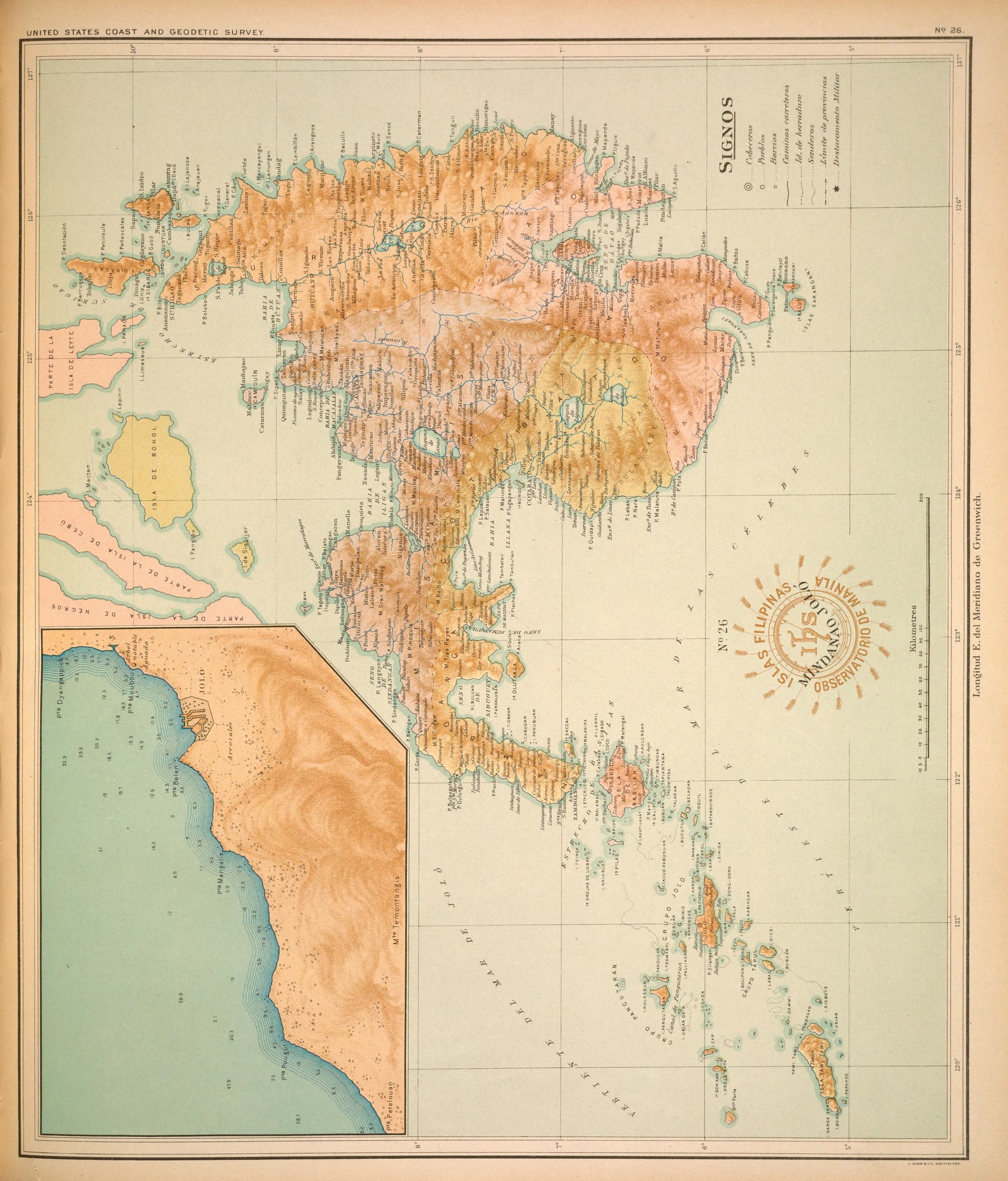
Mindanao
Atlas of the Philippine Islands (Atlas de Filipinas), No. 26: Isla de Mindanao. Mapa general [The island of Mindanao, general map]
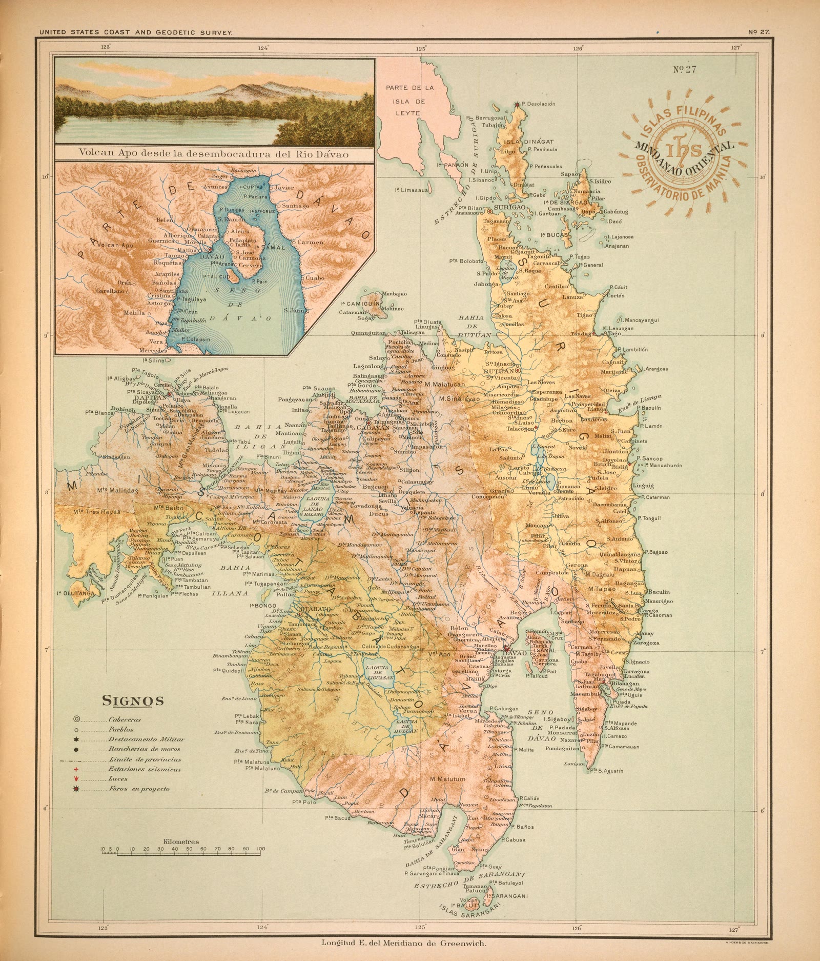
Mindanao
Atlas of the Philippine Islands (Atlas de Filipinas), No. 27: Isla de Mindanao oriental [The island of Mindanao, eastern part]
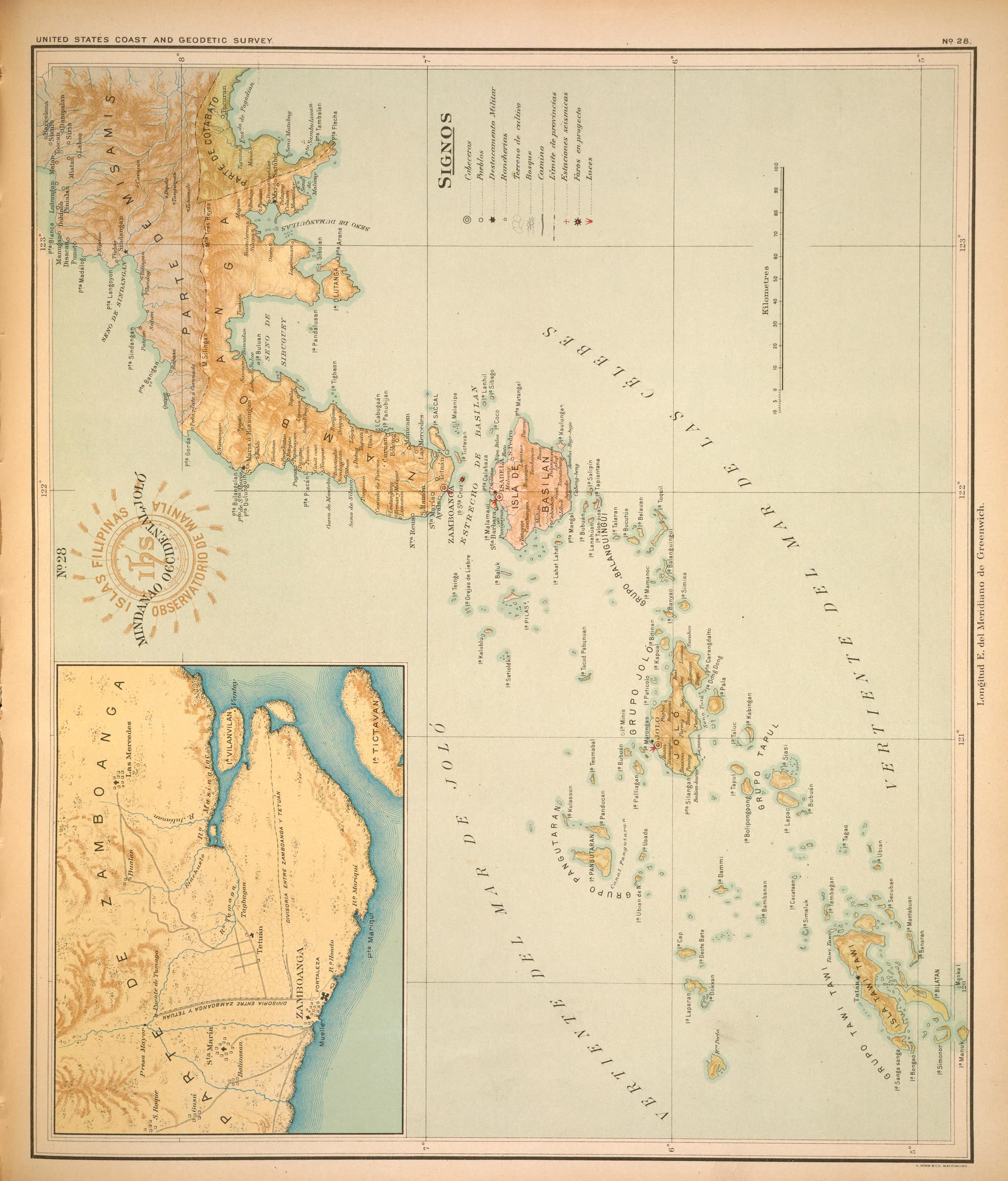
Mindanao
Atlas of the Philippine Islands (Atlas de Filipinas), No. 28: Isla de Mindanao occidental [The island of Mindanao, western part]
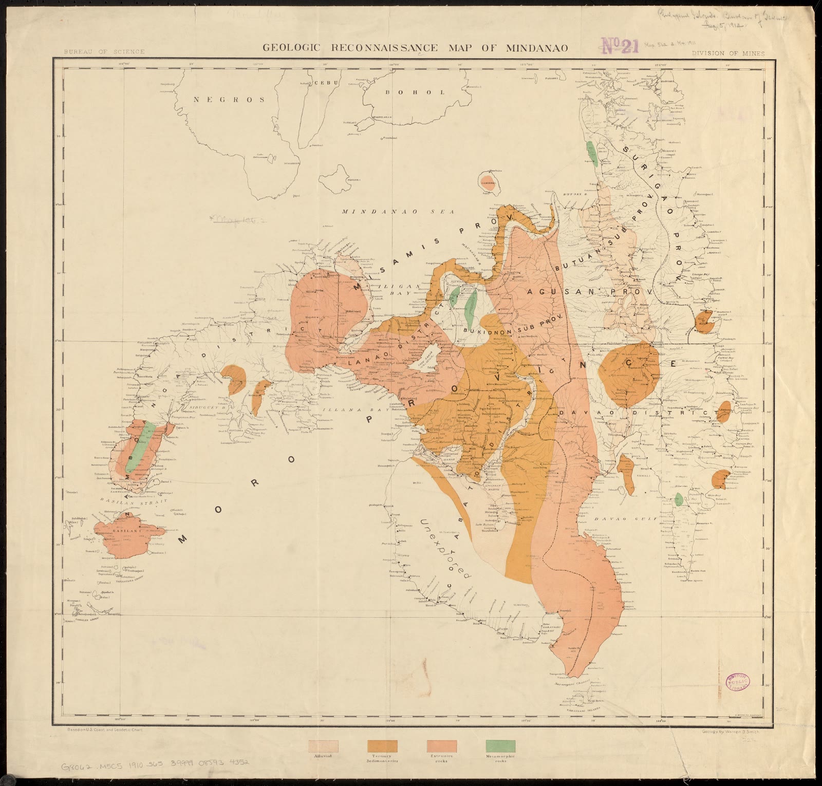
Mindanao
Geologic reconnaissance map of Mindanao
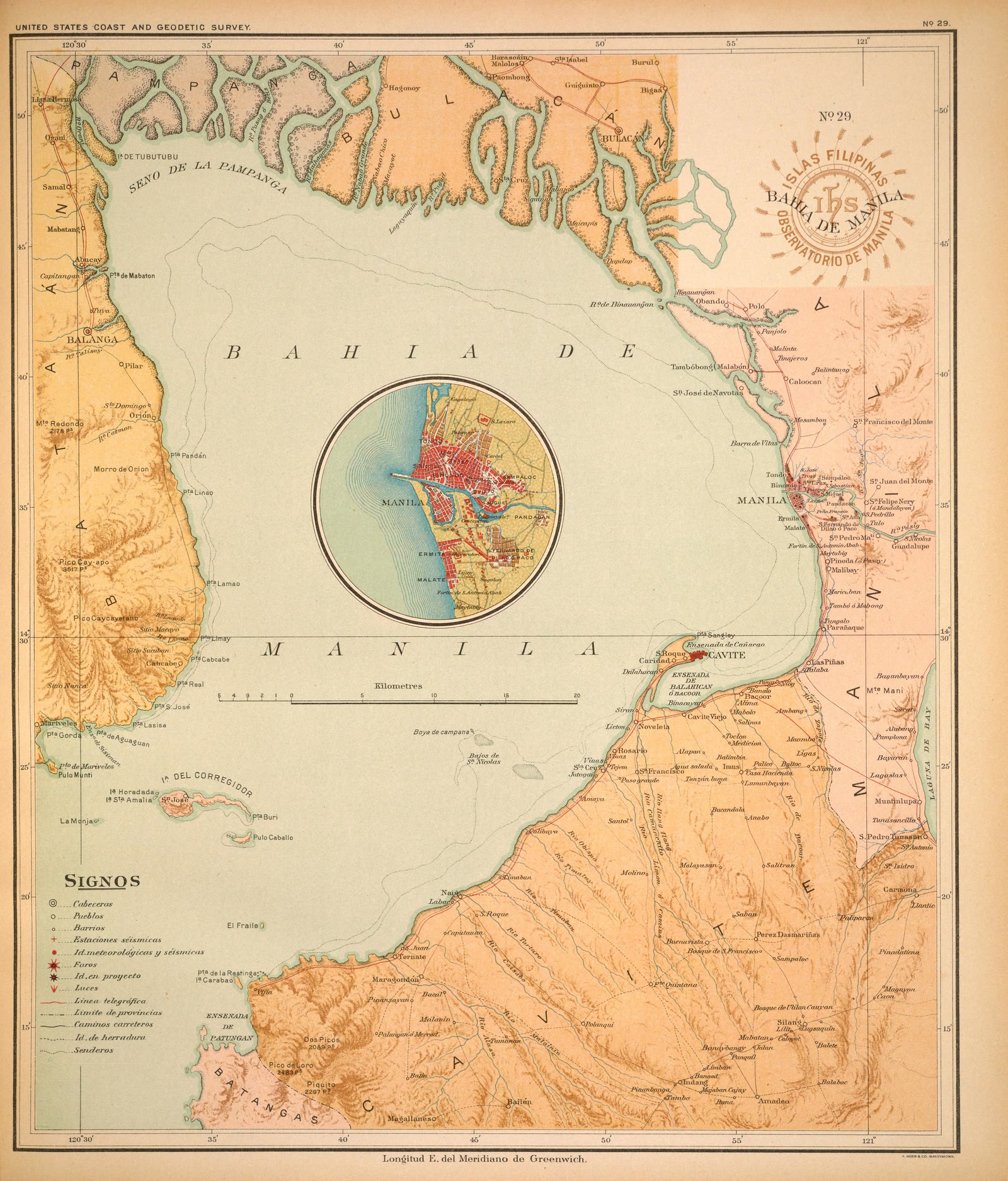
Metro Manila
Atlas of the Philippine Islands (Atlas de Filipinas), No. 29: Bahía de Manila [The bay of Manila]
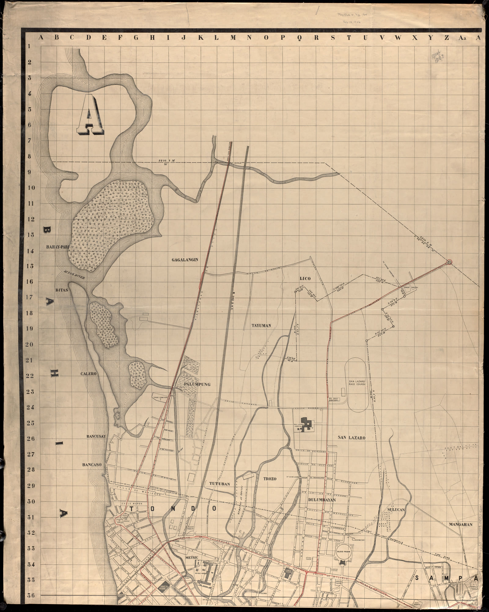
Metro Manila
Index map, city of Manila
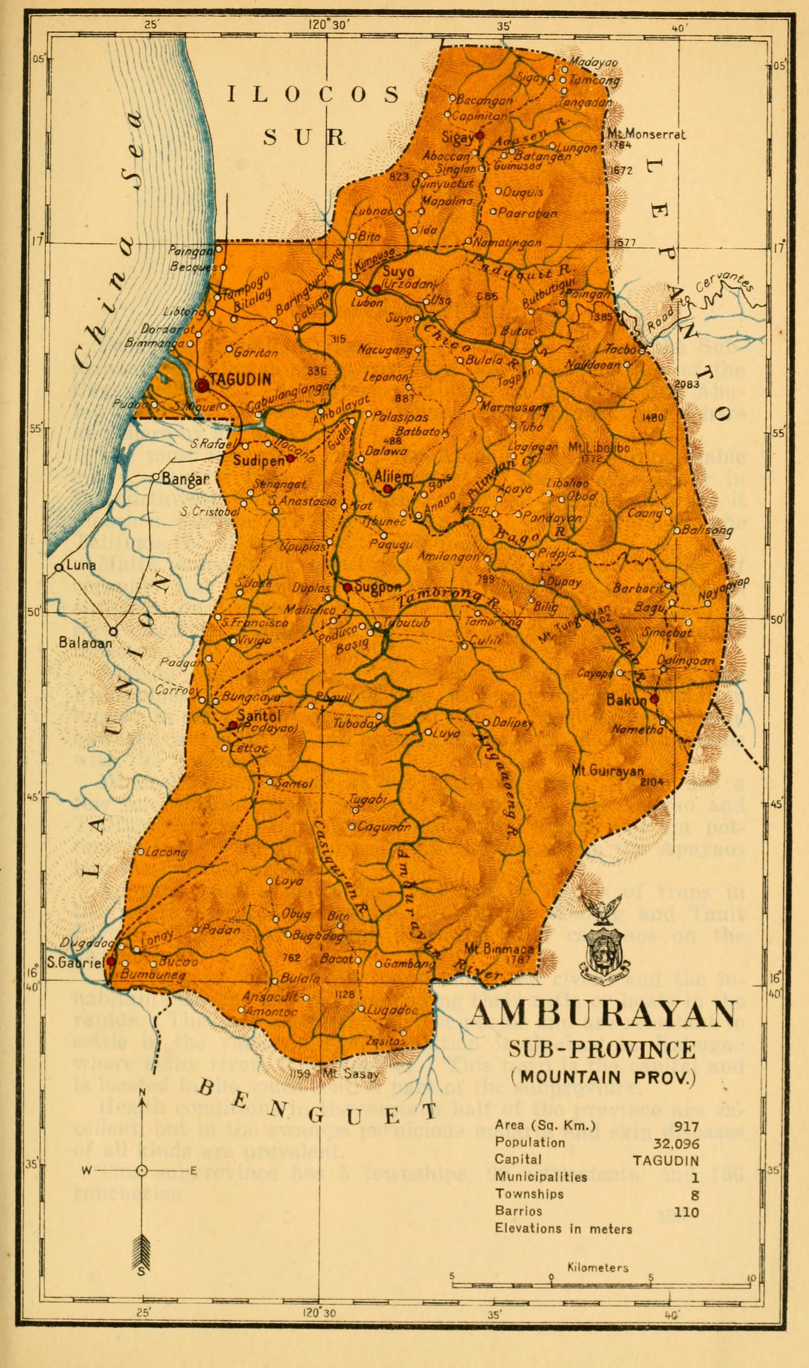
Cordillera Administrative Region
Census of the Philippine Islands taken under the direction of the Philippine Legislature in the year 1918, Volume I, Geography, History, and Climatology: map of AMBURAYAN, Sub-Province (Mountain Prov.)
Cordillera Administrative Region
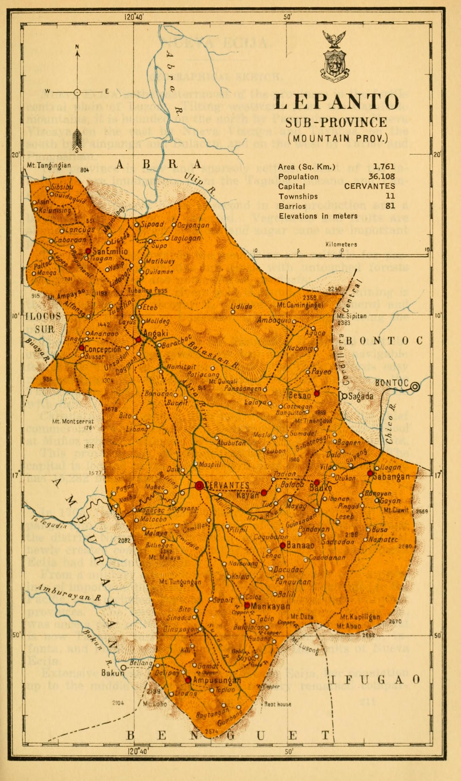
Census of the Philippine Islands taken under the direction of the Philippine Legislature in the year 1918, Volume I, Geography, History, and Climatology: map of LEPANTO, Sub-Province (Mountain Prov.)
Cagayan Valley
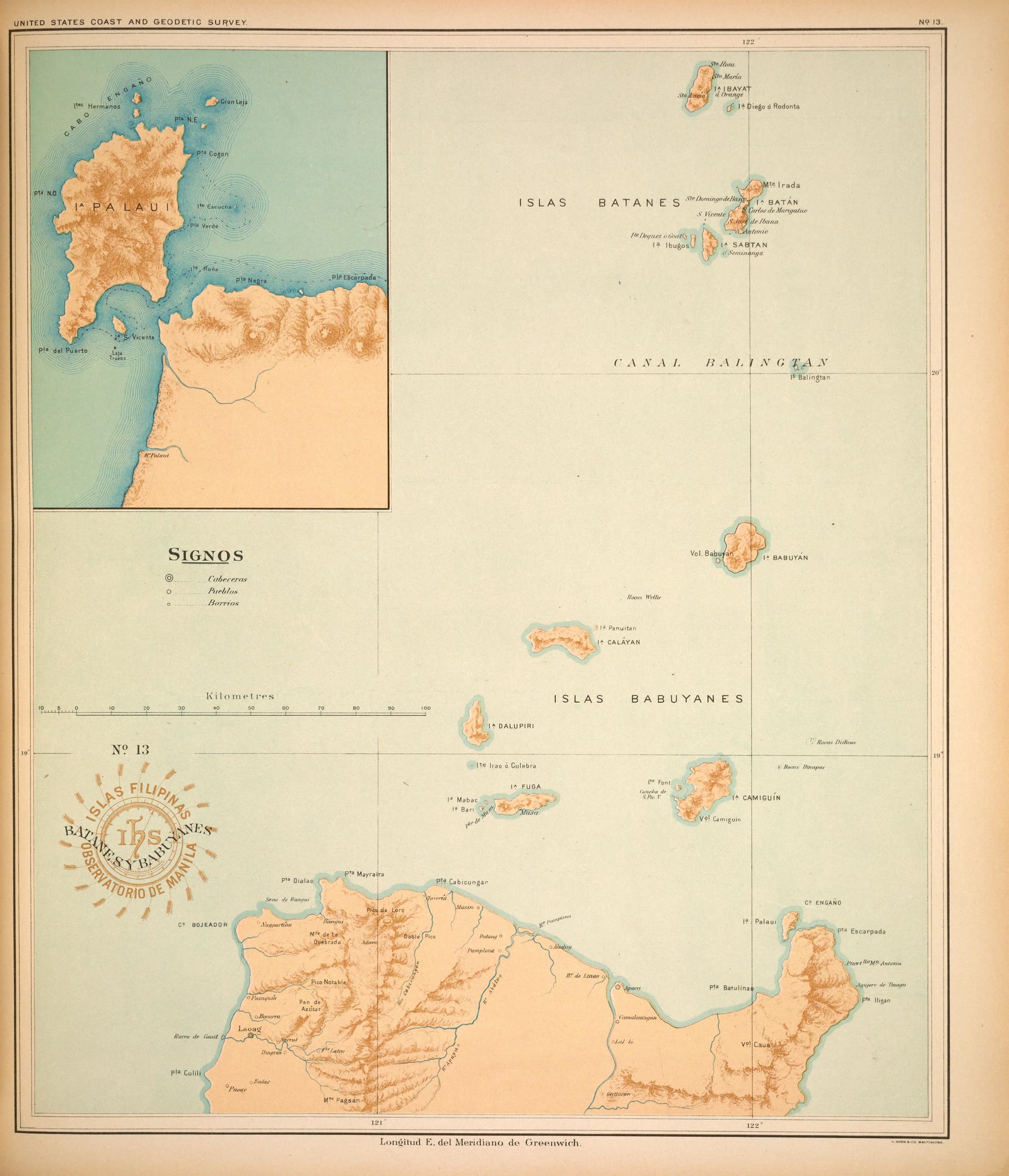
Atlas of the Philippine Islands (Atlas de Filipinas), No. 13: Islas Batanes y Babuyanes [The islands of Batanes and Babuyanes]
Central Luzon
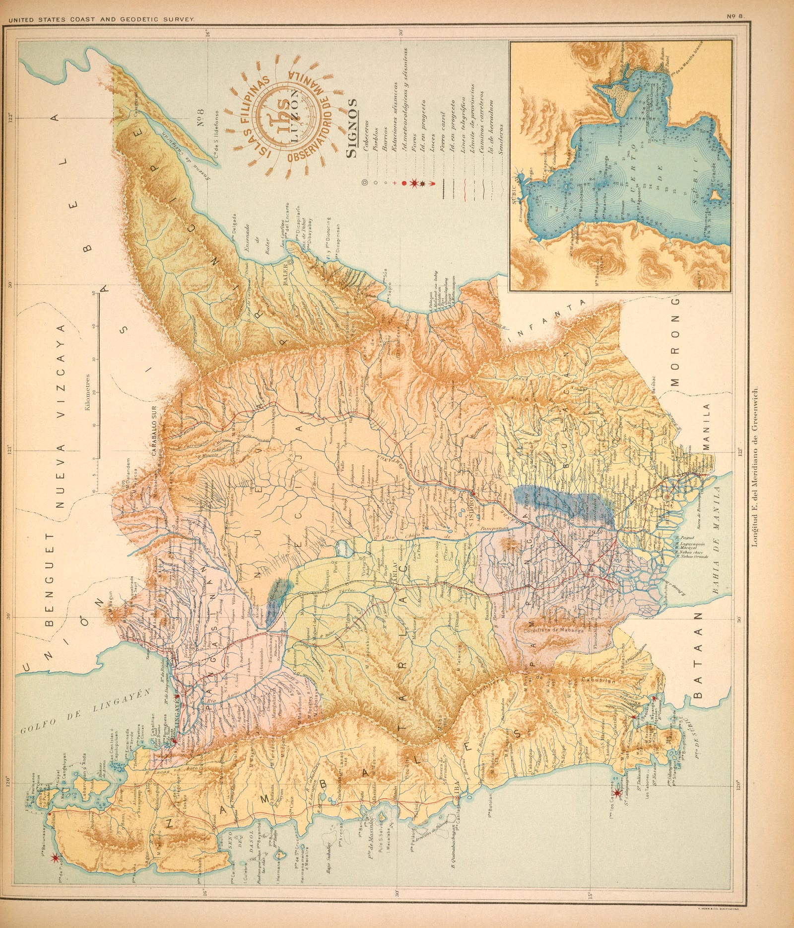
Atlas of the Philippine Islands (Atlas de Filipinas), No. 8: Isla de Luzón [The island of Luzon]
CALABARZON
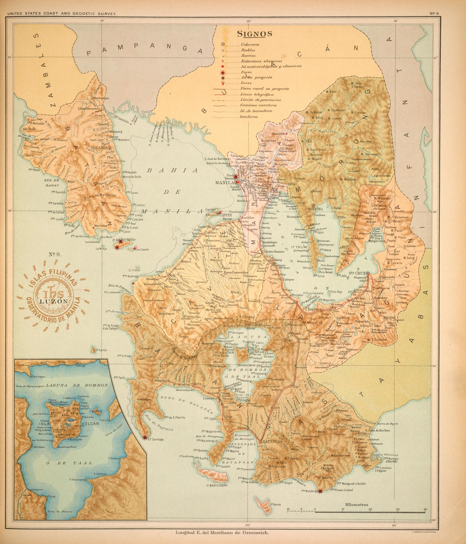
Atlas of the Philippine Islands (Atlas de Filipinas), No. 9: Isla de Luzón [The island of Luzon]
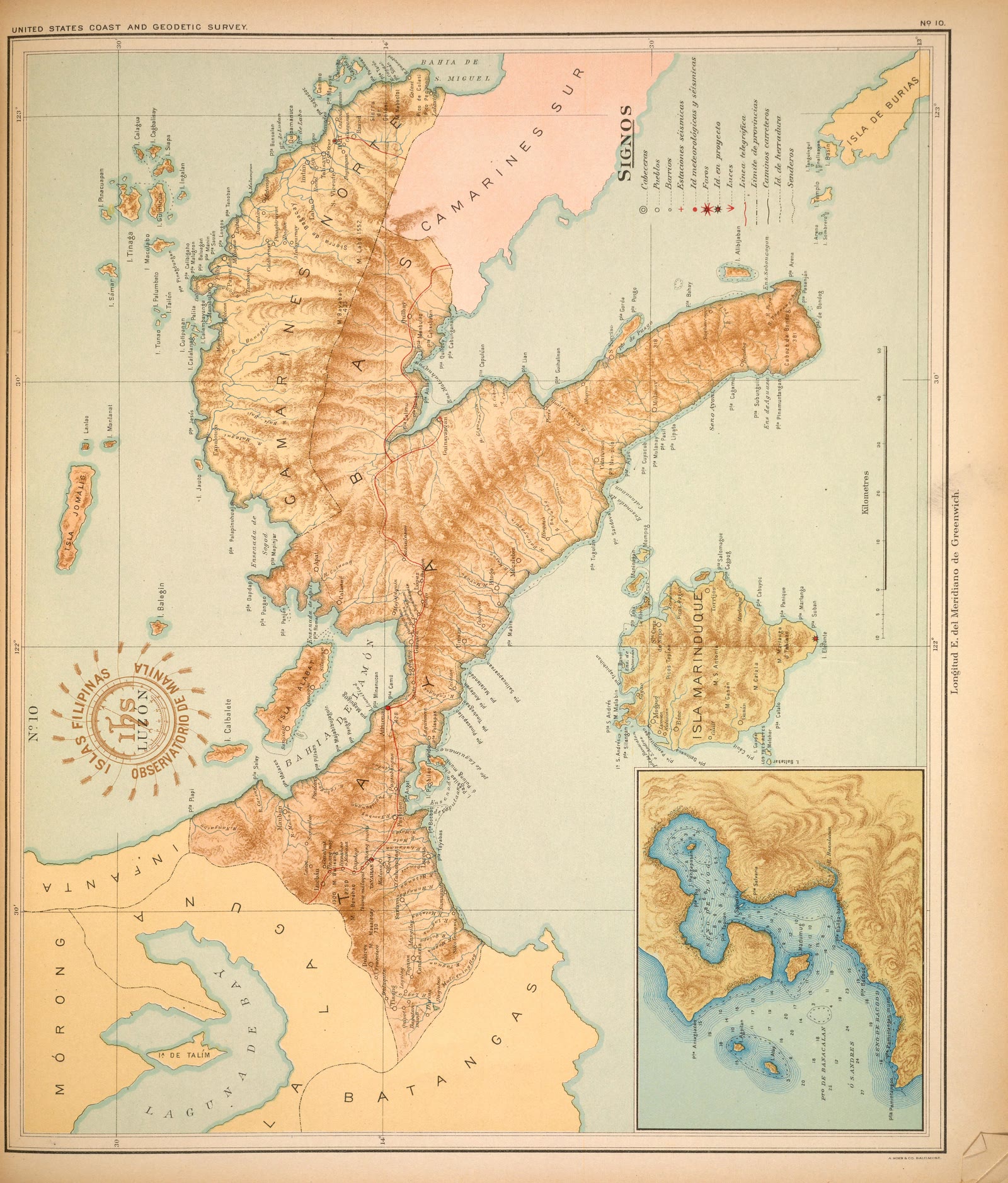
CALABARZON
Atlas of the Philippine Islands (Atlas de Filipinas), No. 10: Isla de Luzón [The island of Luzon]
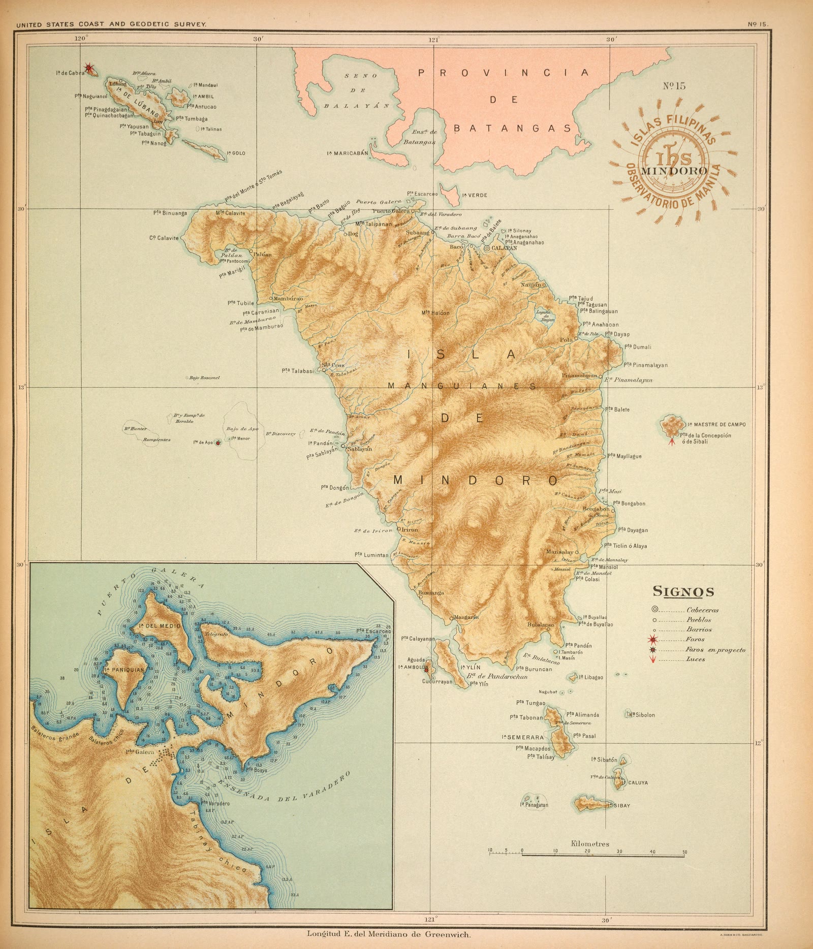
MIMAROPA
Atlas of the Philippine Islands (Atlas de Filipinas), No. 15: Isla de Mindoro [The island of Mindoro]
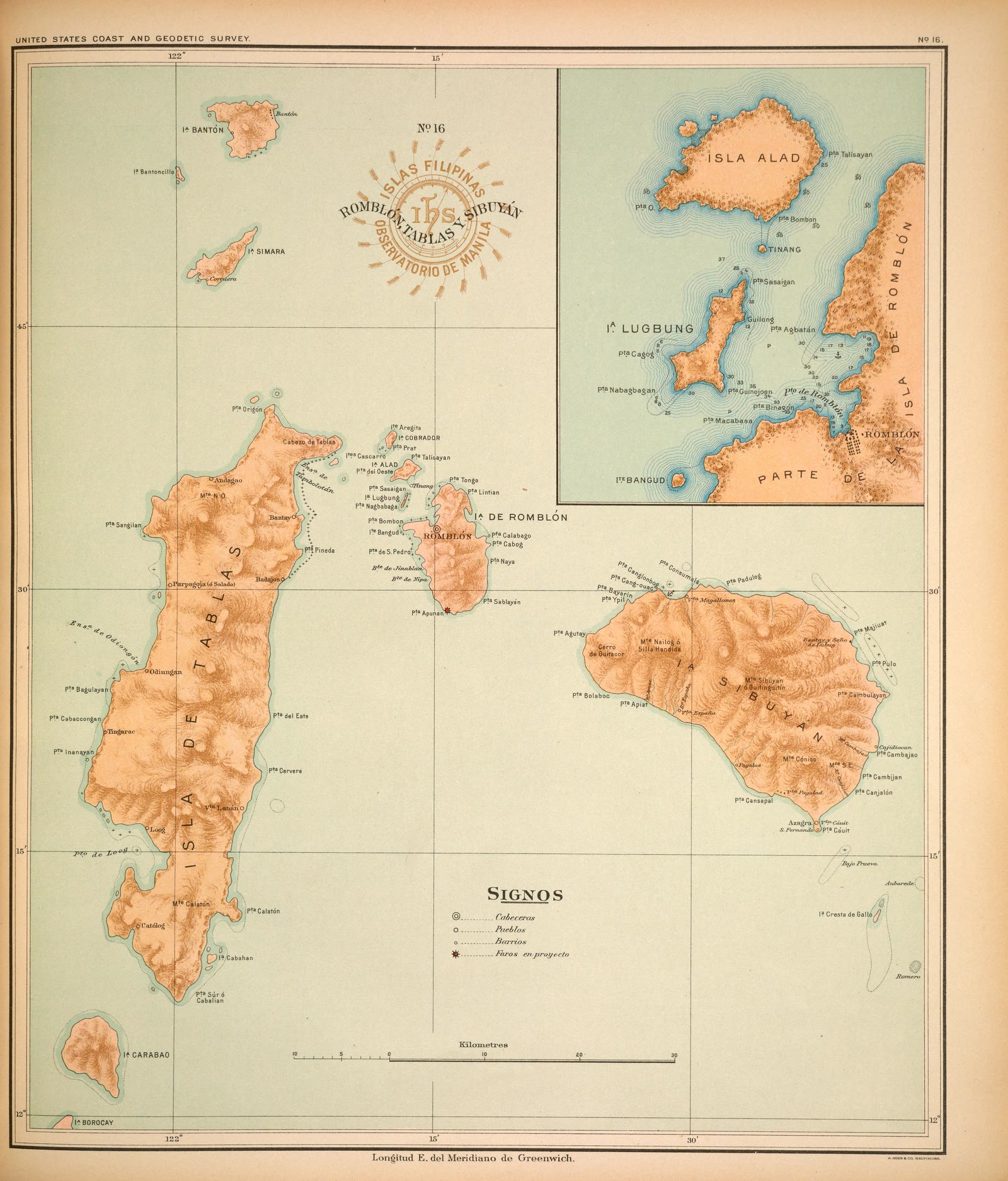
MIMAROPA
Atlas of the Philippine Islands (Atlas de Filipinas), No. 16: Islas de Sibuyán, Romblón y Tablas [The islands of Sibuyan, Romblon, and Tablas]
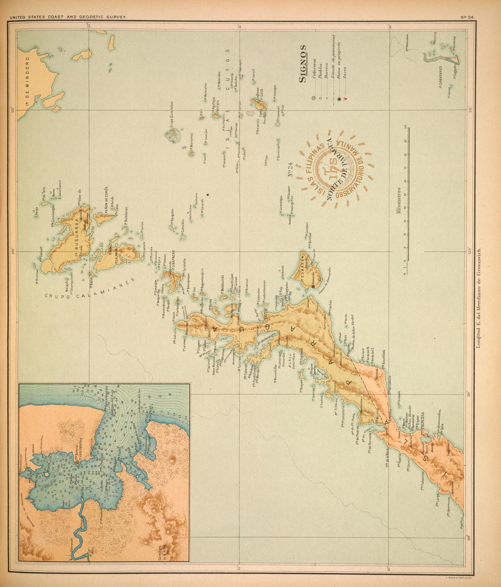
MIMAROPA
Atlas of the Philippine Islands (Atlas de Filipinas), No. 24: Isla de Paragua ó Palawan Norte [The island of Paragua, or North Palawan]
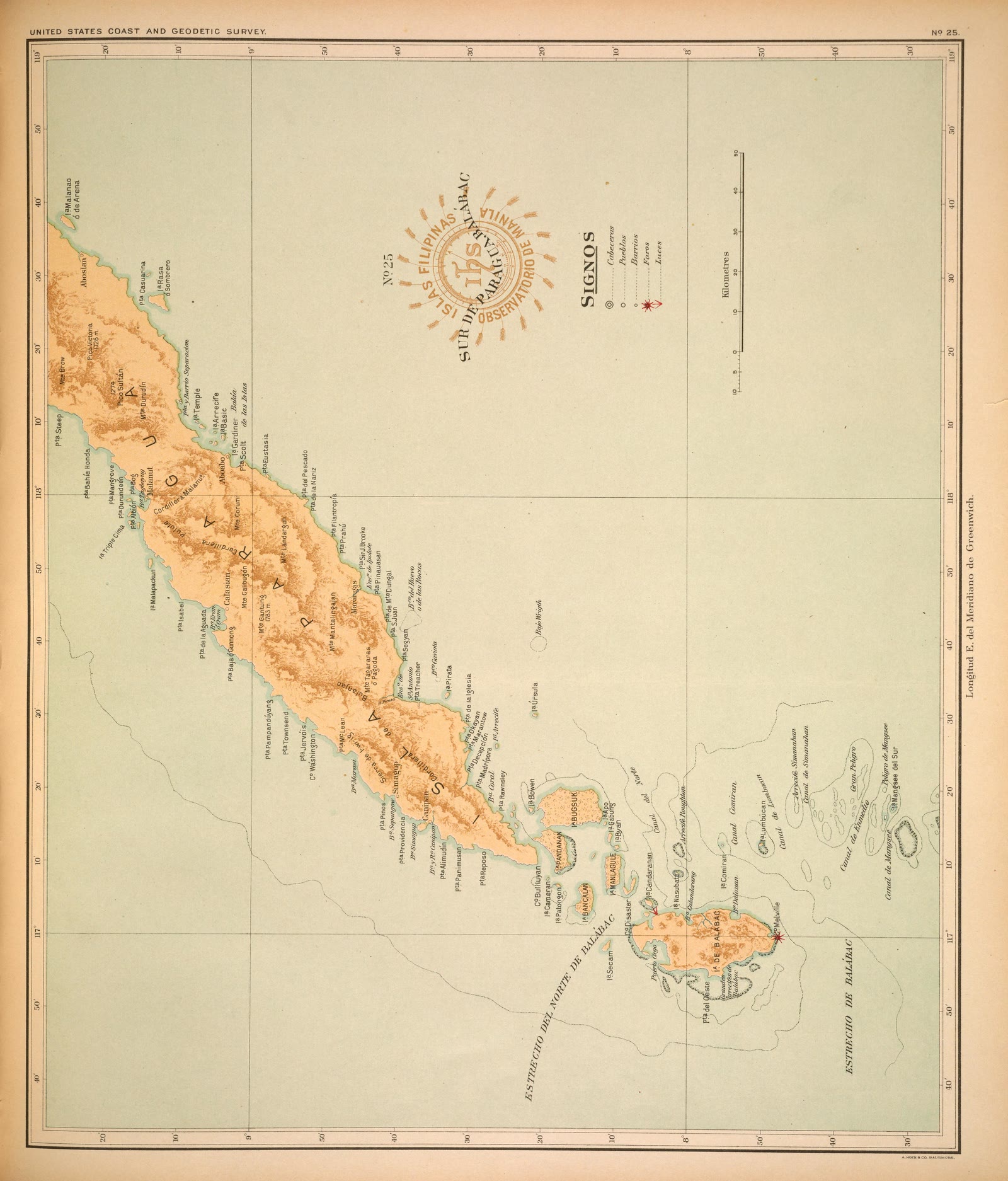
MIMAROPA
Atlas of the Philippine Islands (Atlas de Filipinas), No. 25: Isla de Paragua ó Palawan Sur [The island of Paragua, or South Palawan]
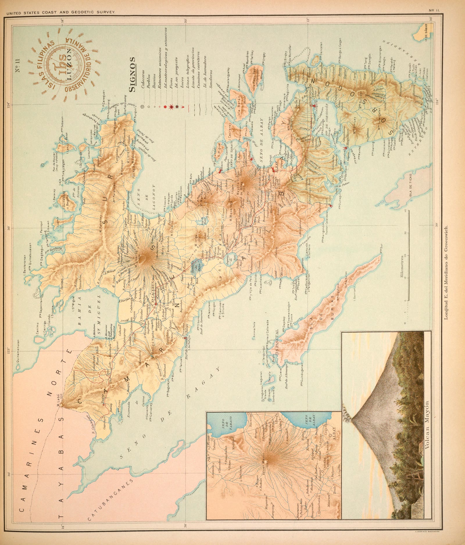
Bicol Region
Atlas of the Philippine Islands (Atlas de Filipinas), No. 11: Isla de Luzón [The island of Luzon]
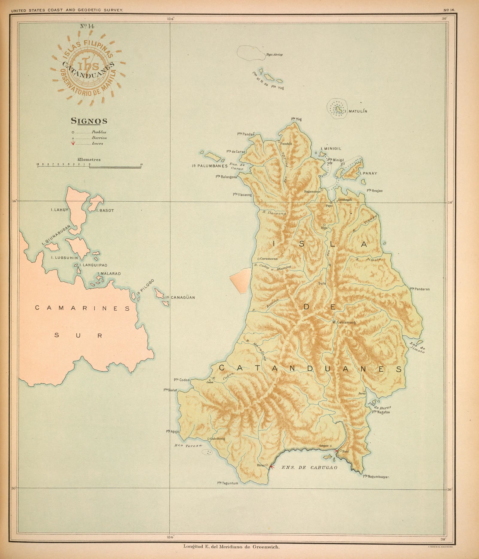
Bicol Region
Atlas of the Philippine Islands (Atlas de Filipinas), No. 14: Isla Catanduanes [The island of Catanduanes]
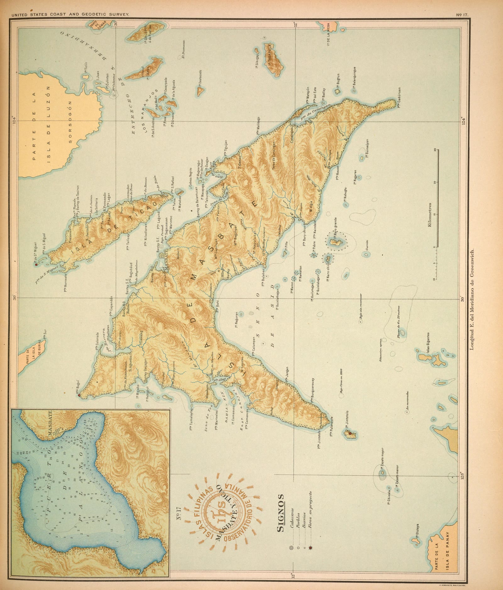
Bicol Region
Atlas of the Philippine Islands (Atlas de Filipinas), No. 17: Islas de Masbate y Ticao [The islands of Masbate and Ticao]
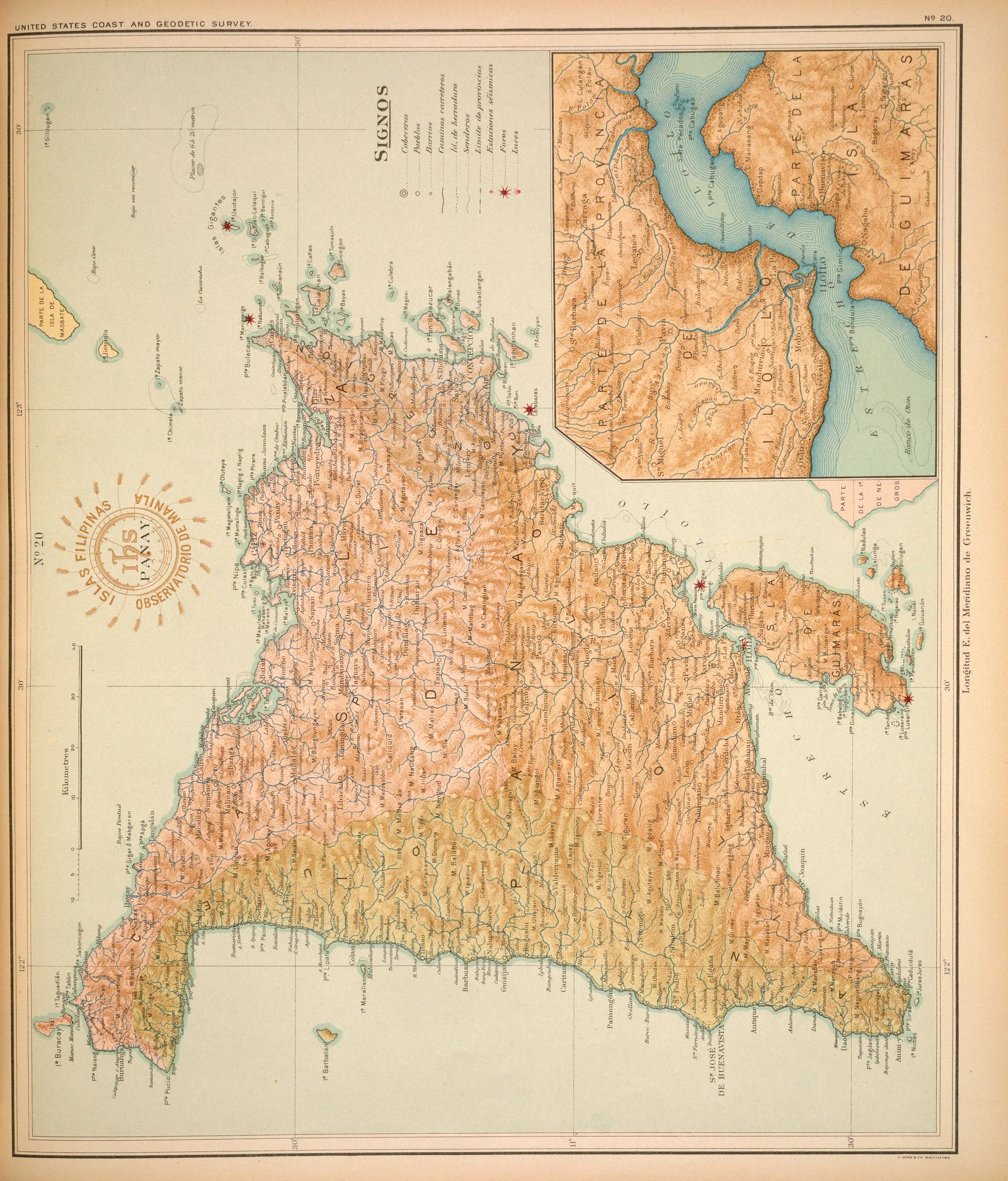
Western Visayas
Atlas of the Philippine Islands (Atlas de Filipinas), No. 20: Isla de Panay [The island of Panay]
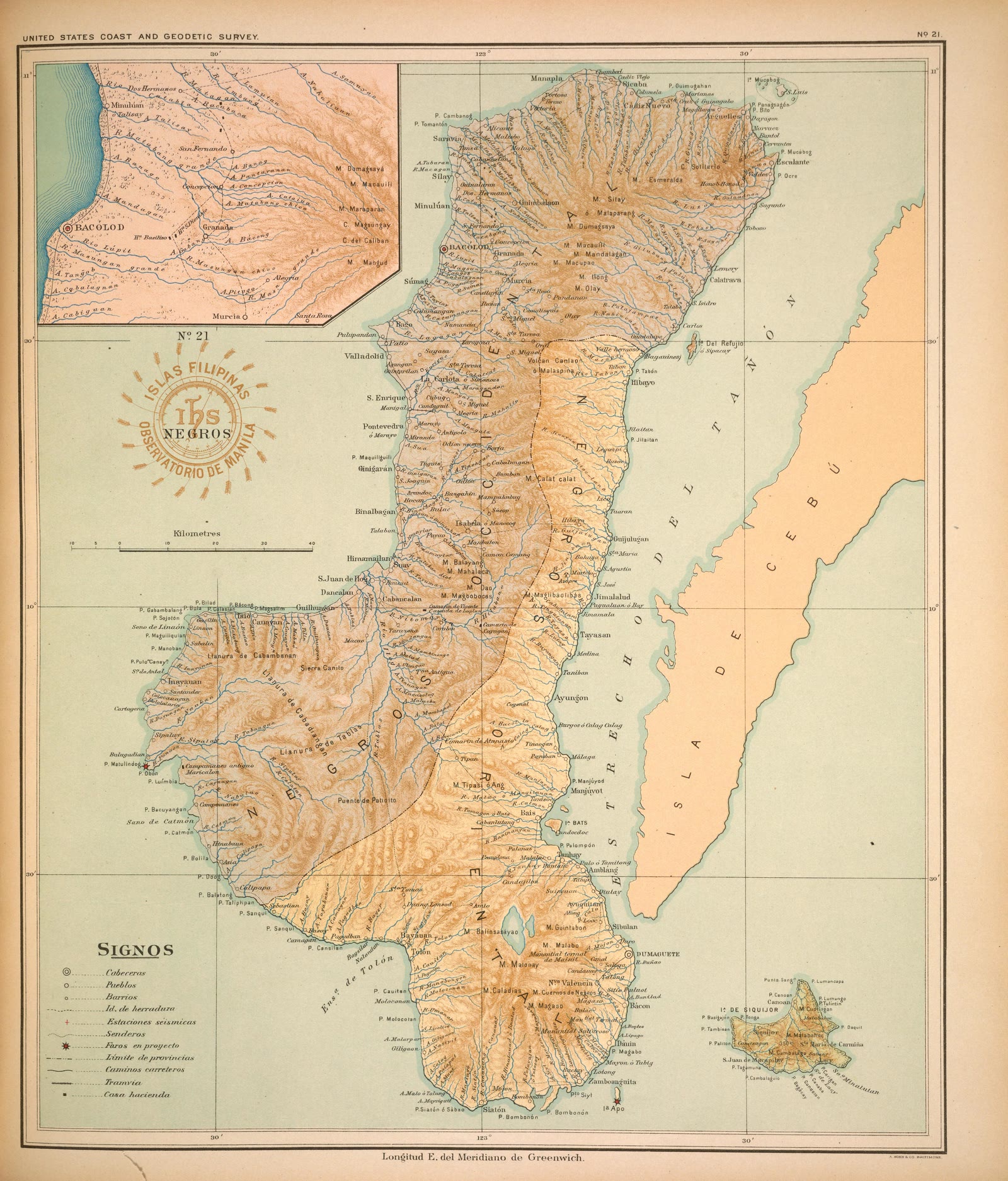
Negros Island Region
Atlas of the Philippine Islands (Atlas de Filipinas), No. 21: Isla de Negros [The island of Negros]
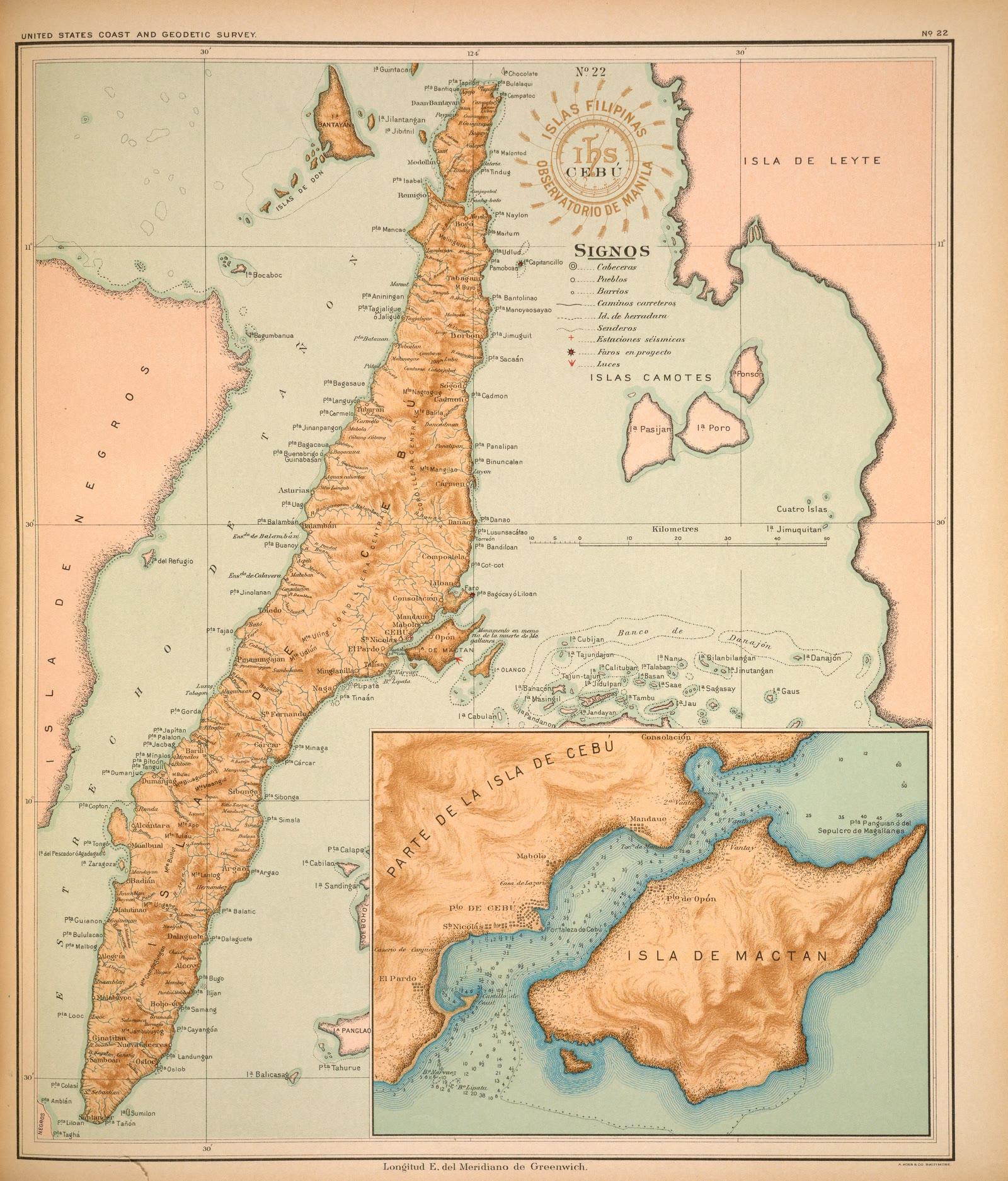
Central Visayas
Atlas of the Philippine Islands (Atlas de Filipinas), No. 22: Isla de Cebú [The island of Cebu]
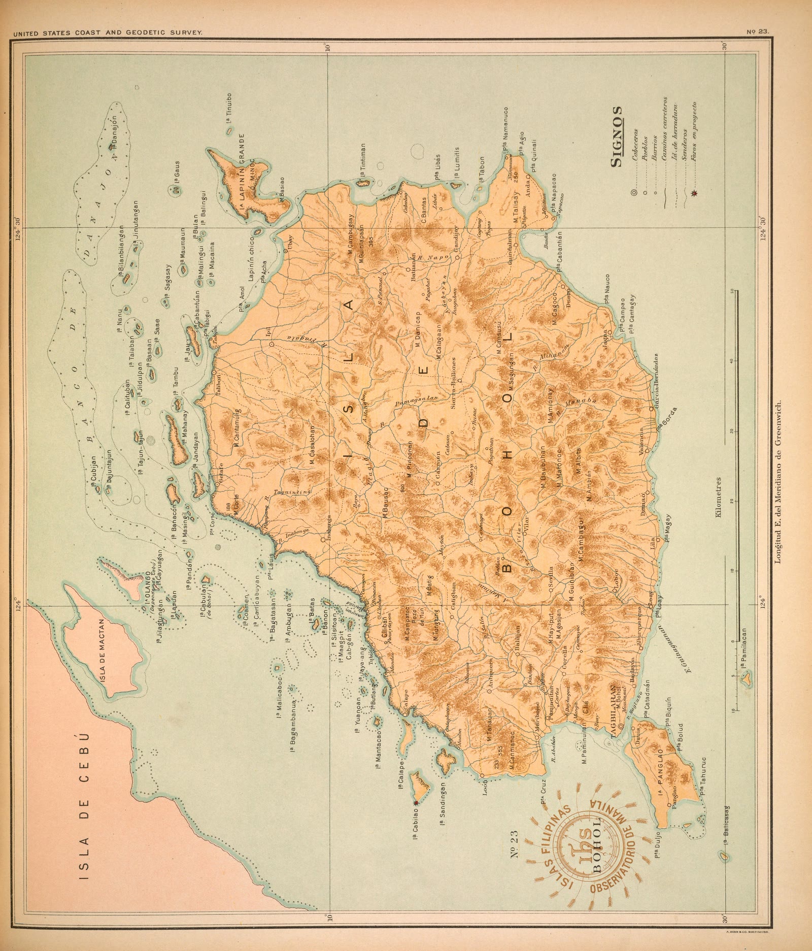
Central Visayas
Atlas of the Philippine Islands (Atlas de Filipinas), No. 23: Isla de Bohol [The island of Bohol]
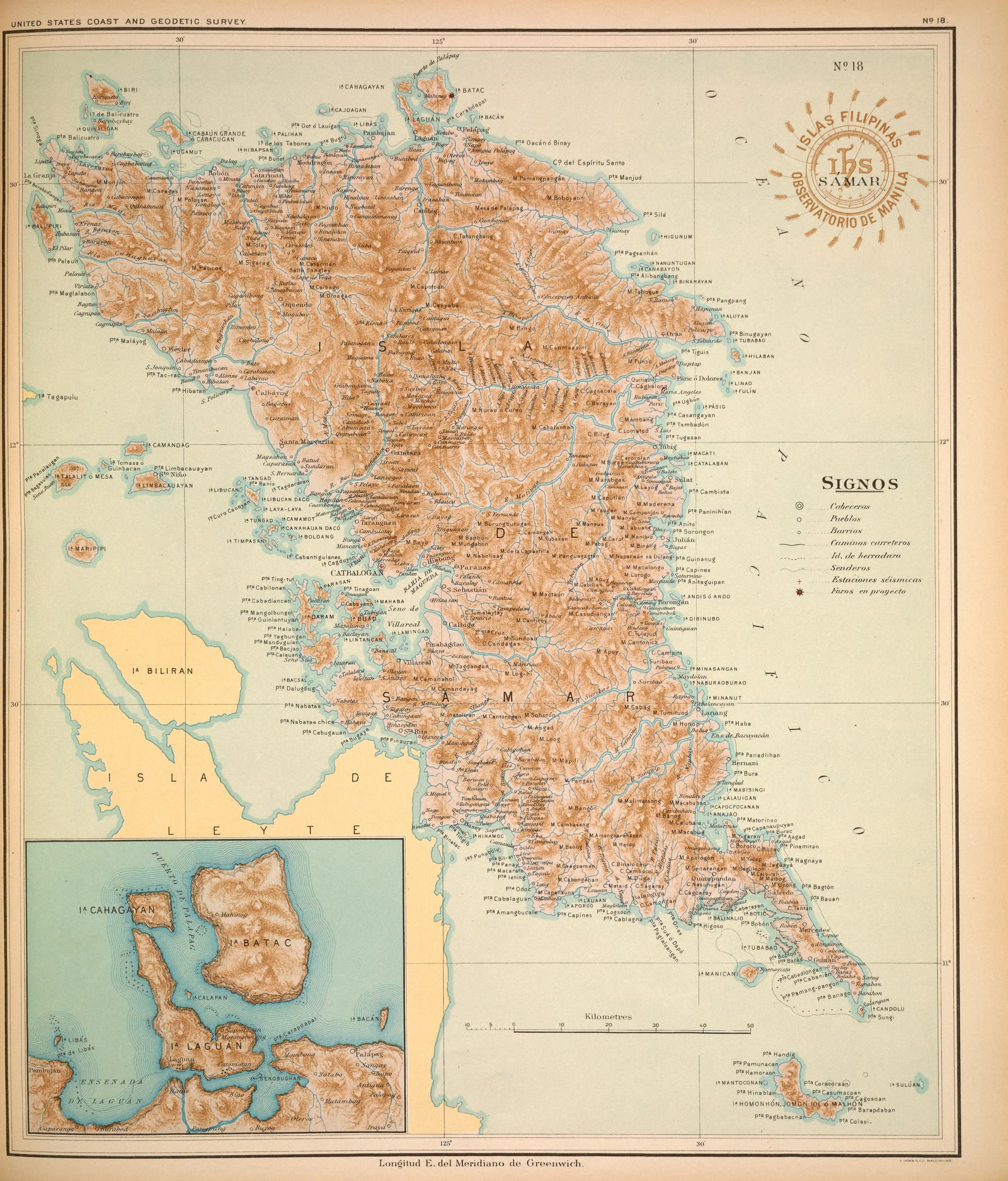
Eastern Visayas
Atlas of the Philippine Islands (Atlas de Filipinas), No. 18: Isla de Samar [The island of Samar]
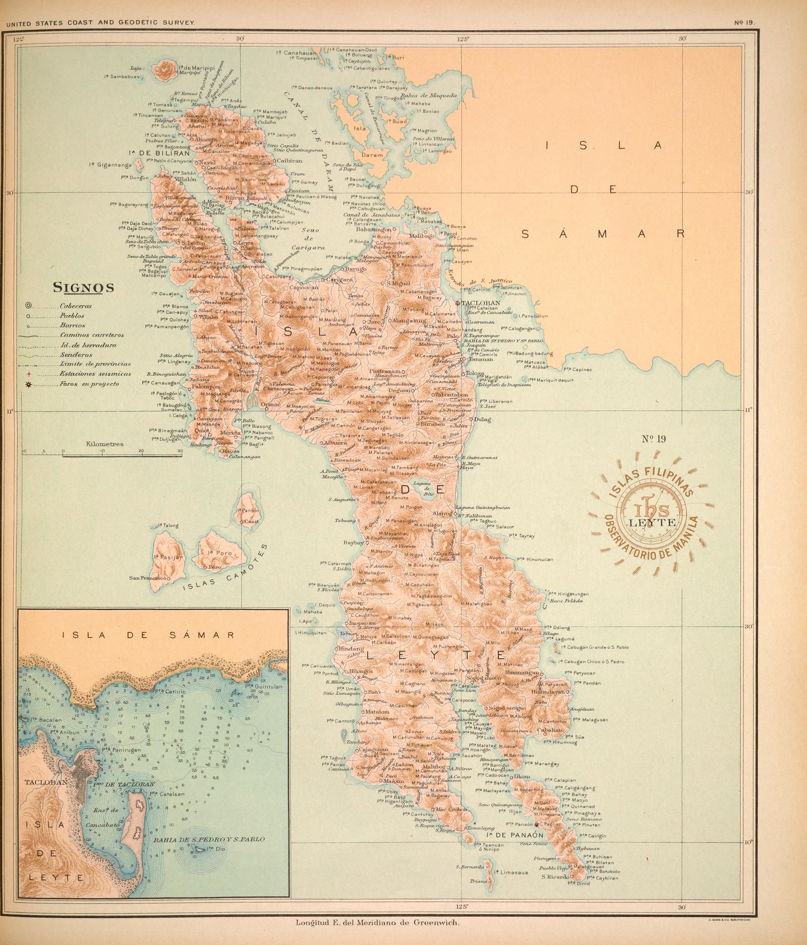
Eastern Visayas
Atlas of the Philippine Islands (Atlas de Filipinas), No. 19: Isla de Leyte [The island of Leyte]
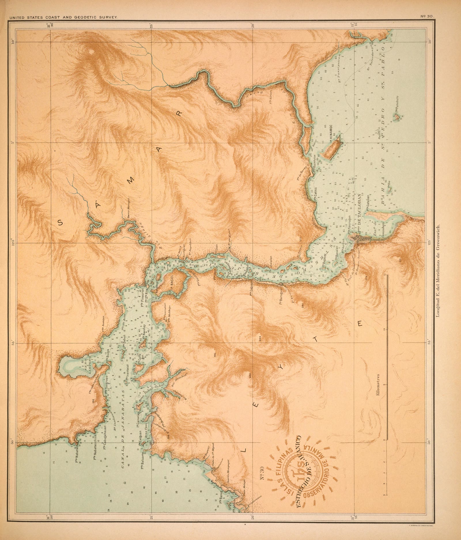
Eastern Visayas
Atlas of the Philippine Islands (Atlas de Filipinas), No. 30: Estrecho de S. Juanico [The strait of S. Juanico]
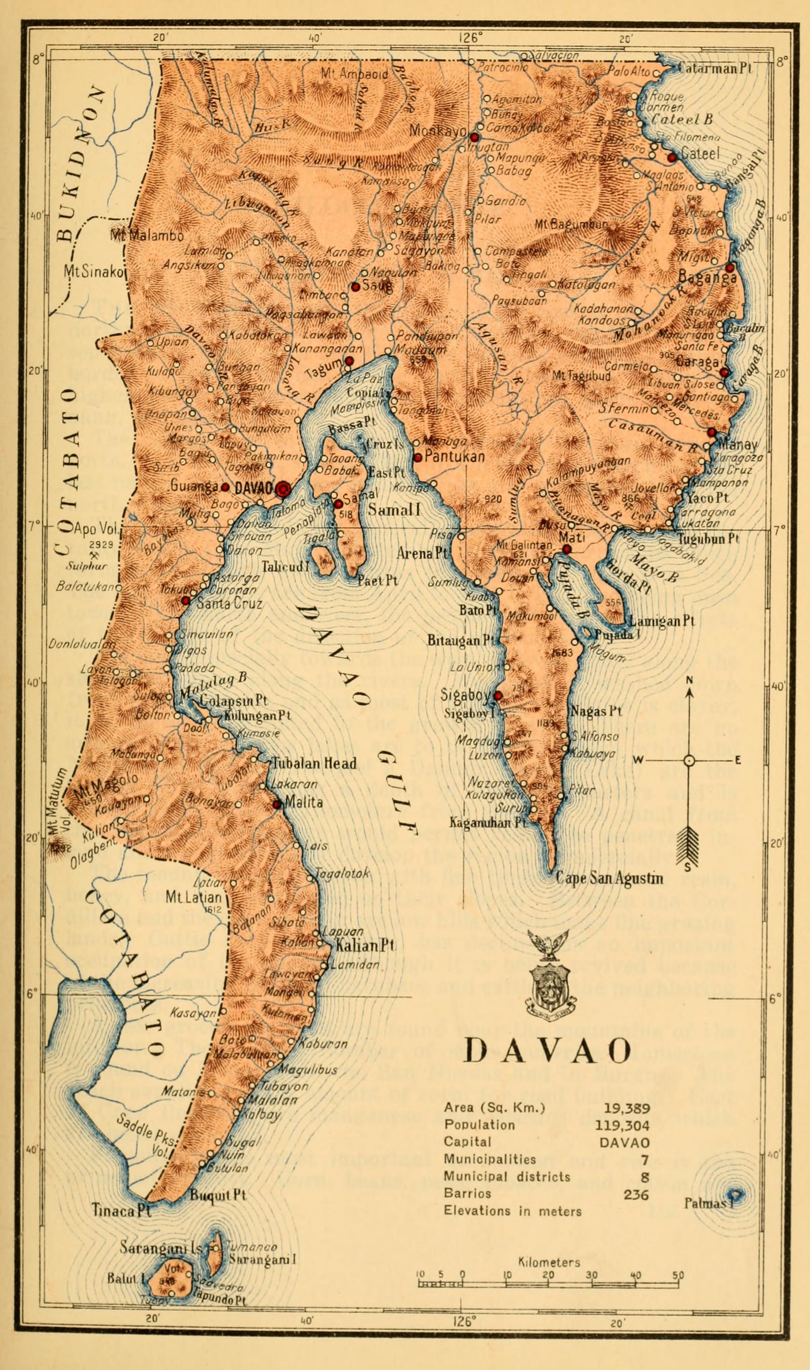
Davao Region
Census of the Philippine Islands taken under the direction of the Philippine Legislature in the year 1918, Volume I, Geography, History, and Climatology: map of DAVAO
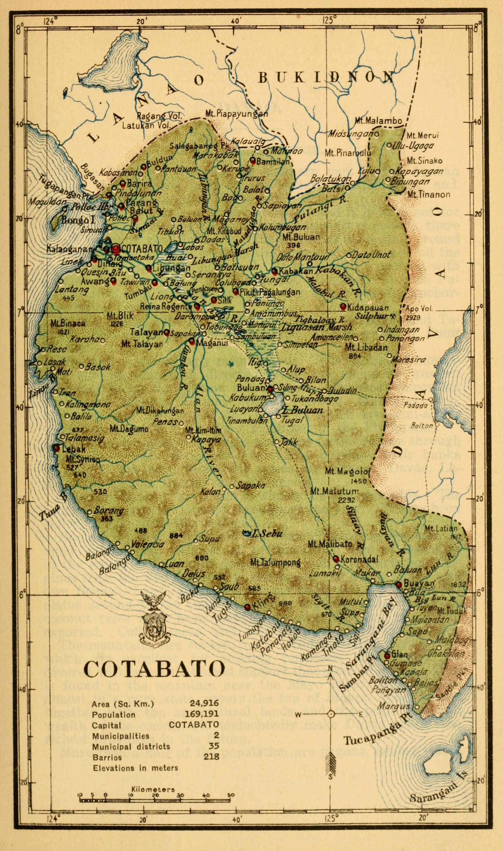
SOCCSKSARGEN
Census of the Philippine Islands taken under the direction of the Philippine Legislature in the year 1918, Volume I, Geography, History, and Climatology: map of COTABATO
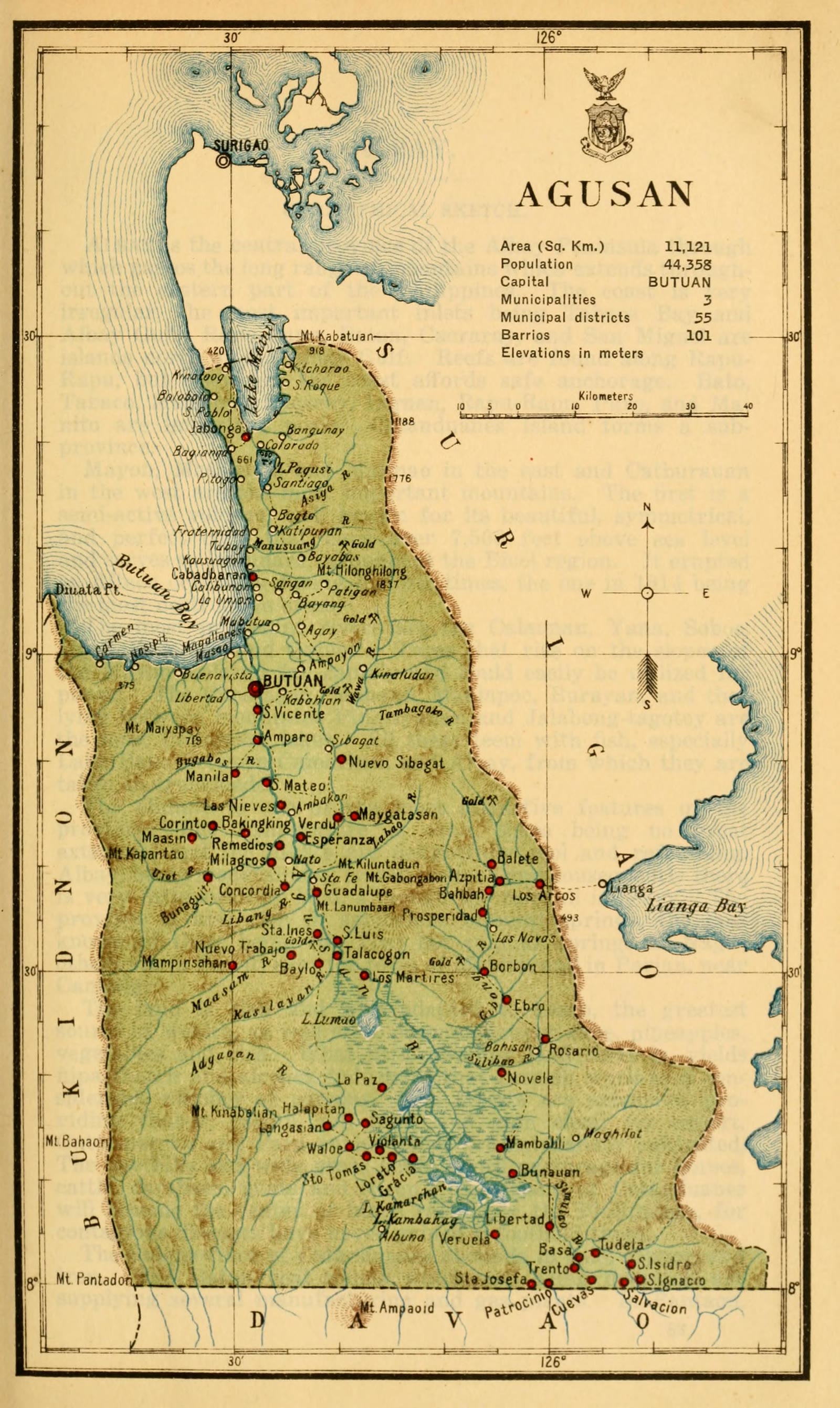
Caraga
Census of the Philippine Islands taken under the direction of the Philippine Legislature in the year 1918, Volume I, Geography, History, and Climatology: map of AGUSAN
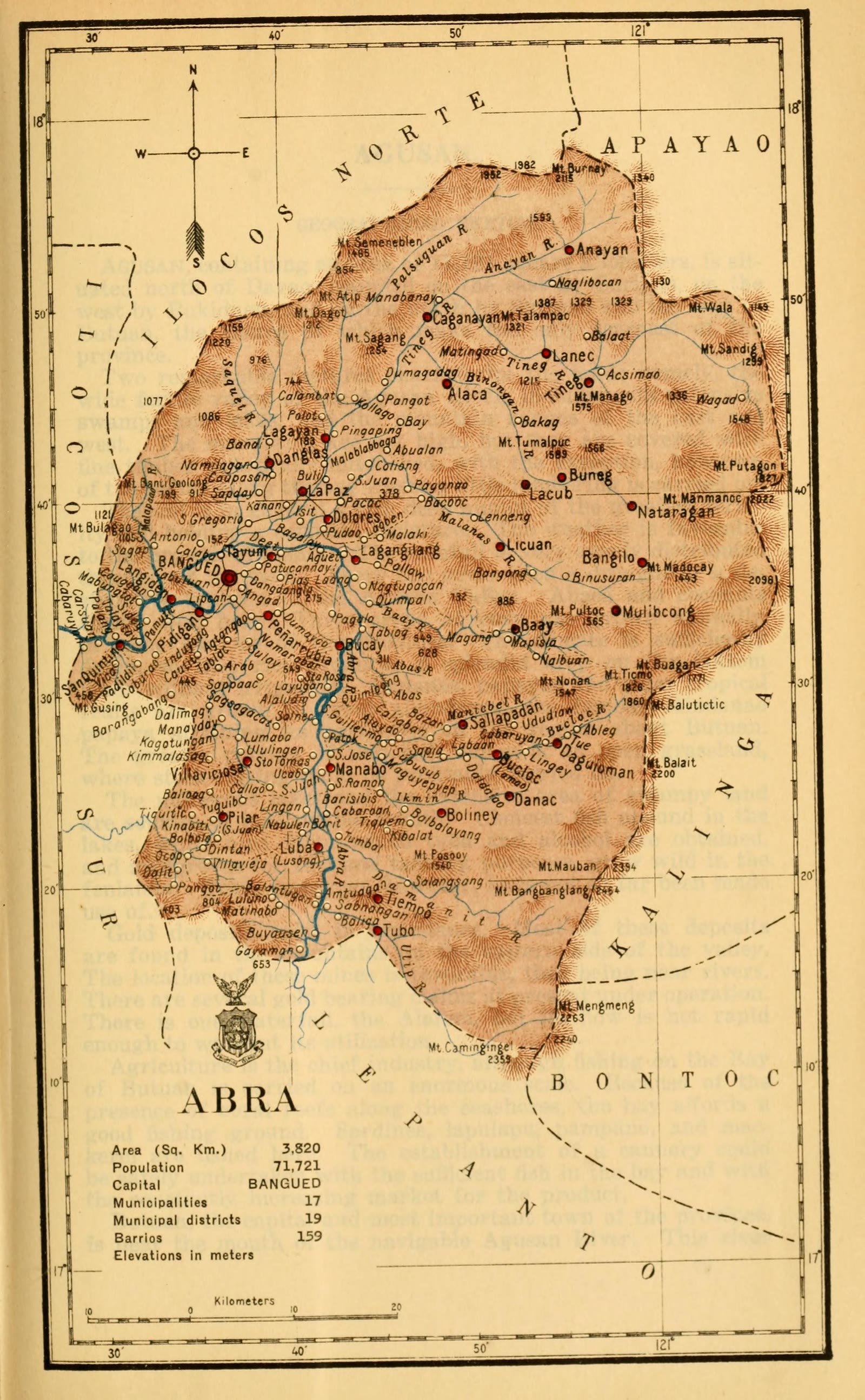
Abra
Census of the Philippine Islands taken under the direction of the Philippine Legislature in the year 1918, Volume I, Geography, History, and Climatology: map of ABRA
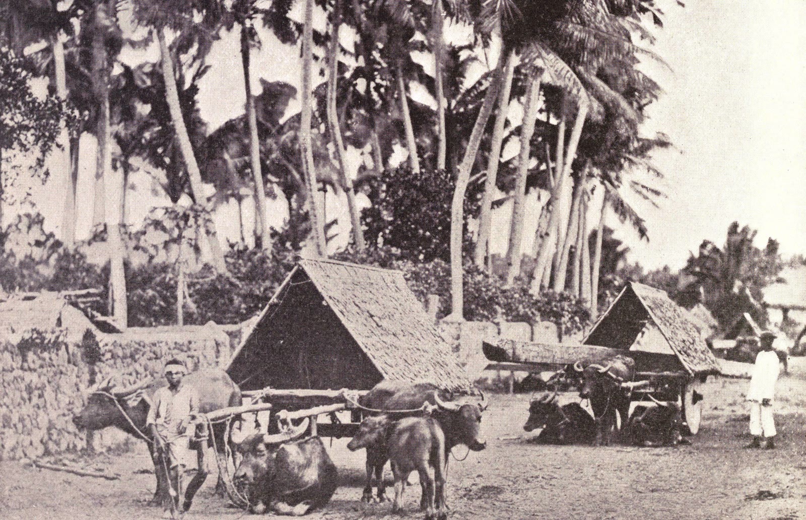
Albay
Albay wagons, 1899
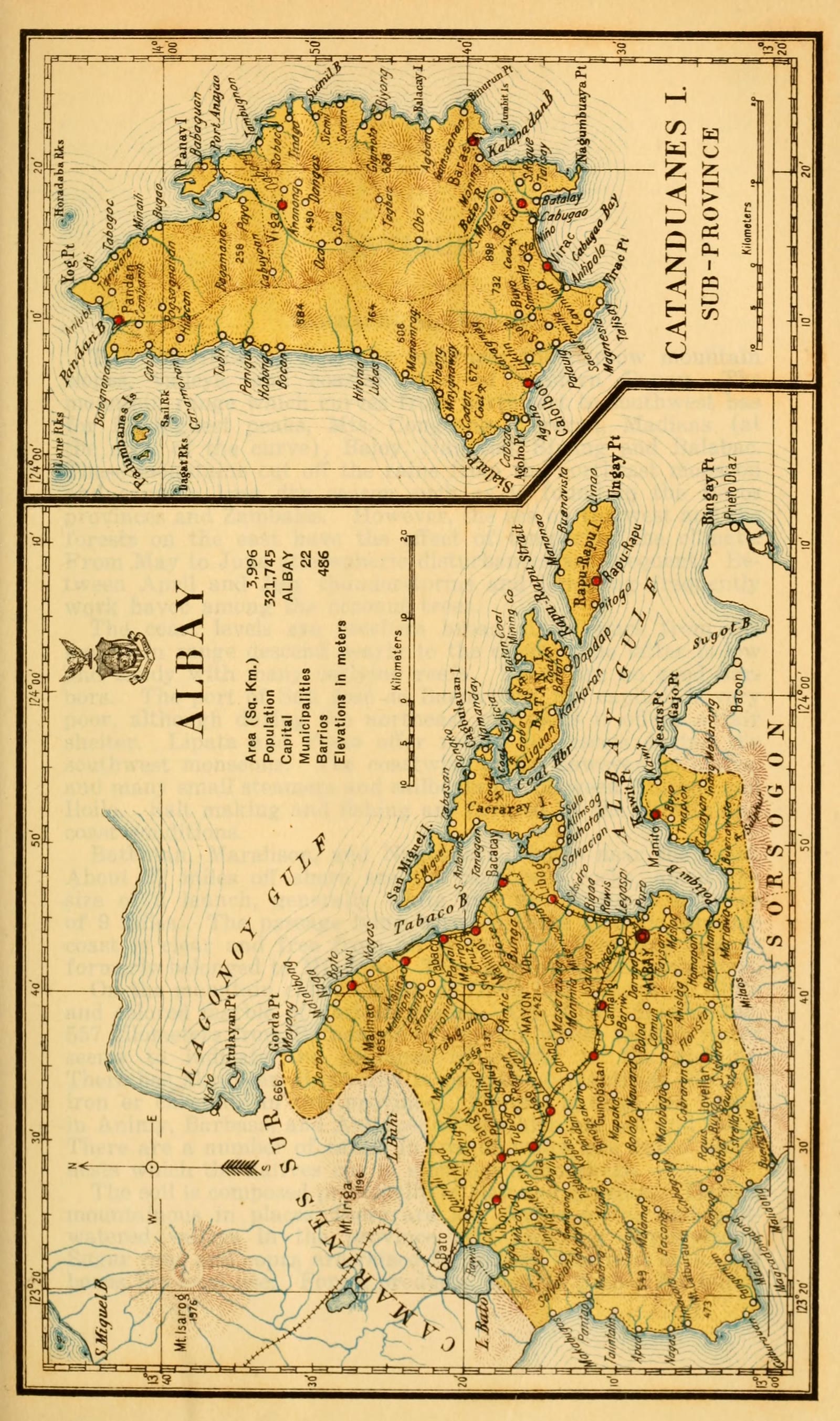
Albay
Census of the Philippine Islands taken under the direction of the Philippine Legislature in the year 1918, Volume I, Geography, History, and Climatology: map of ALBAY (with CATANDUANES Sub-Province)
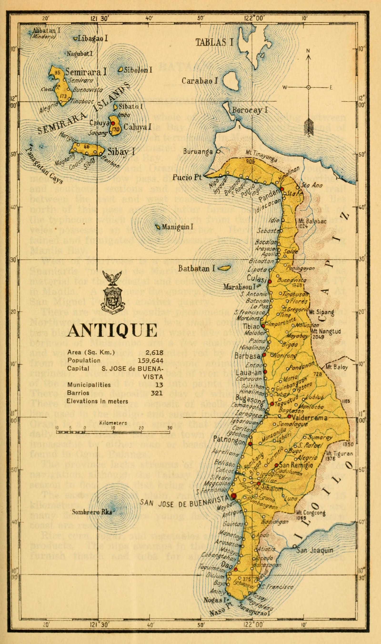
Antique
Census of the Philippine Islands taken under the direction of the Philippine Legislature in the year 1918, Volume I, Geography, History, and Climatology: map of ANTIQUE
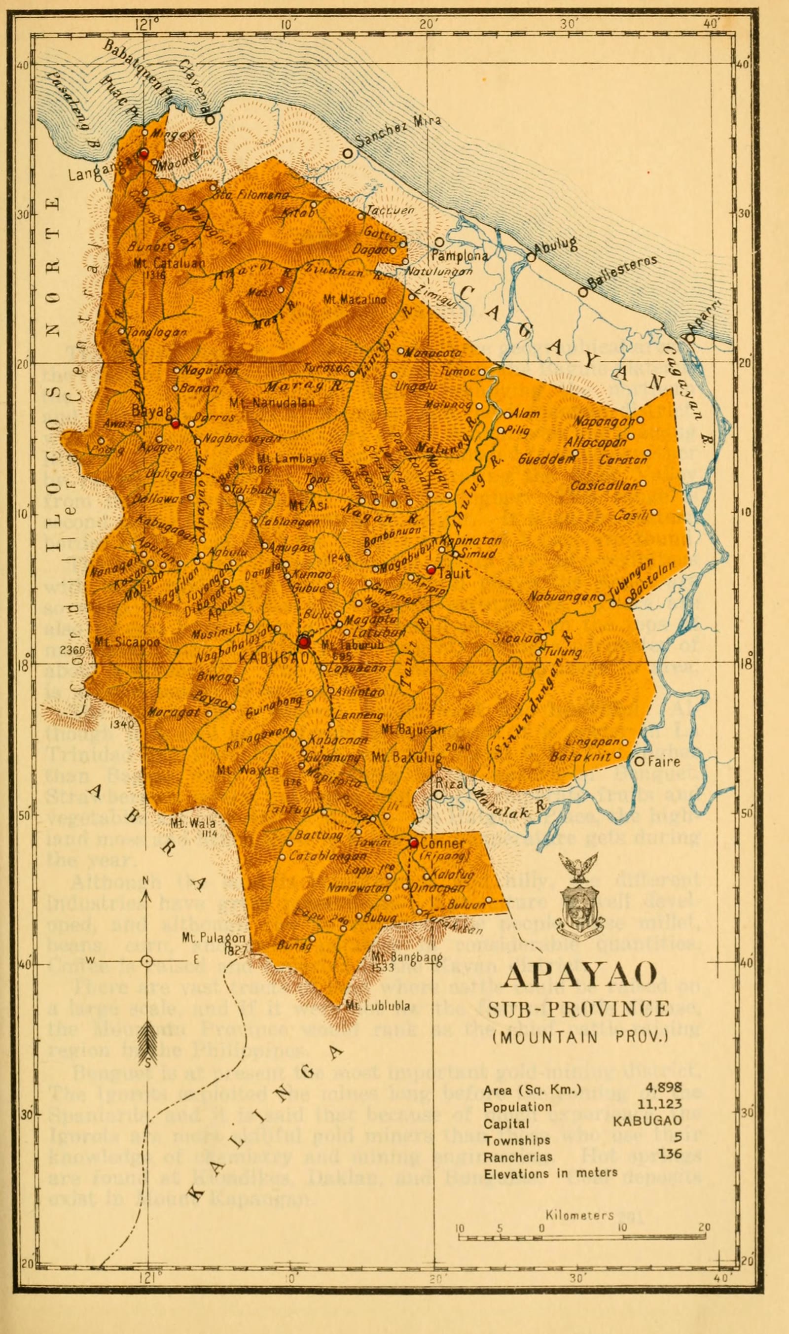
Apayao
Census of the Philippine Islands taken under the direction of the Philippine Legislature in the year 1918, Volume I, Geography, History, and Climatology: map of APAYAO, Sub-Province (Mountain Prov.)
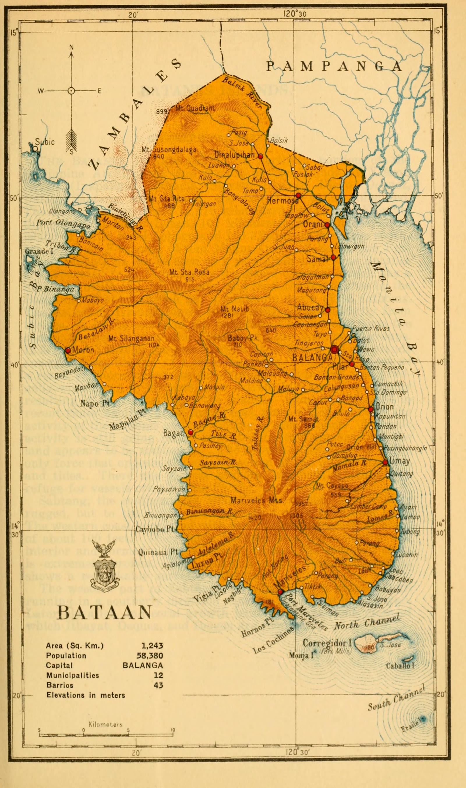
Bataan
Census of the Philippine Islands taken under the direction of the Philippine Legislature in the year 1918, Volume I, Geography, History, and Climatology: map of BATAAN
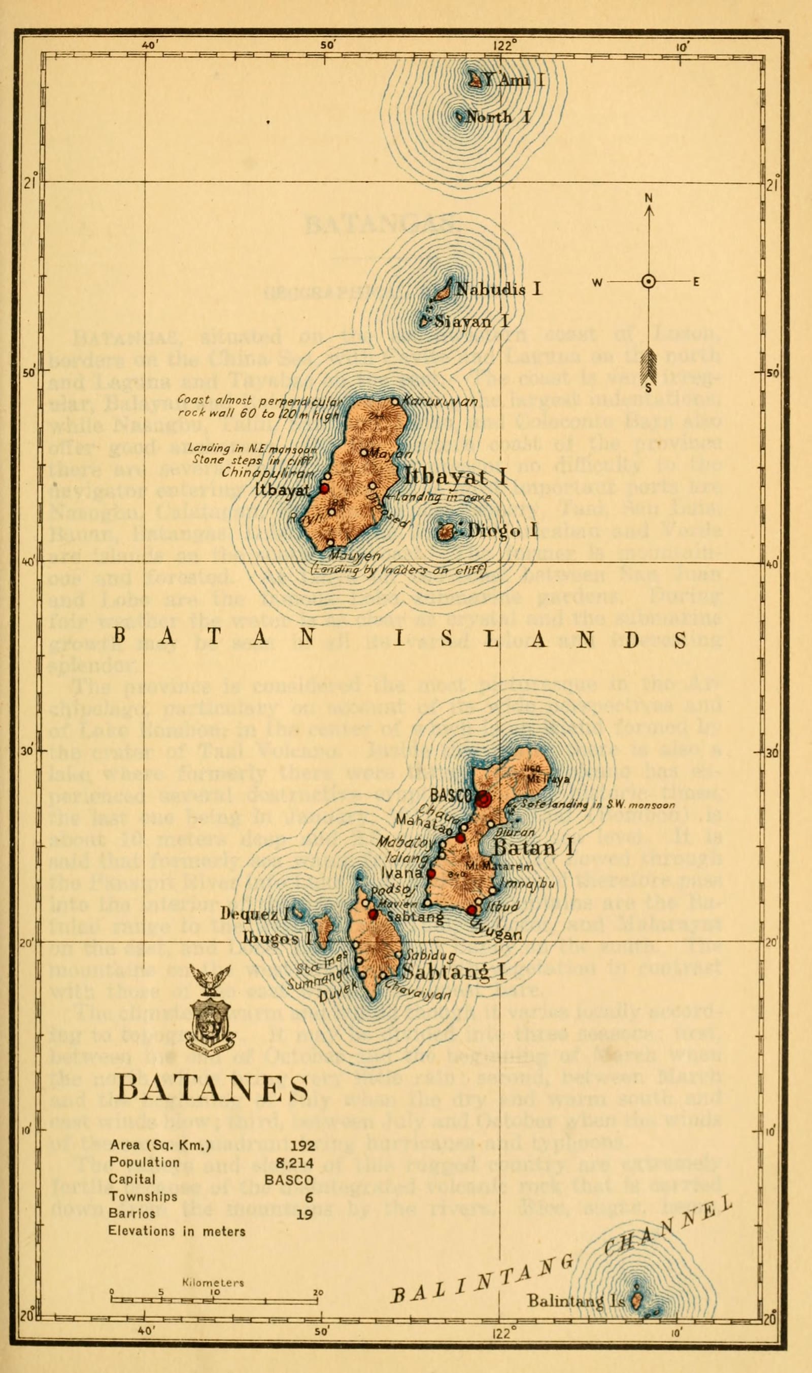
Batanes
Census of the Philippine Islands taken under the direction of the Philippine Legislature in the year 1918, Volume I, Geography, History, and Climatology: map of BATANES
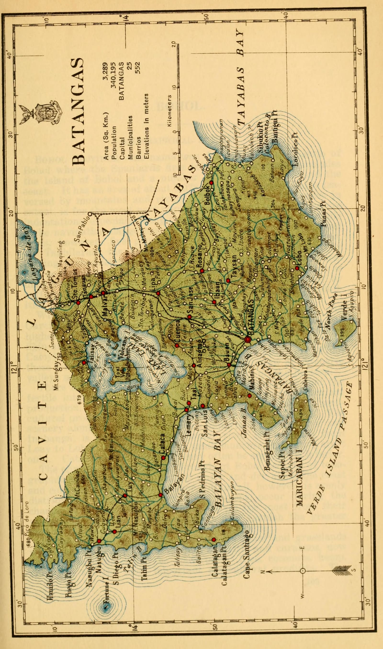
Batangas
Census of the Philippine Islands taken under the direction of the Philippine Legislature in the year 1918, Volume I, Geography, History, and Climatology: map of BATANGAS
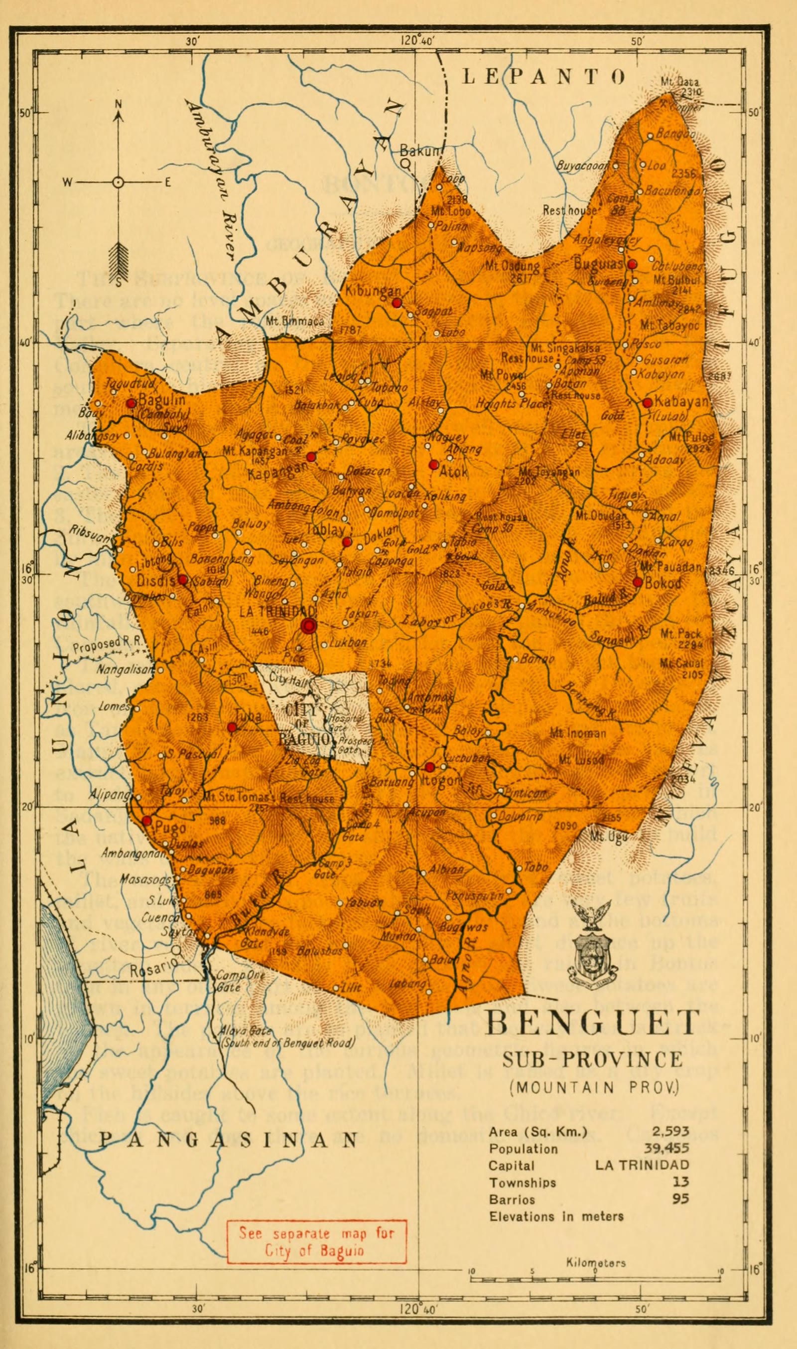
Benguet
Census of the Philippine Islands taken under the direction of the Philippine Legislature in the year 1918, Volume I, Geography, History, and Climatology: map of BENGUET, Sub-Province (Mountain Prov.)
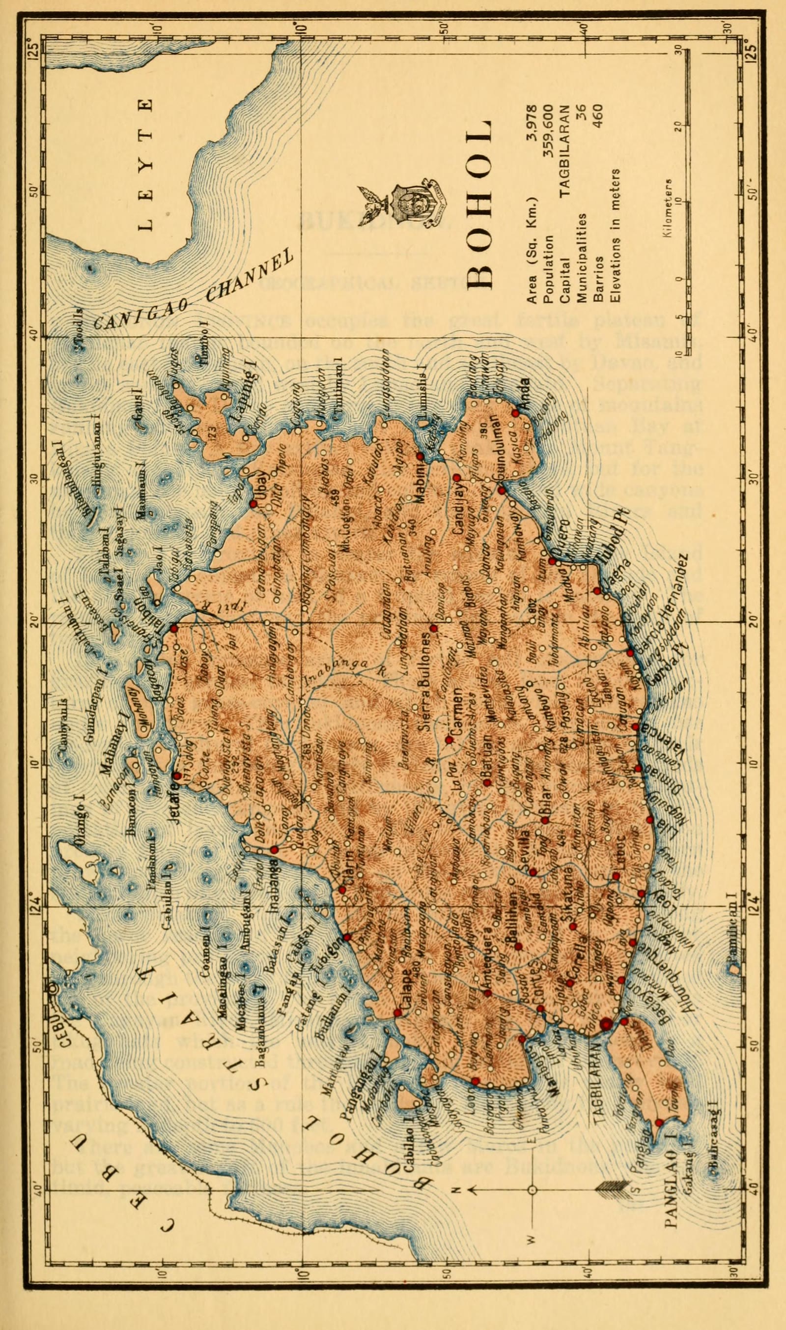
Bohol
Census of the Philippine Islands taken under the direction of the Philippine Legislature in the year 1918, Volume I, Geography, History, and Climatology: map of BOHOL


Sources
Page updated October 9, 2026. Archive catalog release e205c7180a5b.
Who holds the pictures on this page, and their rights. Each picture's own page names its record.
- 1.Boston Public Library, Norman B. Leventhal Map & Education Center Collection. 9 pictures. No known restrictions.
- 2.Smithsonian Libraries; scan by Smithsonian Libraries via the Internet Archive. 23 pictures. No known restrictions.
- 3.Boston Public Library, Urban Maps. 1 picture. No known restrictions.
- 4.University of Connecticut Libraries; scan by University of Connecticut Libraries via the Internet Archive. 14 pictures. Public domain.
- 5.The Internet Archive. 1 picture. Public domain.
Every holder, licence and author in the Archive: Data and credits.
See something wrong on this page? Write to hello@scene.ph with the page address. We check every report against the source.