The American era
From the war of 1898 to the eve of the Pacific War: the first surveys, the census atlases, the towns photographed. 135 pictures, 1898 to 1941.
Pictures, page 2 of 3
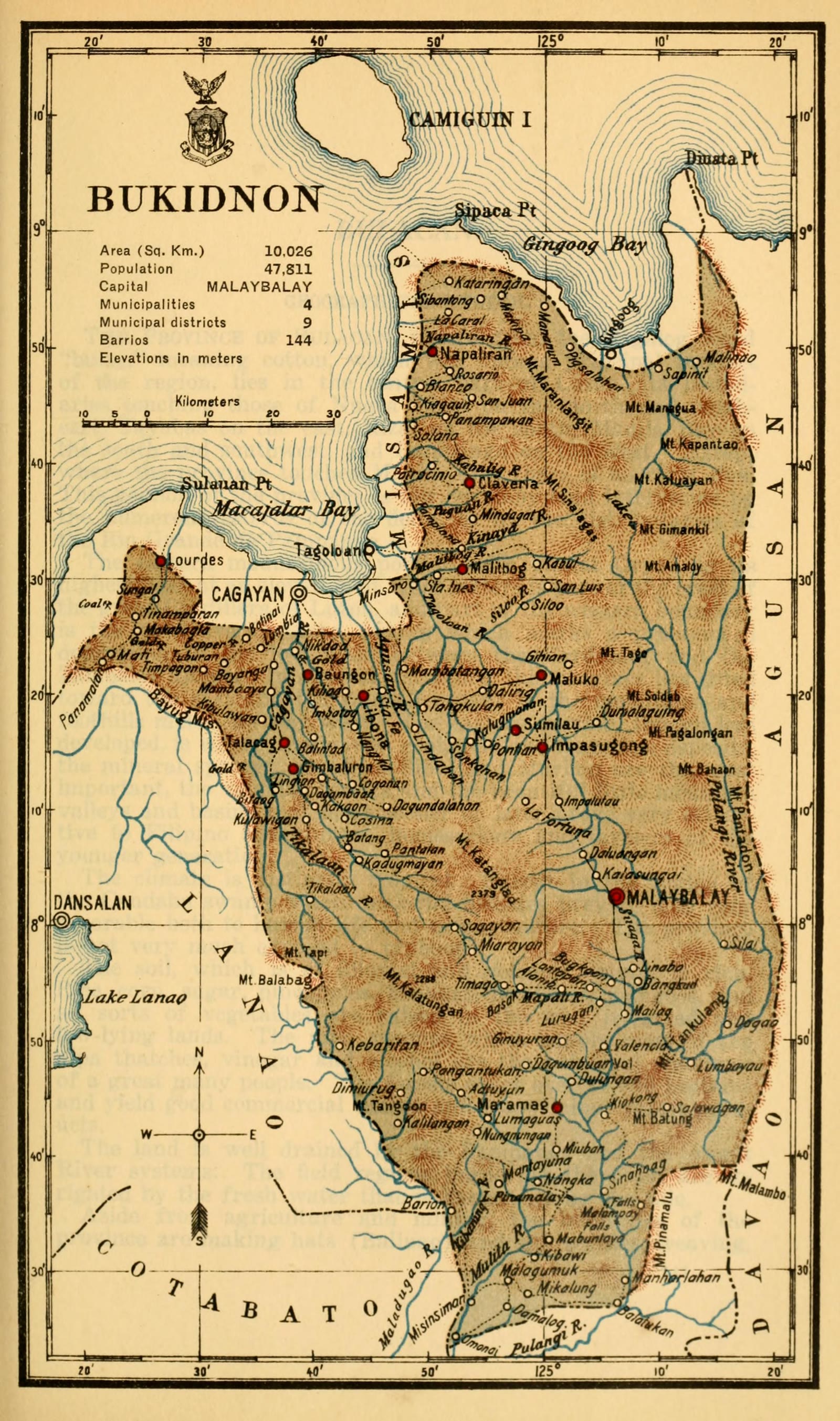
Bukidnon
Census of the Philippine Islands taken under the direction of the Philippine Legislature in the year 1918, Volume I, Geography, History, and Climatology: map of BUKIDNON
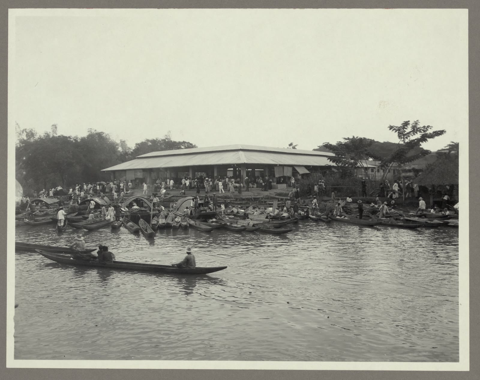
Bulacan
Canoes along the shore at the market, Hagonoy, Bulacan, Philippines LCCN2006683812
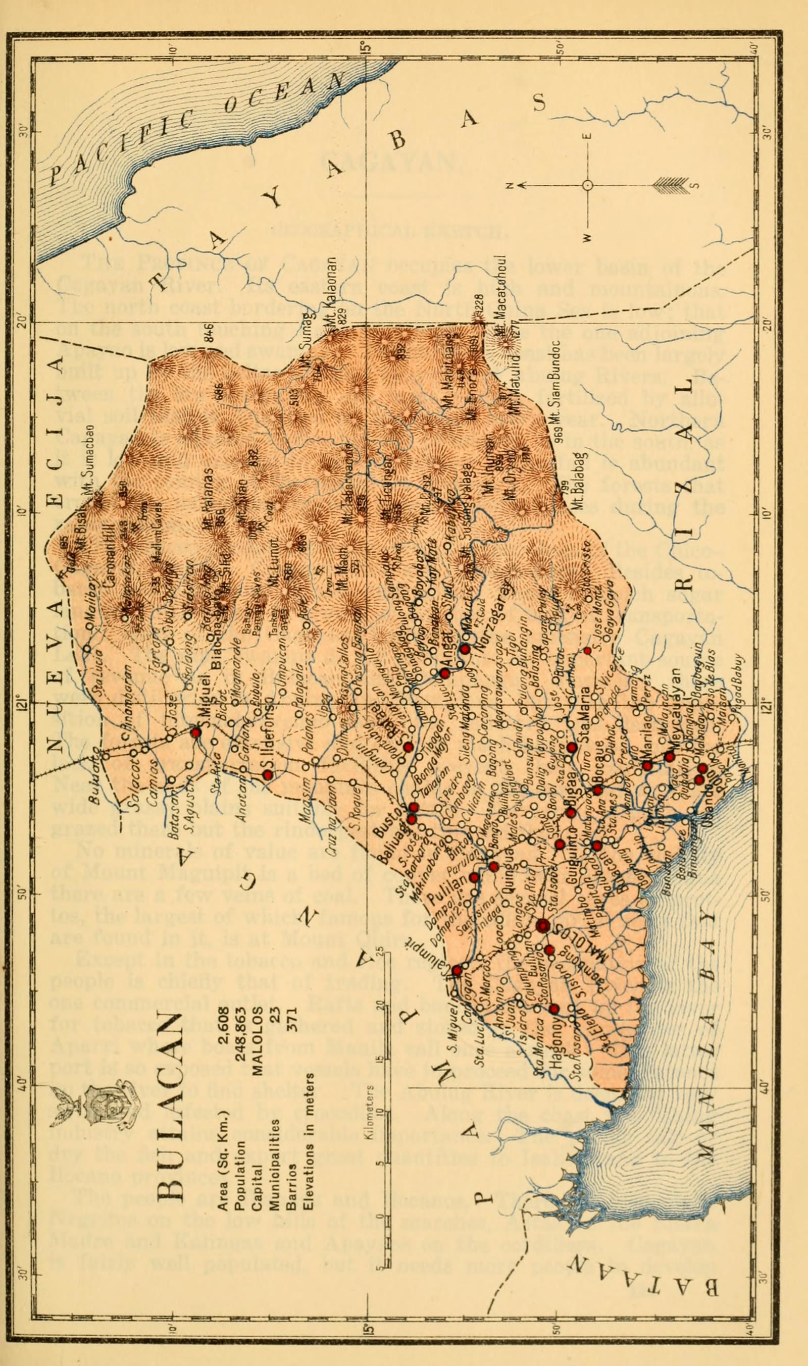
Bulacan
Census of the Philippine Islands taken under the direction of the Philippine Legislature in the year 1918, Volume I, Geography, History, and Climatology: map of BULACAN
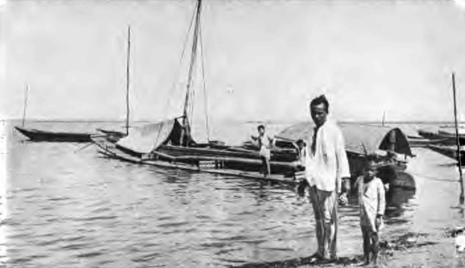
Cagayan
A barangayan boat in the Cagayan River
Cagayan
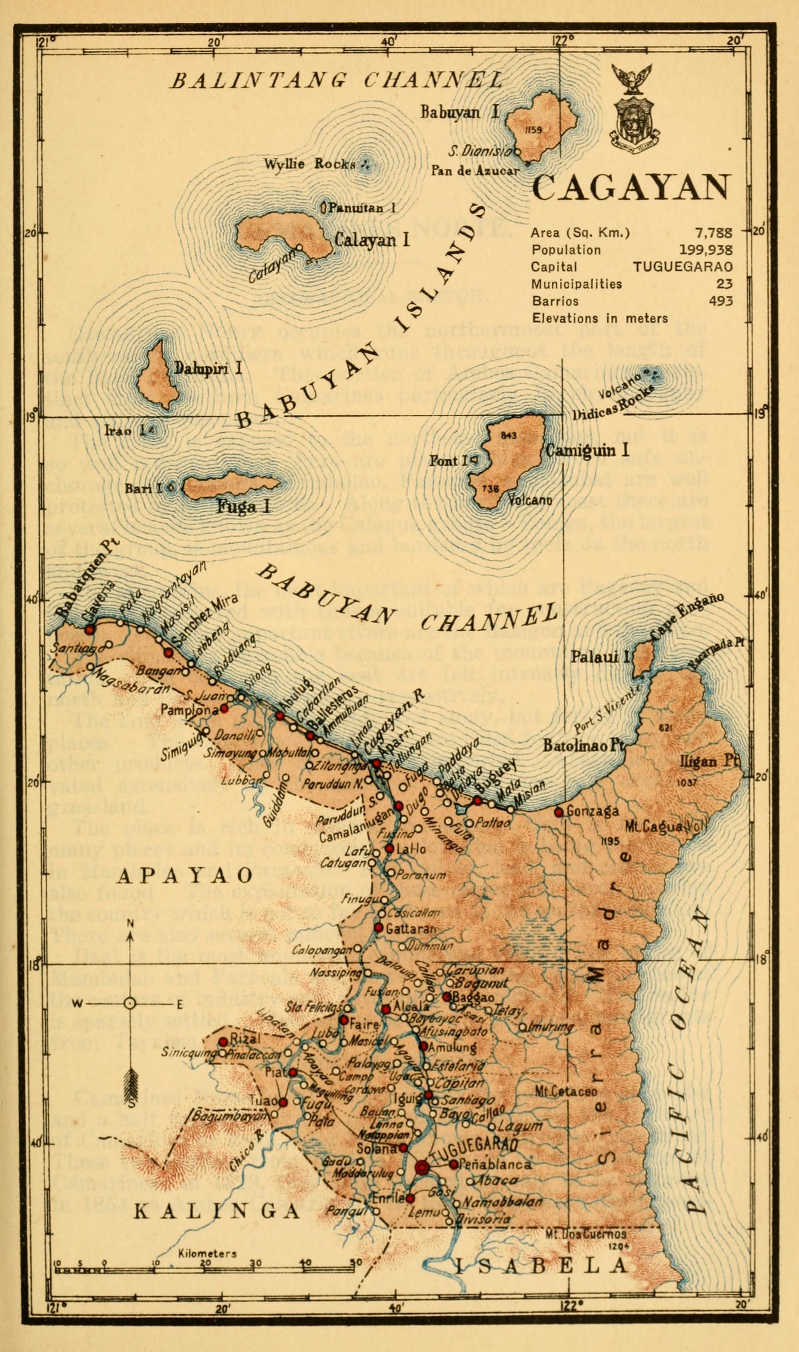
Census of the Philippine Islands taken under the direction of the Philippine Legislature in the year 1918, Volume I, Geography, History, and Climatology: map of CAGAYAN
Camarines Norte
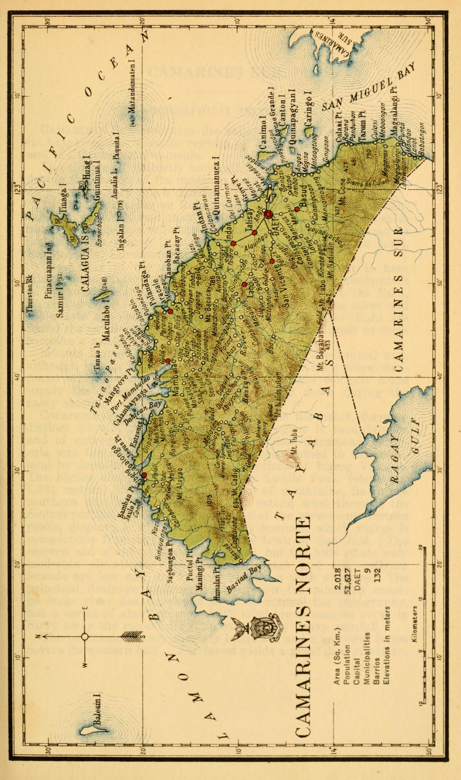
Census of the Philippine Islands taken under the direction of the Philippine Legislature in the year 1918, Volume I, Geography, History, and Climatology: map of CAMARINES NORTE
Camarines Norte
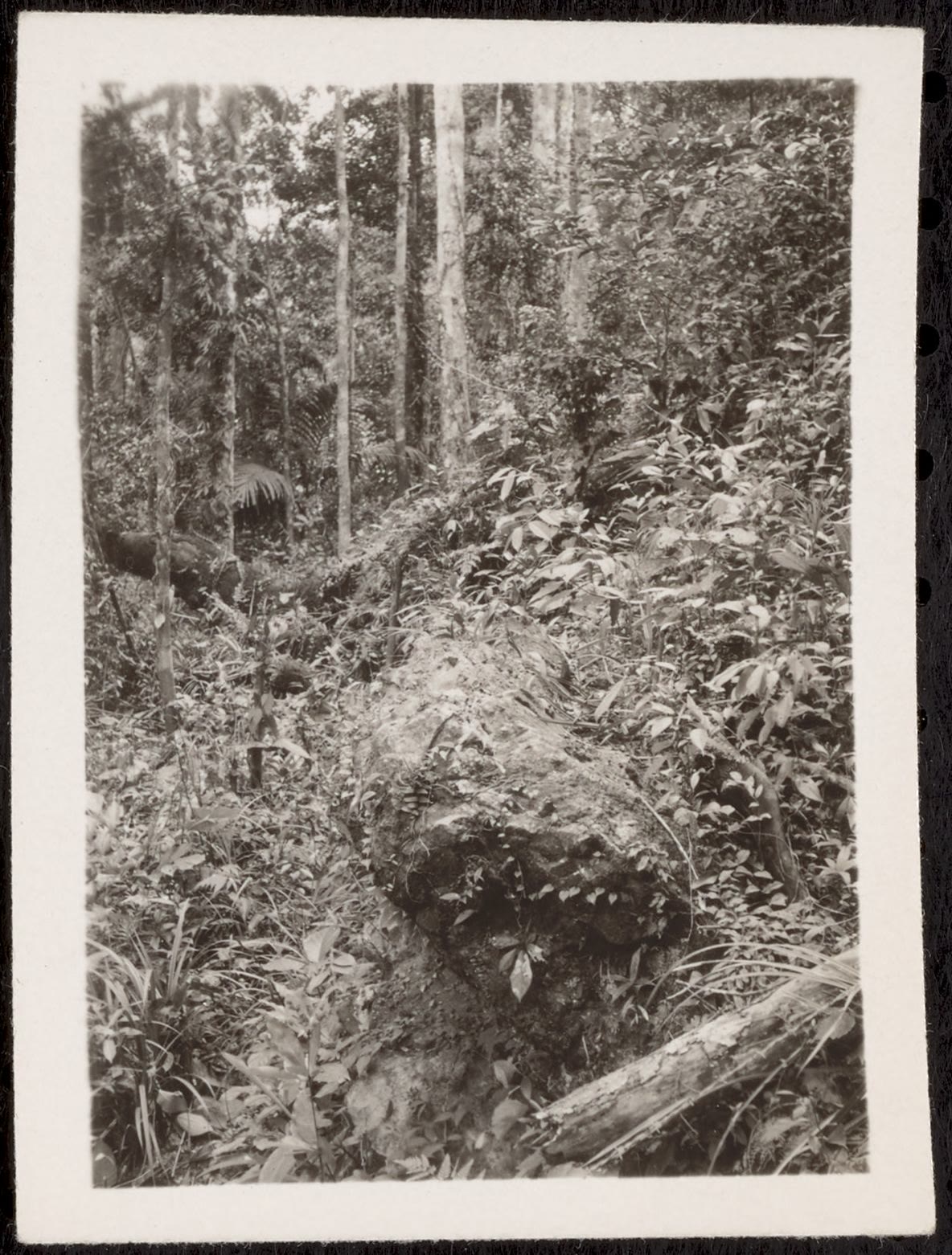
District of [Paracale], Island of Luzon, P.I. jungle scene
Camarines Norte
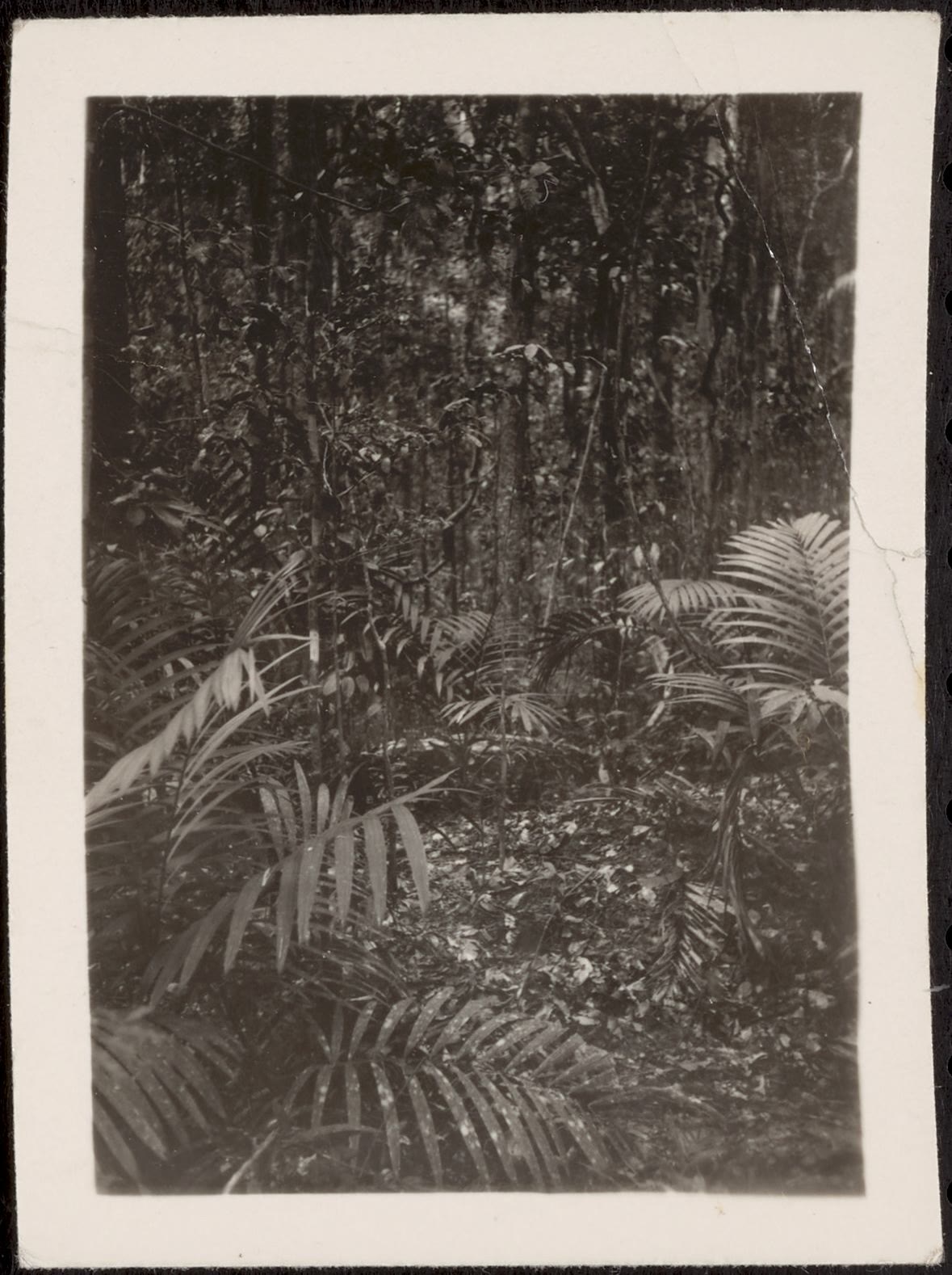
District of [Paracale], Island of Luzon, P.I. jungle scene
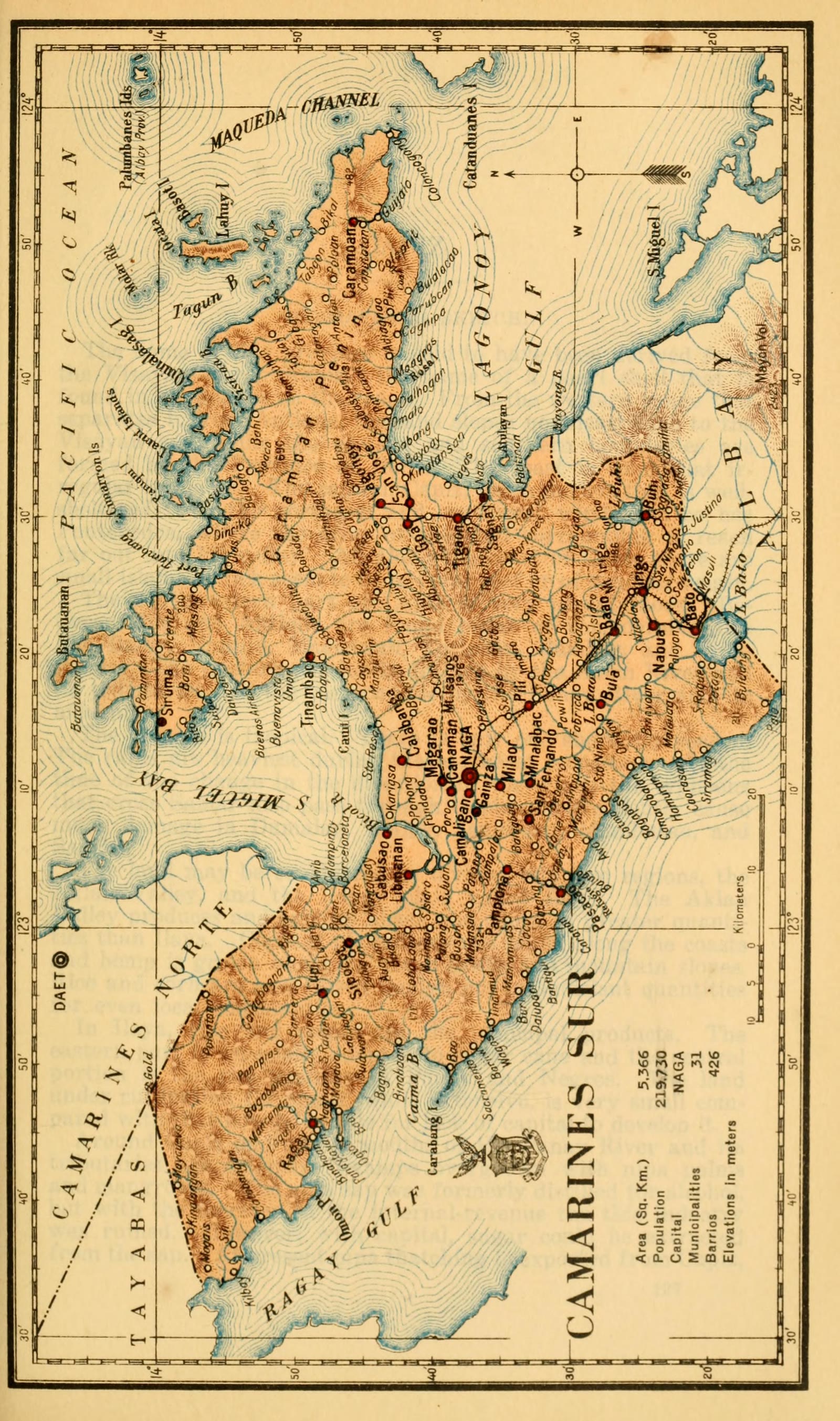
Camarines Sur
Census of the Philippine Islands taken under the direction of the Philippine Legislature in the year 1918, Volume I, Geography, History, and Climatology: map of CAMARINES SUR
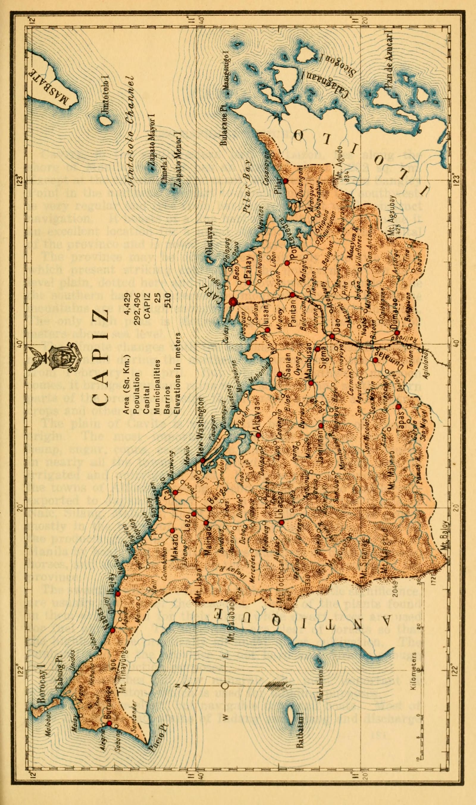
Capiz
Census of the Philippine Islands taken under the direction of the Philippine Legislature in the year 1918, Volume I, Geography, History, and Climatology: map of CAPIZ
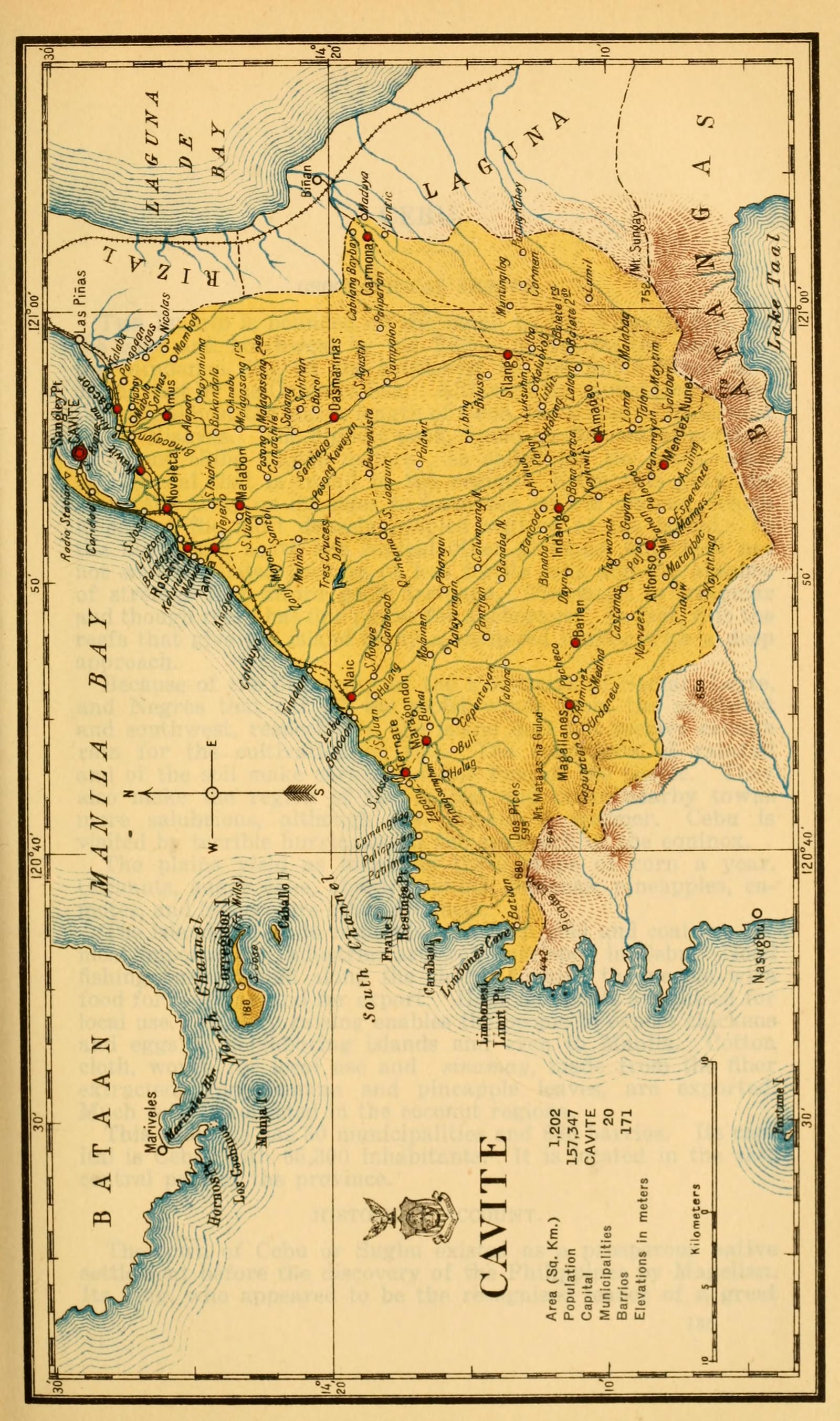
Cavite
Census of the Philippine Islands taken under the direction of the Philippine Legislature in the year 1918, Volume I, Geography, History, and Climatology: map of CAVITE
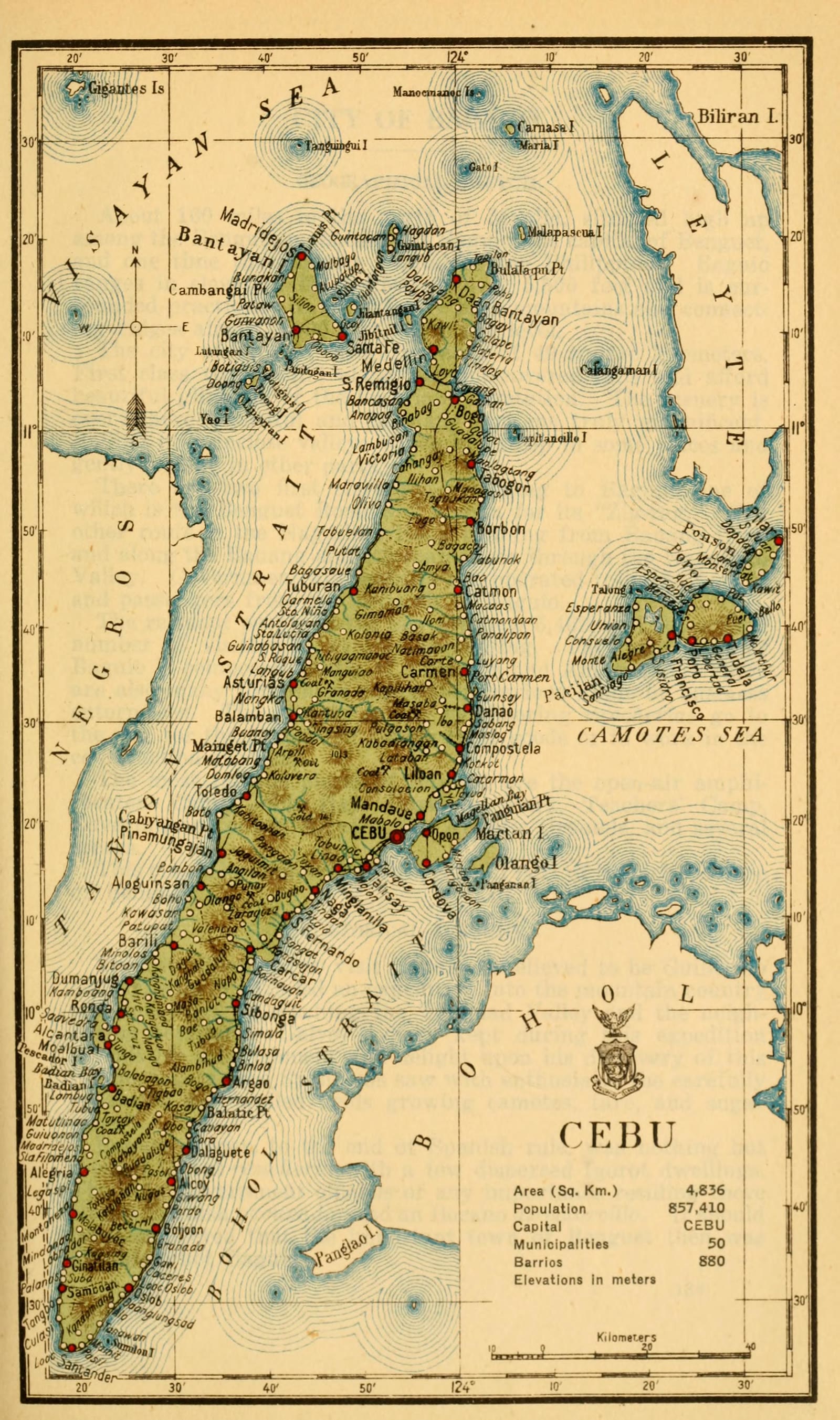
Cebu
Census of the Philippine Islands taken under the direction of the Philippine Legislature in the year 1918, Volume I, Geography, History, and Climatology: map of CEBU
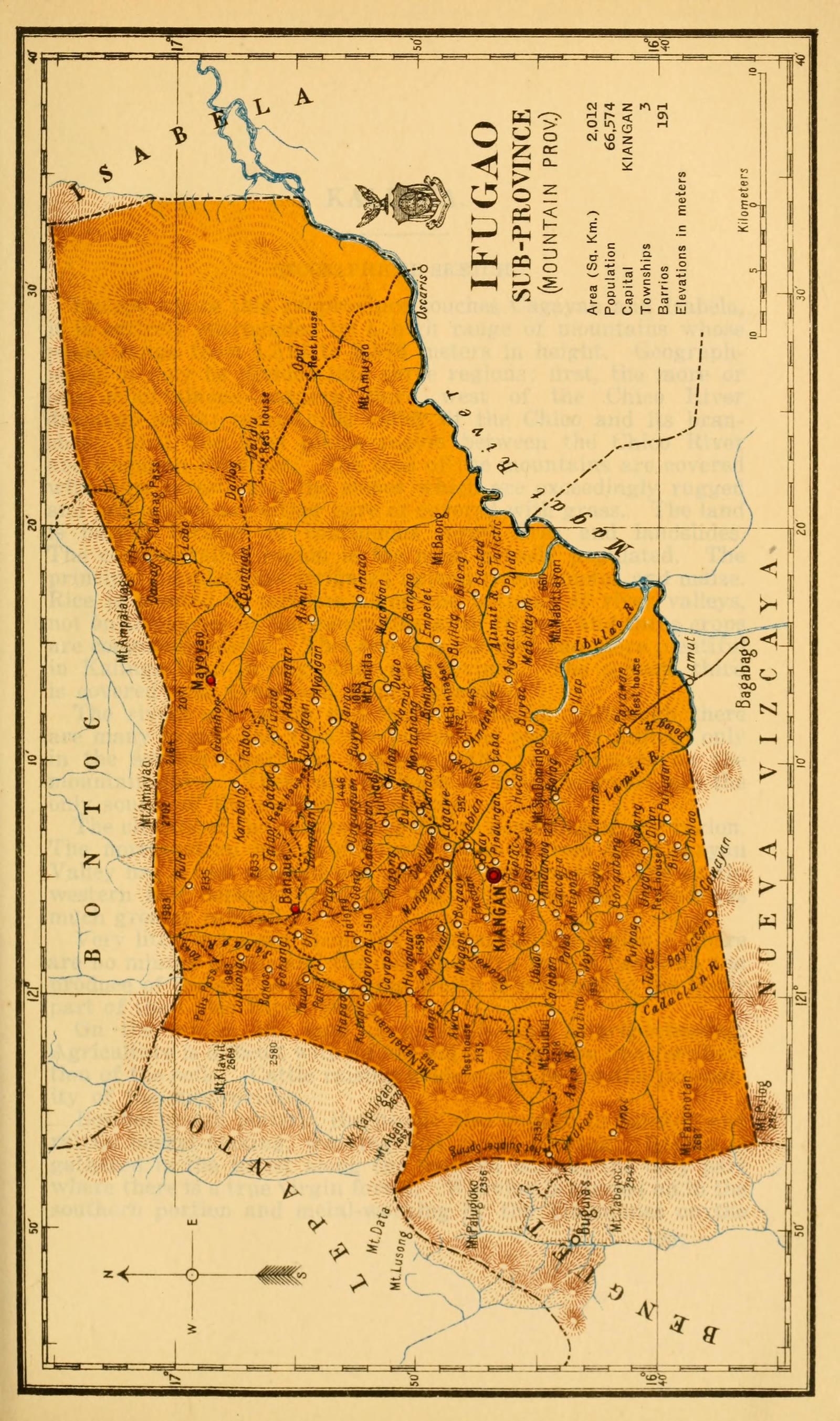
Ifugao
Census of the Philippine Islands taken under the direction of the Philippine Legislature in the year 1918, Volume I, Geography, History, and Climatology: map of IFUGAO, Sub-Province (Mountain Prov.)
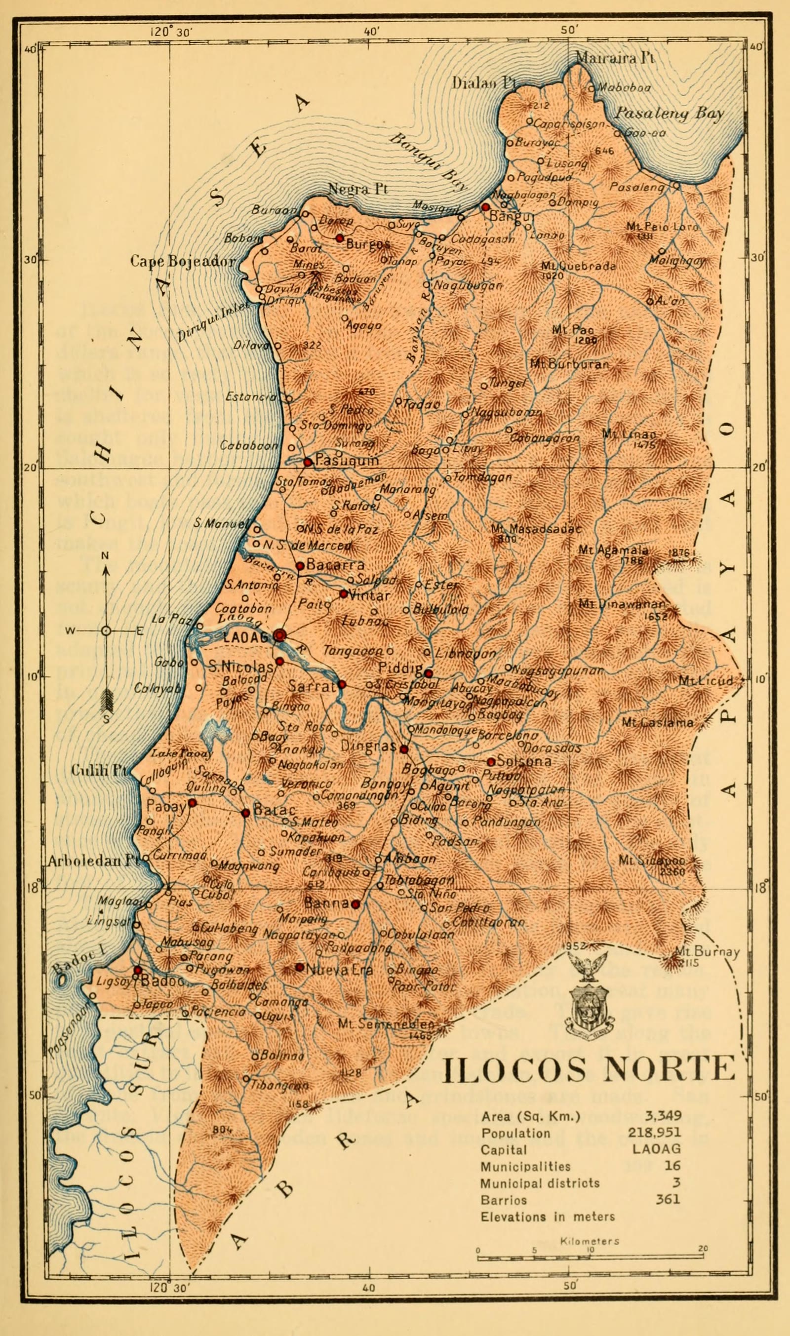
Ilocos Norte
Census of the Philippine Islands taken under the direction of the Philippine Legislature in the year 1918, Volume I, Geography, History, and Climatology: map of ILOCOS NORTE
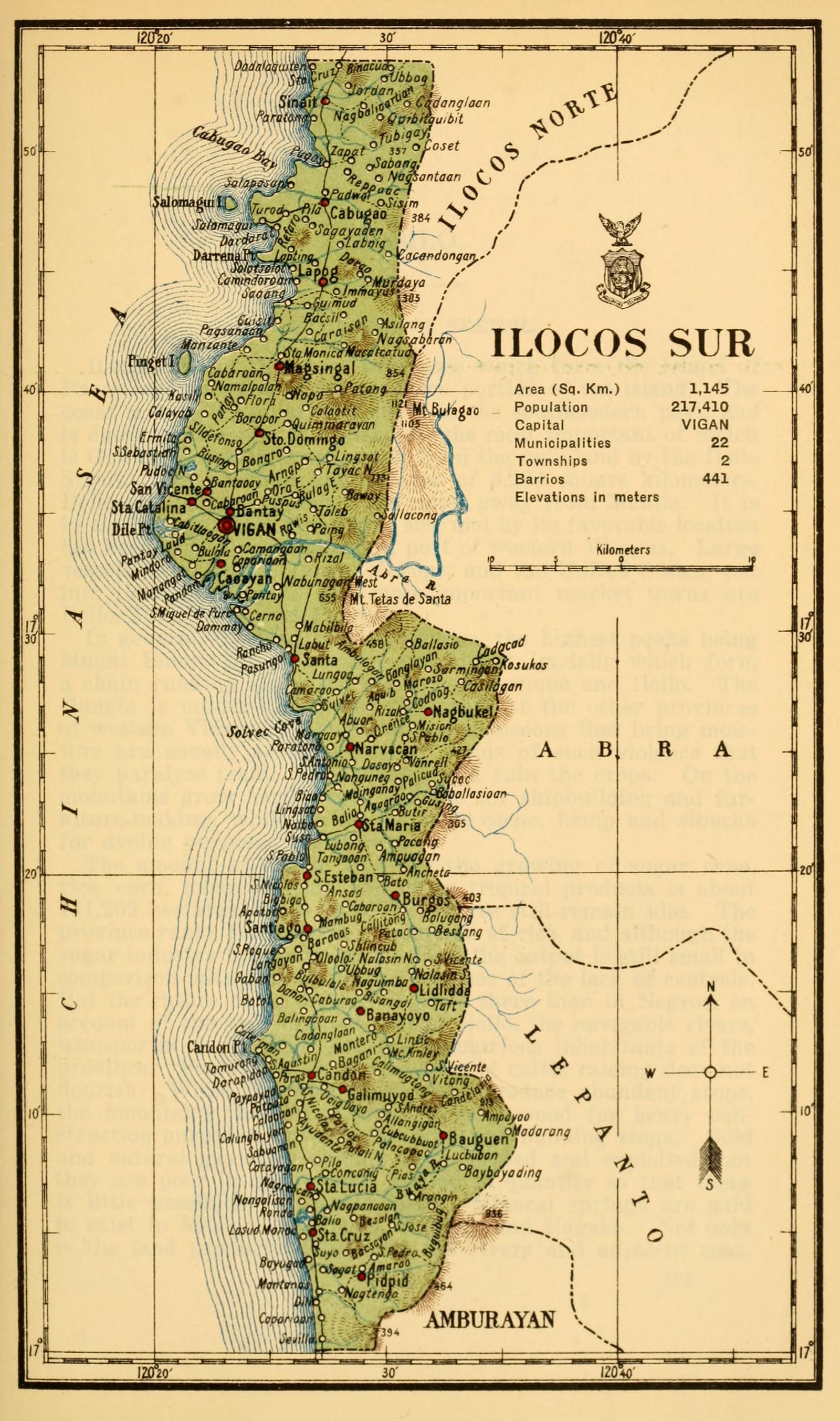
Ilocos Sur
Census of the Philippine Islands taken under the direction of the Philippine Legislature in the year 1918, Volume I, Geography, History, and Climatology: map of ILOCOS SUR
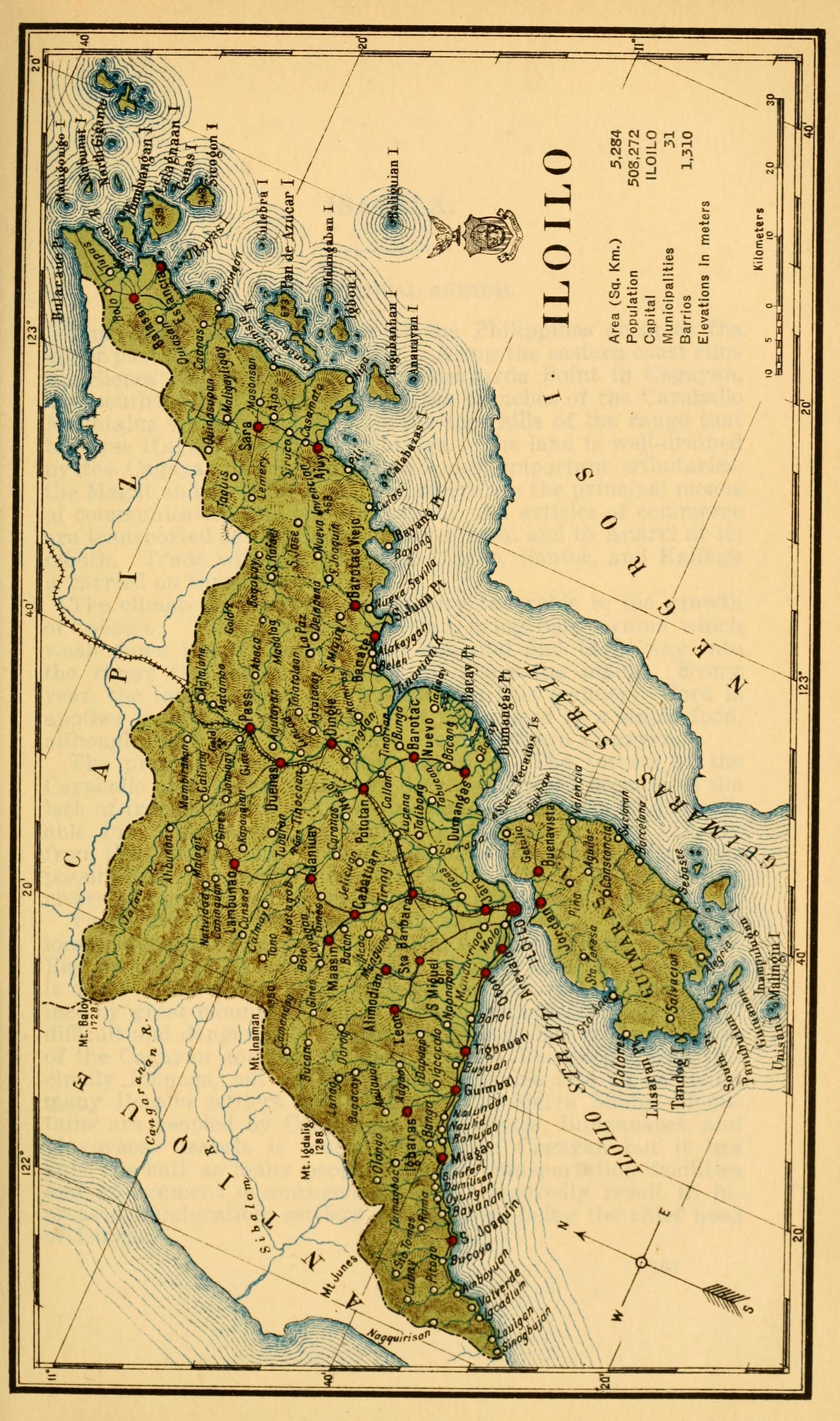
Iloilo
Census of the Philippine Islands taken under the direction of the Philippine Legislature in the year 1918, Volume I, Geography, History, and Climatology: map of ILOILO
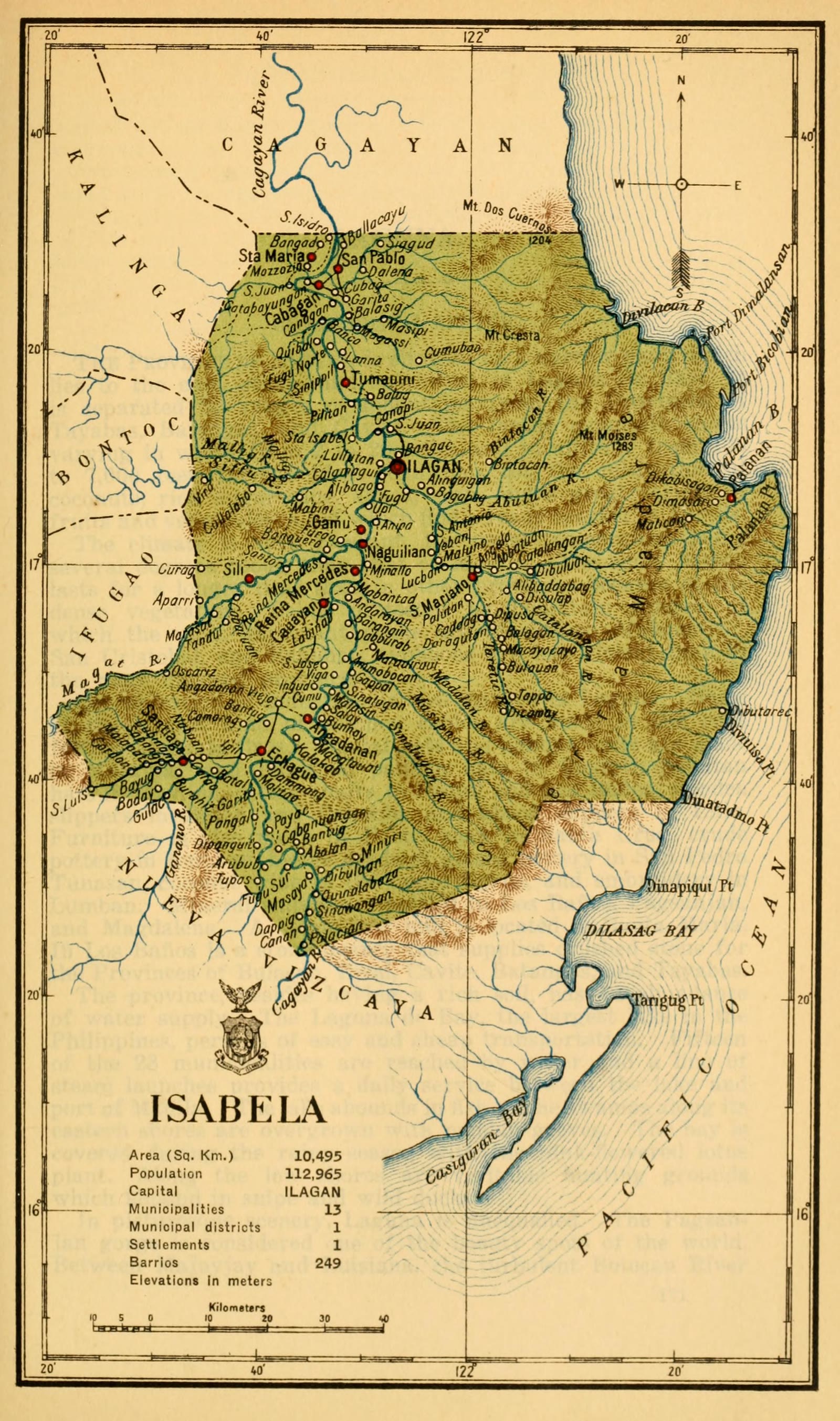
Isabela
Census of the Philippine Islands taken under the direction of the Philippine Legislature in the year 1918, Volume I, Geography, History, and Climatology: map of ISABELA
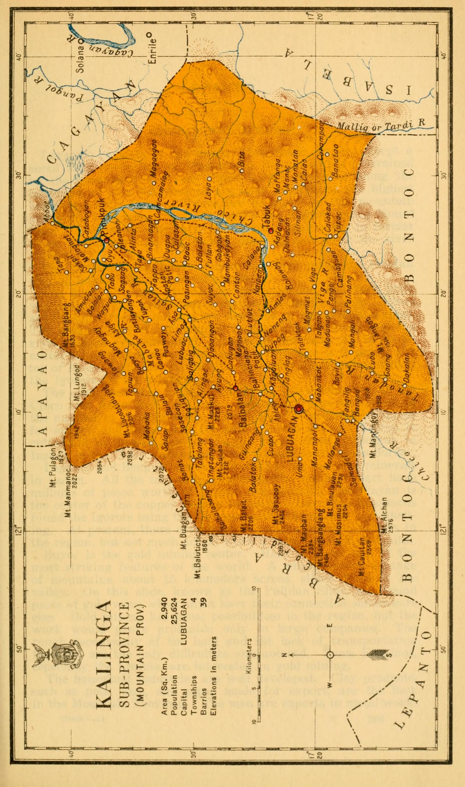
Kalinga
Census of the Philippine Islands taken under the direction of the Philippine Legislature in the year 1918, Volume I, Geography, History, and Climatology: map of KALINGA, Sub-Province (Mountain Prov.)
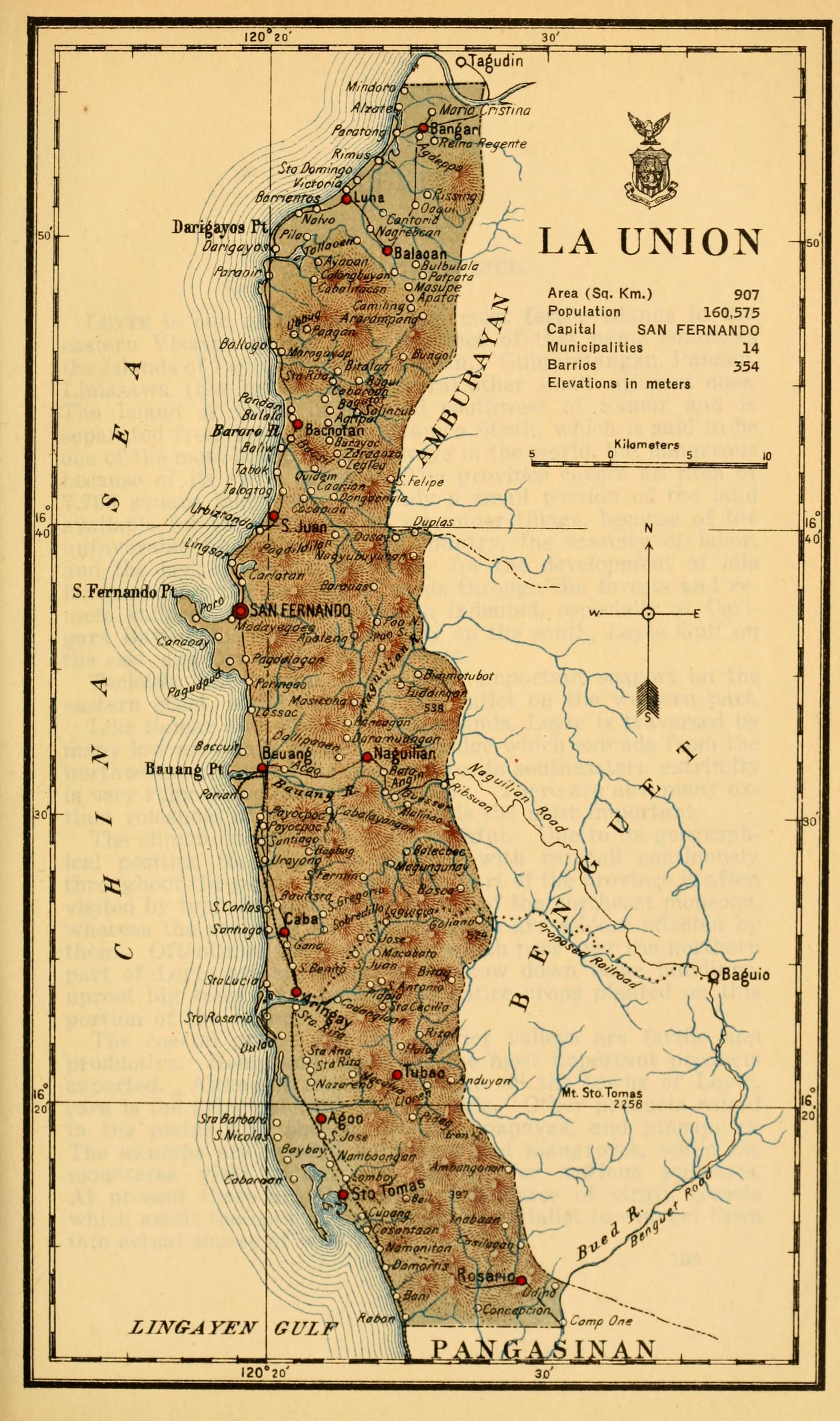
La Union
Census of the Philippine Islands taken under the direction of the Philippine Legislature in the year 1918, Volume I, Geography, History, and Climatology: map of LA UNION
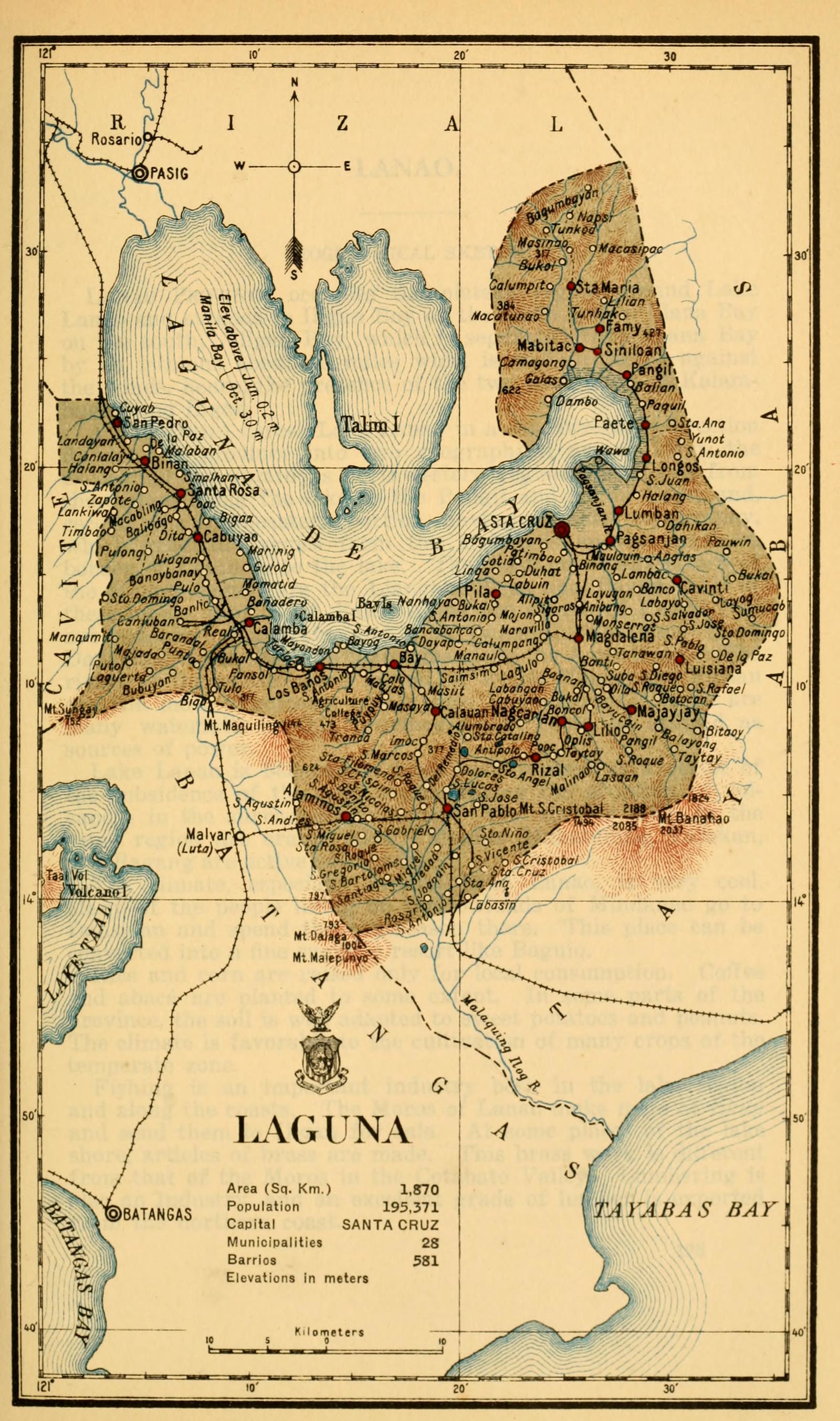
Laguna
Census of the Philippine Islands taken under the direction of the Philippine Legislature in the year 1918, Volume I, Geography, History, and Climatology: map of LAGUNA
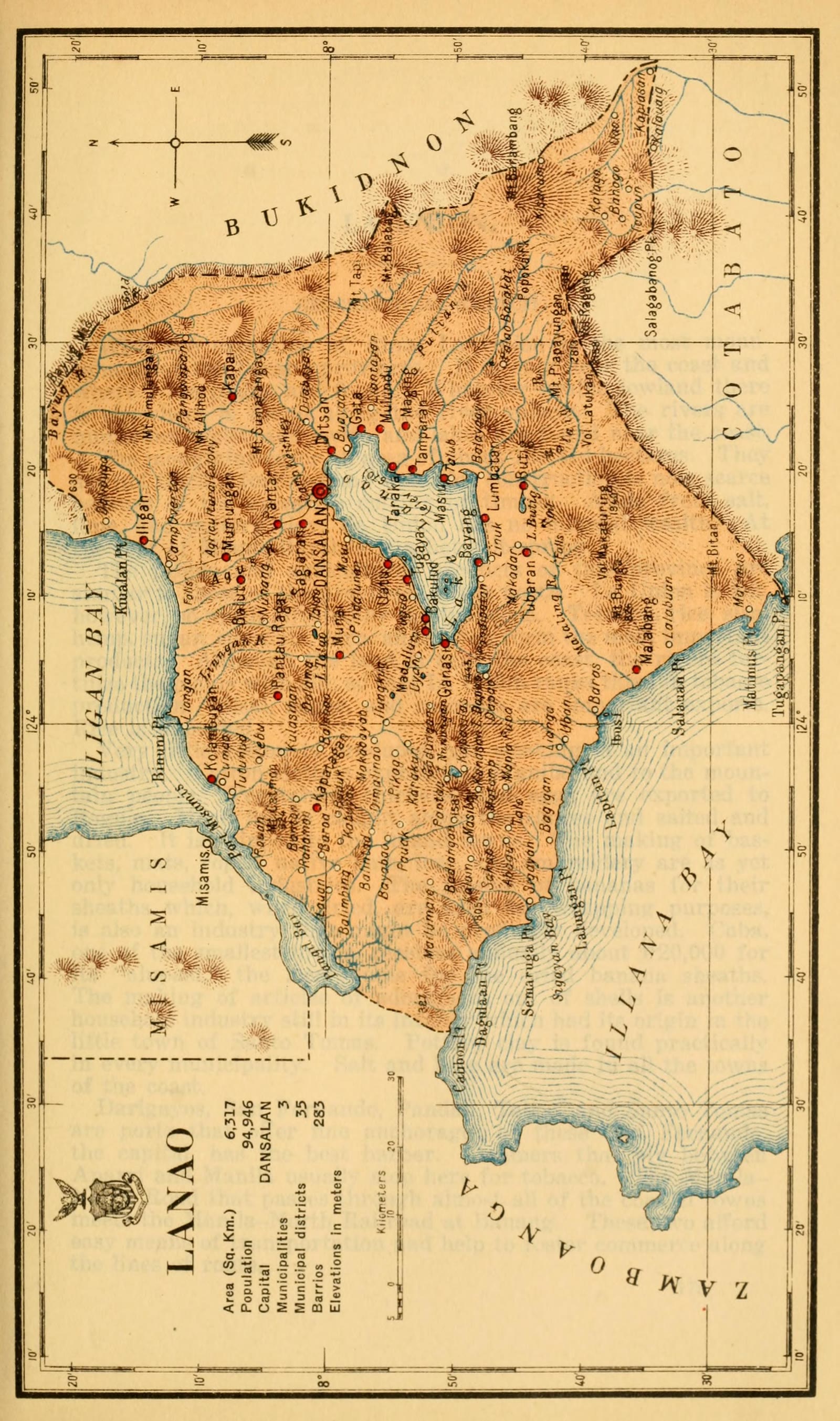
Lanao del Sur
Census of the Philippine Islands taken under the direction of the Philippine Legislature in the year 1918, Volume I, Geography, History, and Climatology: map of LANAO
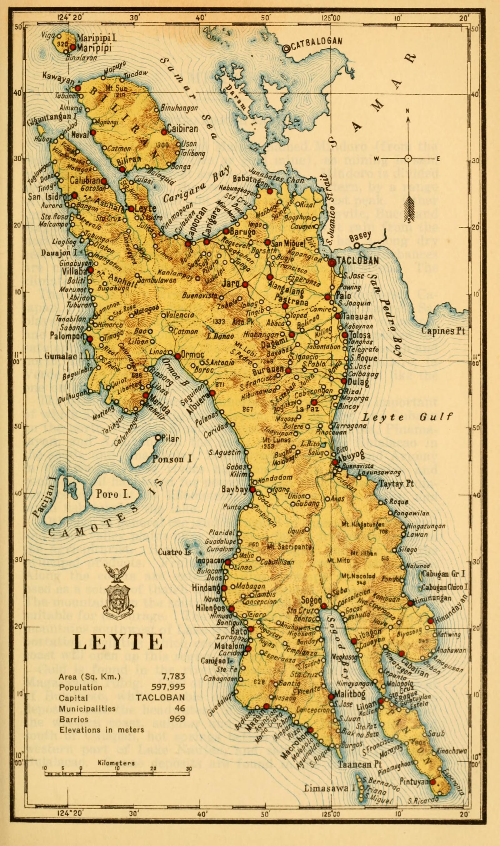
Leyte
Census of the Philippine Islands taken under the direction of the Philippine Legislature in the year 1918, Volume I, Geography, History, and Climatology: map of LEYTE
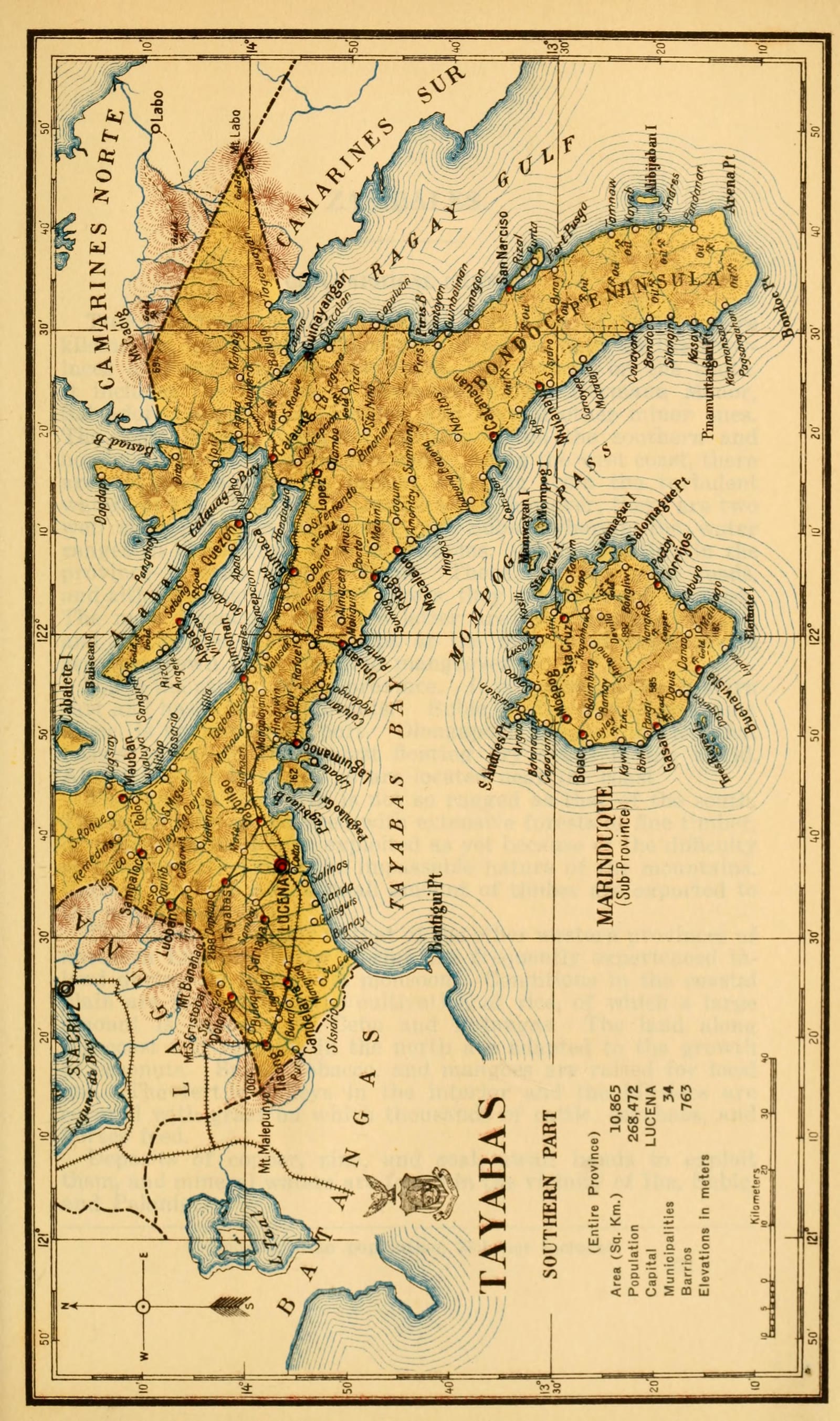
Marinduque
Census of the Philippine Islands taken under the direction of the Philippine Legislature in the year 1918, Volume I, Geography, History, and Climatology: map of TAYABAS, Southern Part (Entire Province)
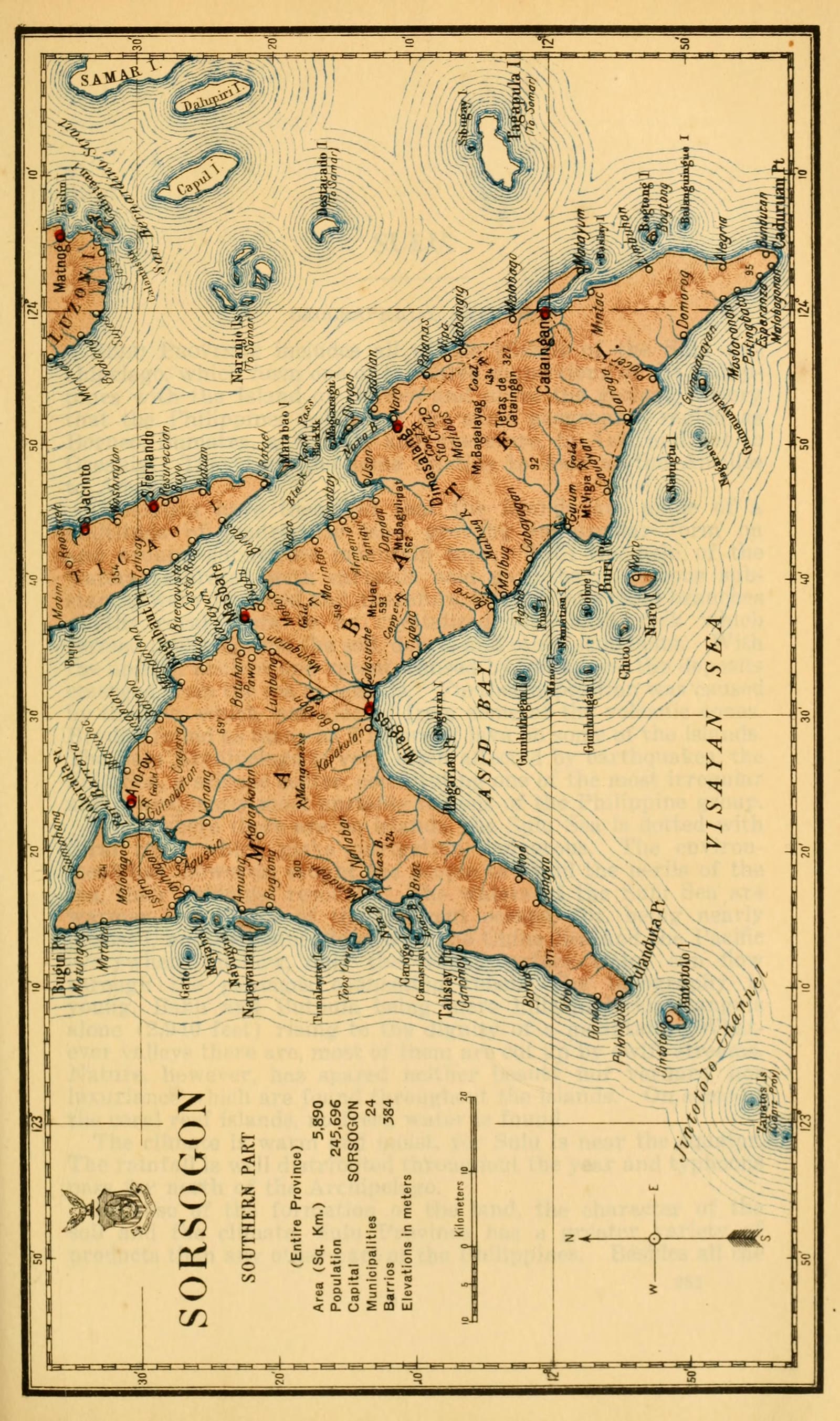
Masbate
Census of the Philippine Islands taken under the direction of the Philippine Legislature in the year 1918, Volume I, Geography, History, and Climatology: map of SORSOGON, Southern Part (Entire Province)
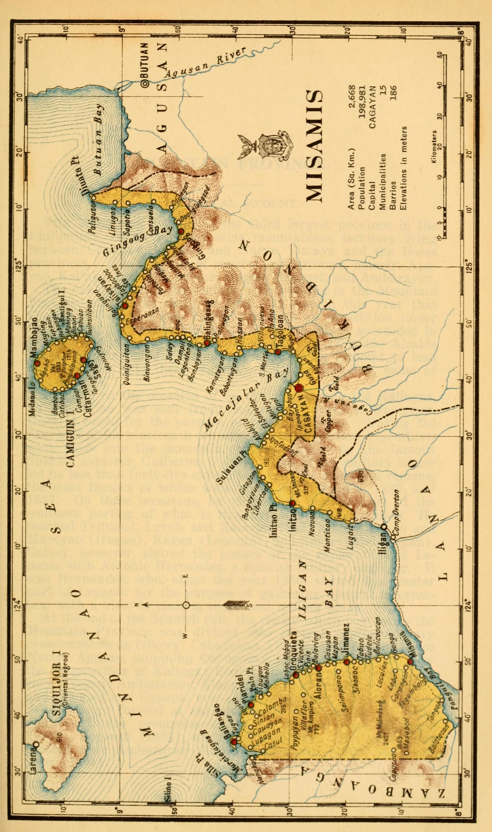
Misamis Oriental
Census of the Philippine Islands taken under the direction of the Philippine Legislature in the year 1918, Volume I, Geography, History, and Climatology: map of MISAMIS
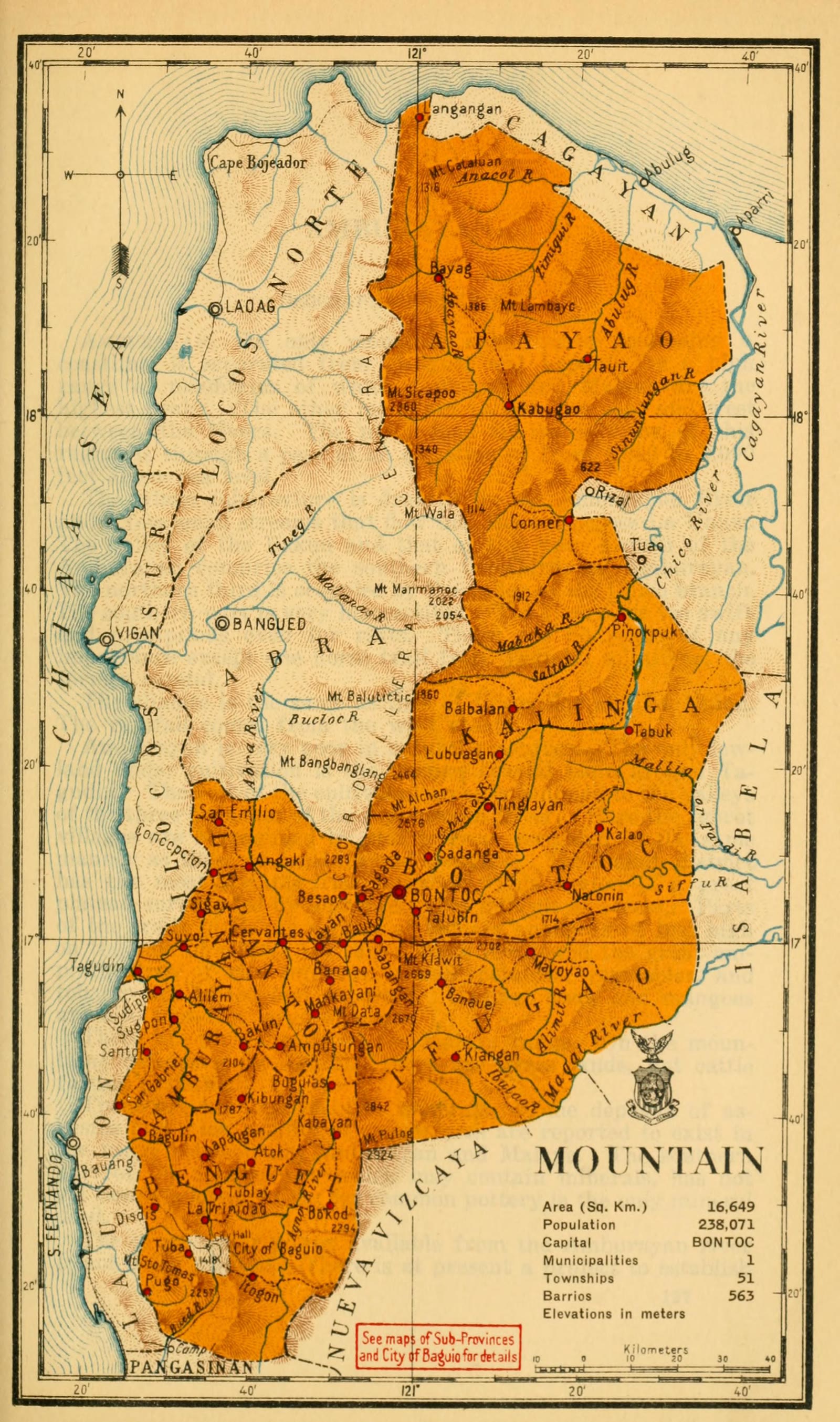
Mountain Province
Census of the Philippine Islands taken under the direction of the Philippine Legislature in the year 1918, Volume I, Geography, History, and Climatology: map of MOUNTAIN, Sub-Province (Mountain Prov.)
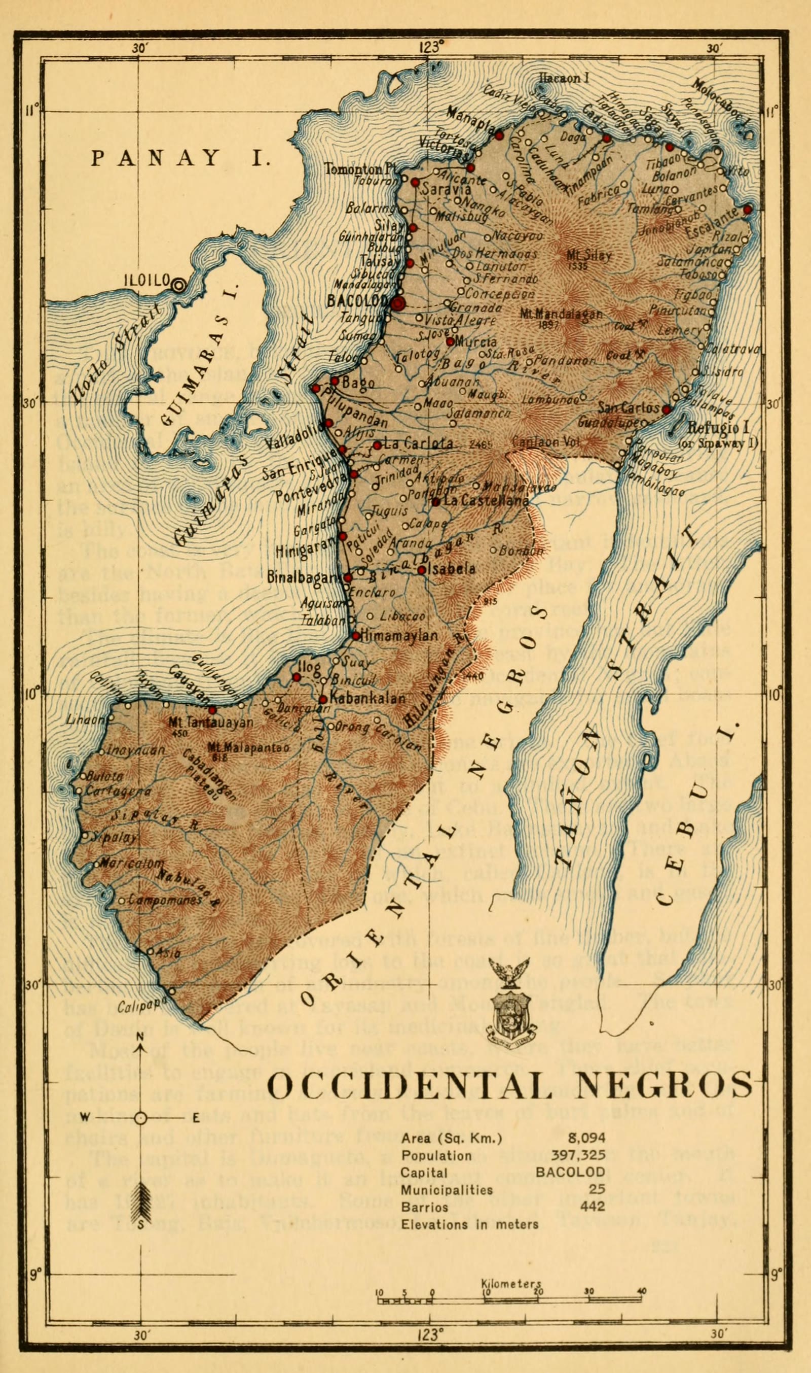
Negros Occidental
Census of the Philippine Islands taken under the direction of the Philippine Legislature in the year 1918, Volume I, Geography, History, and Climatology: map of OCCIDENTAL NEGROS
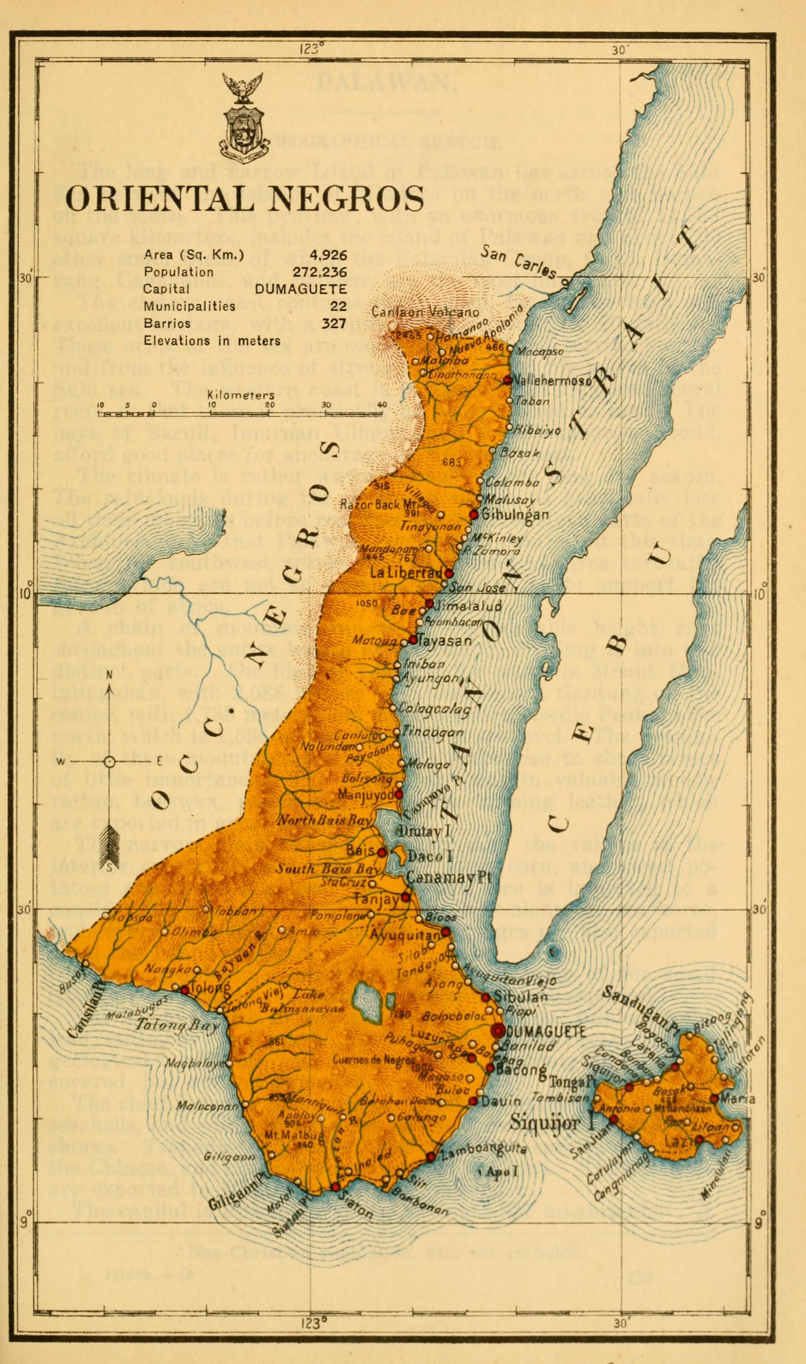
Negros Oriental
Census of the Philippine Islands taken under the direction of the Philippine Legislature in the year 1918, Volume I, Geography, History, and Climatology: map of ORIENTAL NEGROS
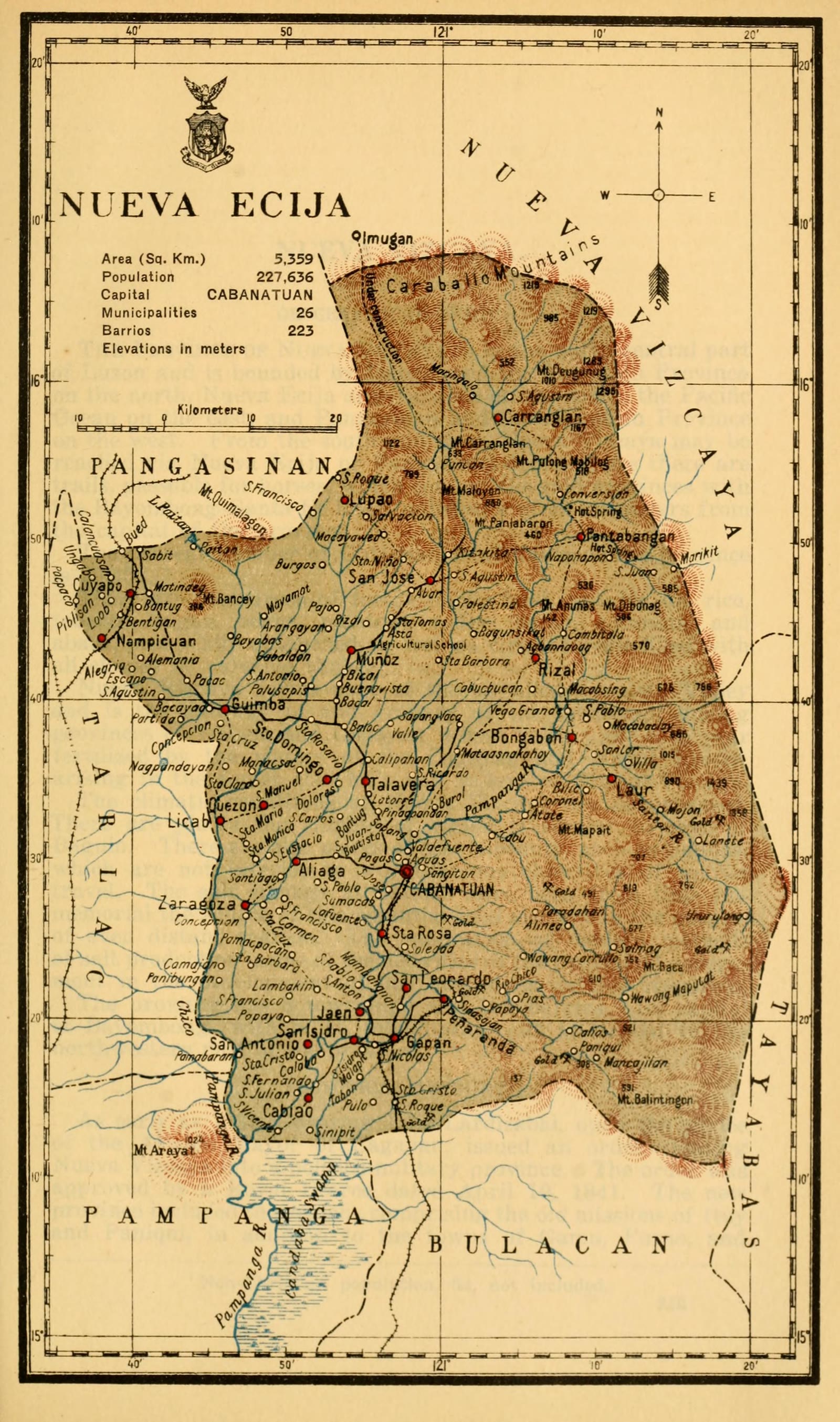
Nueva Ecija
Census of the Philippine Islands taken under the direction of the Philippine Legislature in the year 1918, Volume I, Geography, History, and Climatology: map of NUEVA ECIJA
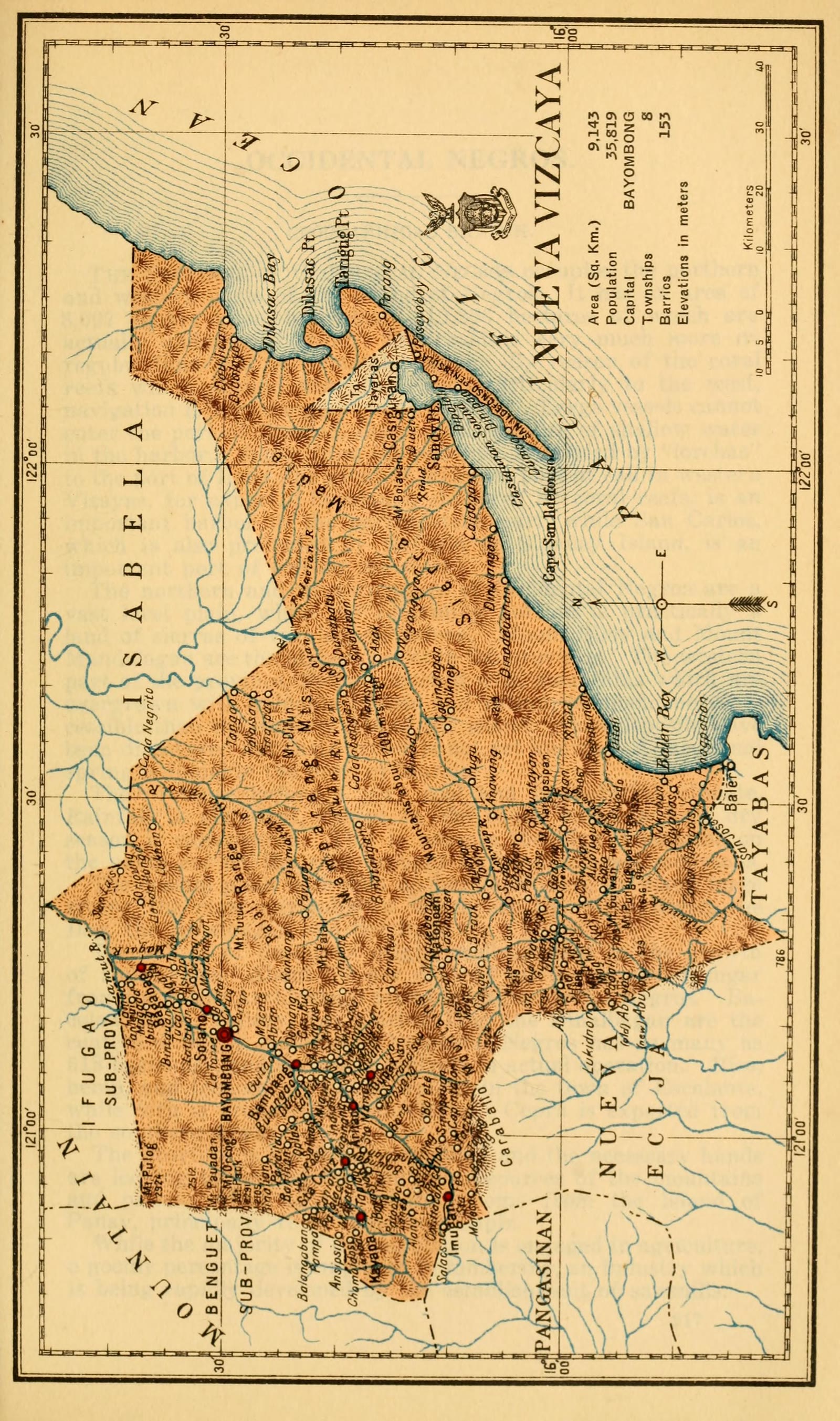
Nueva Vizcaya
Census of the Philippine Islands taken under the direction of the Philippine Legislature in the year 1918, Volume I, Geography, History, and Climatology: map of NUEVA VIZCAYA
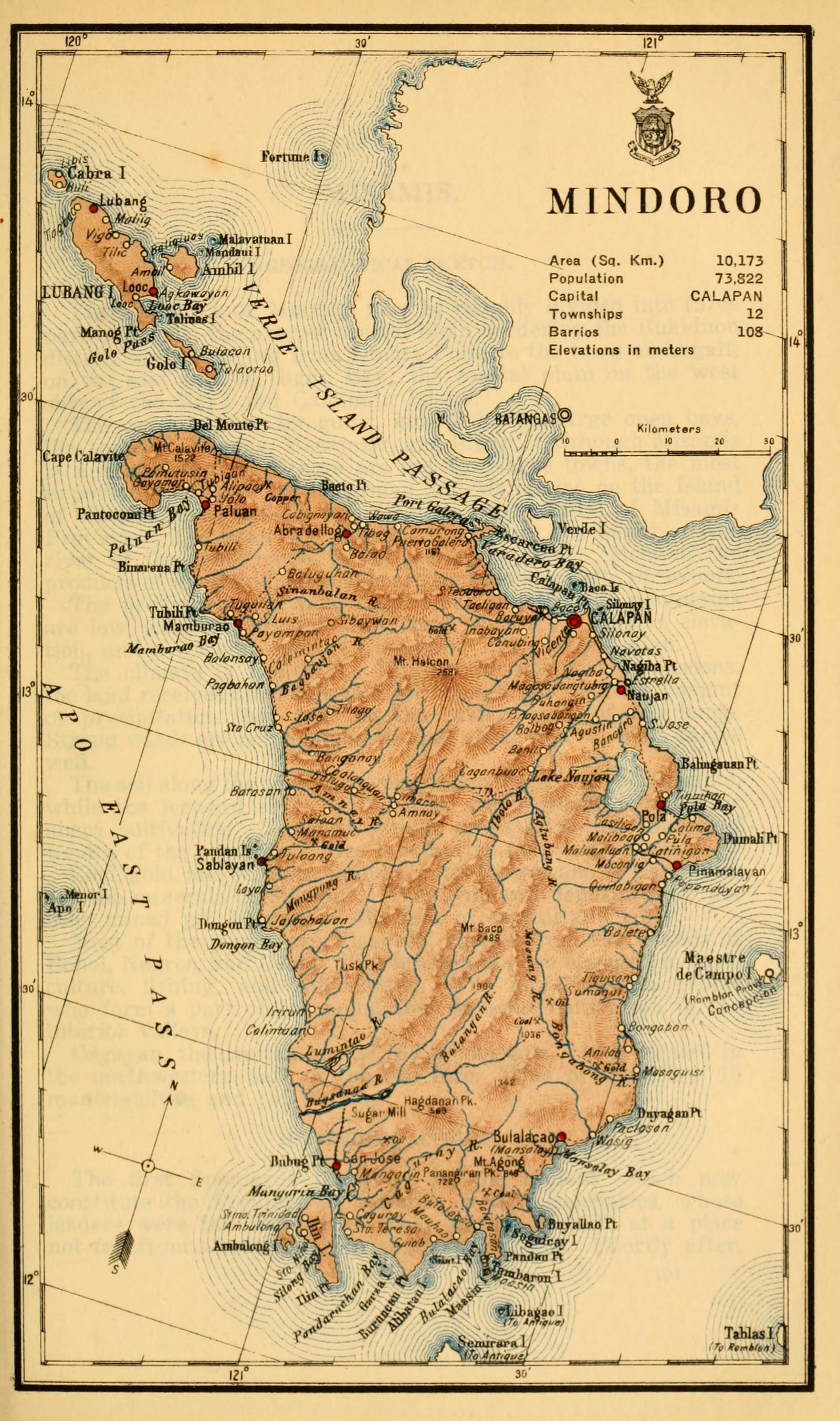
Oriental Mindoro
Census of the Philippine Islands taken under the direction of the Philippine Legislature in the year 1918, Volume I, Geography, History, and Climatology: map of MINDORO
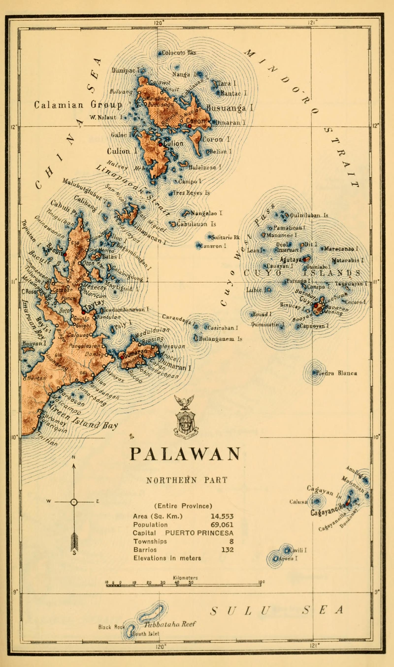
Palawan
Census of the Philippine Islands taken under the direction of the Philippine Legislature in the year 1918, Volume I, Geography, History, and Climatology: map of PALAWAN, Northern Part (Entire Province)
Palawan
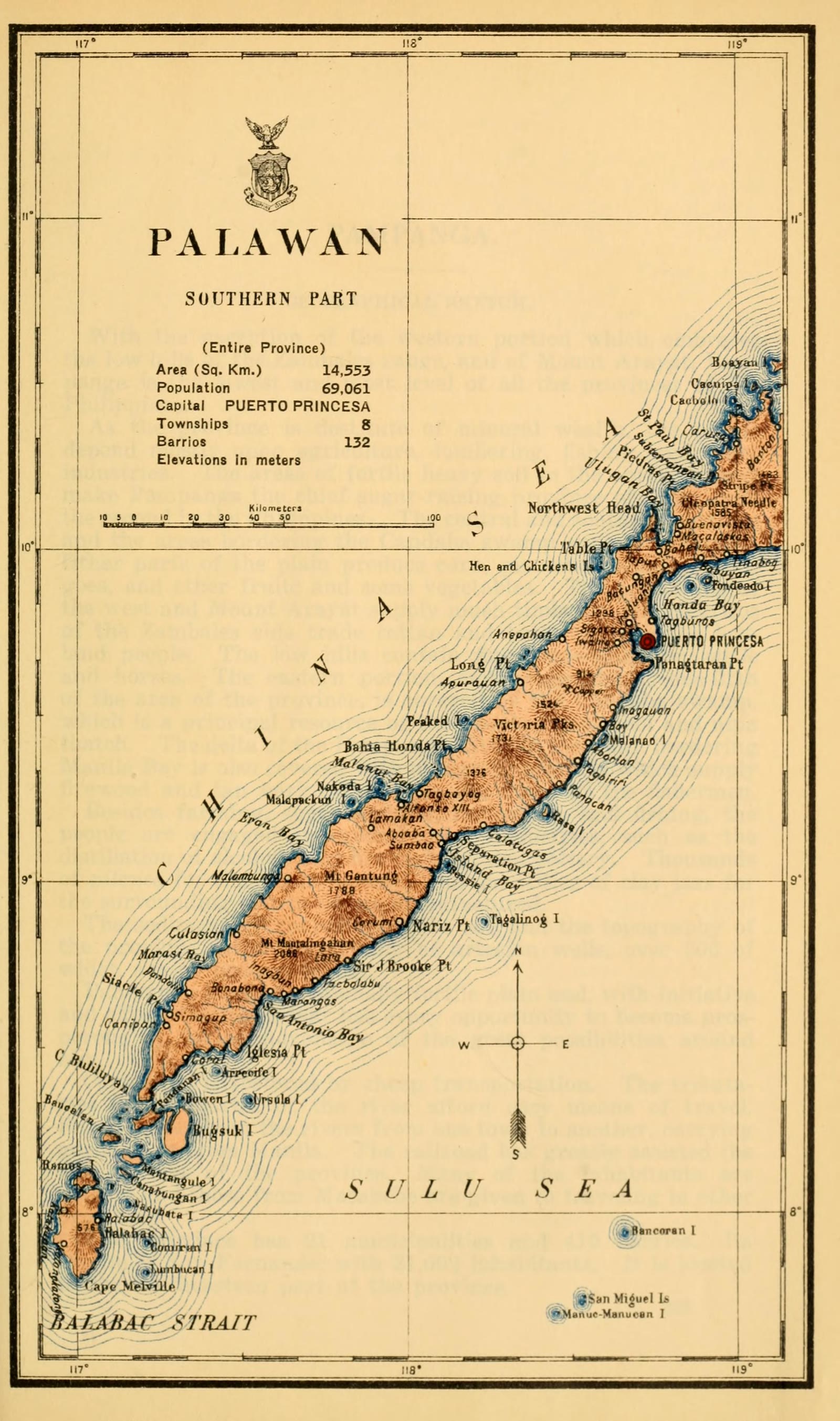
Census of the Philippine Islands taken under the direction of the Philippine Legislature in the year 1918, Volume I, Geography, History, and Climatology: map of PALAWAN, Southern Part (Entire Province)
Pampanga
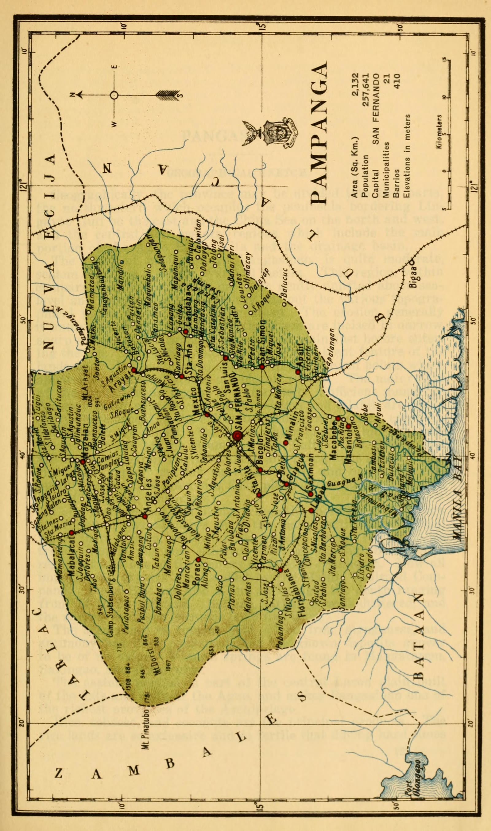
Census of the Philippine Islands taken under the direction of the Philippine Legislature in the year 1918, Volume I, Geography, History, and Climatology: map of PAMPANGA
Pangasinan
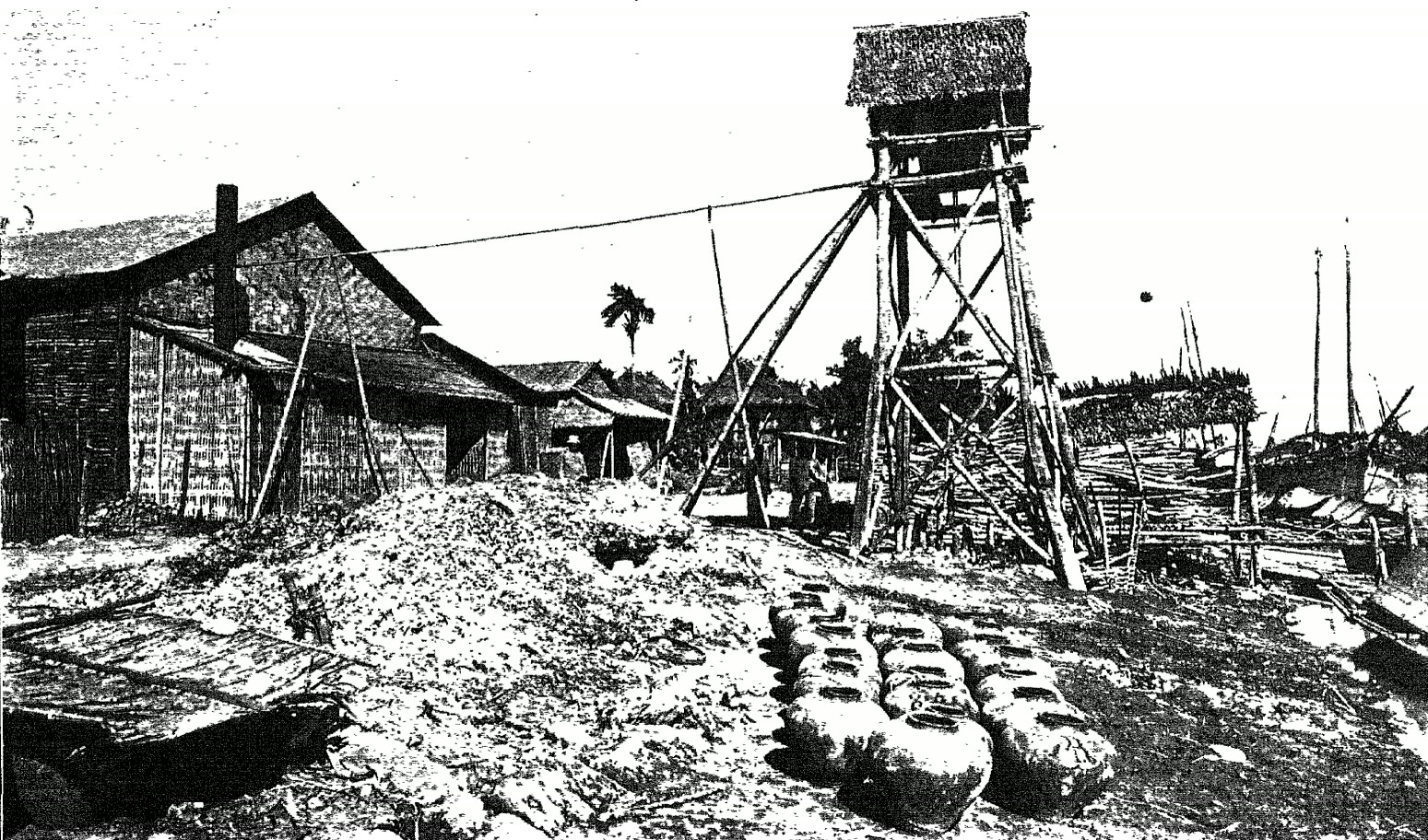
Exterior of primitive distillery in Pangasinan Province (Philippines, c. 1912)
Pangasinan
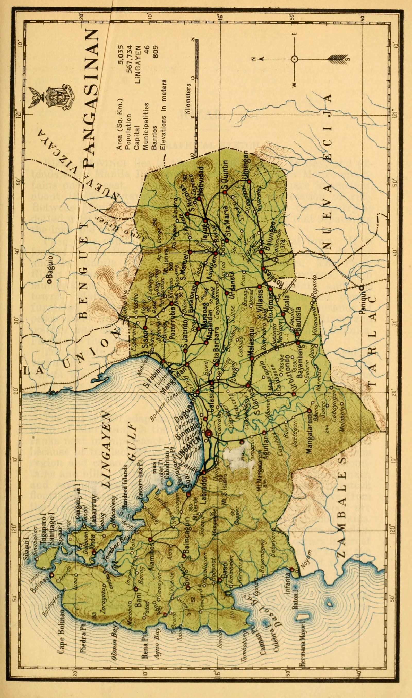
Census of the Philippine Islands taken under the direction of the Philippine Legislature in the year 1918, Volume I, Geography, History, and Climatology: map of PANGASINAN
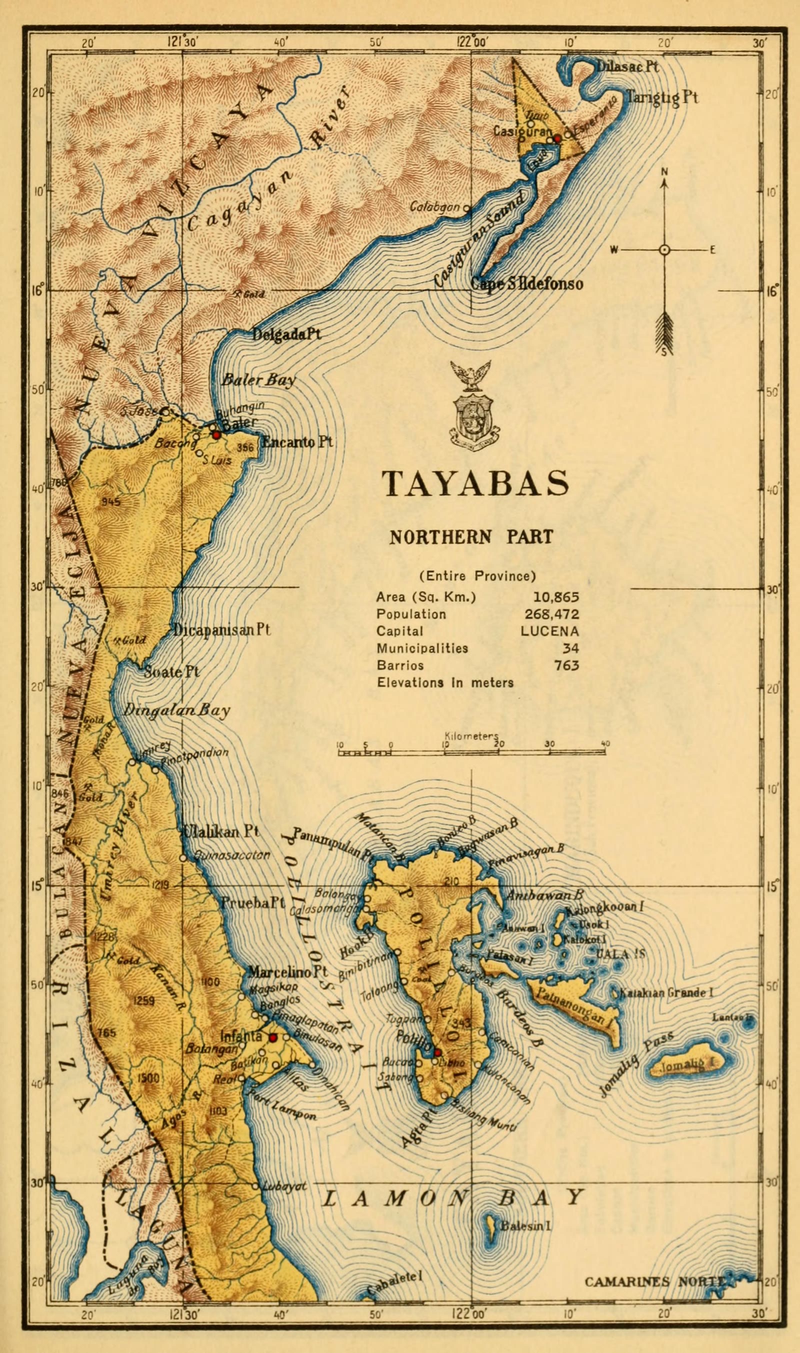
Quezon
Census of the Philippine Islands taken under the direction of the Philippine Legislature in the year 1918, Volume I, Geography, History, and Climatology: map of TAYABAS, Northern Part (Entire Province)
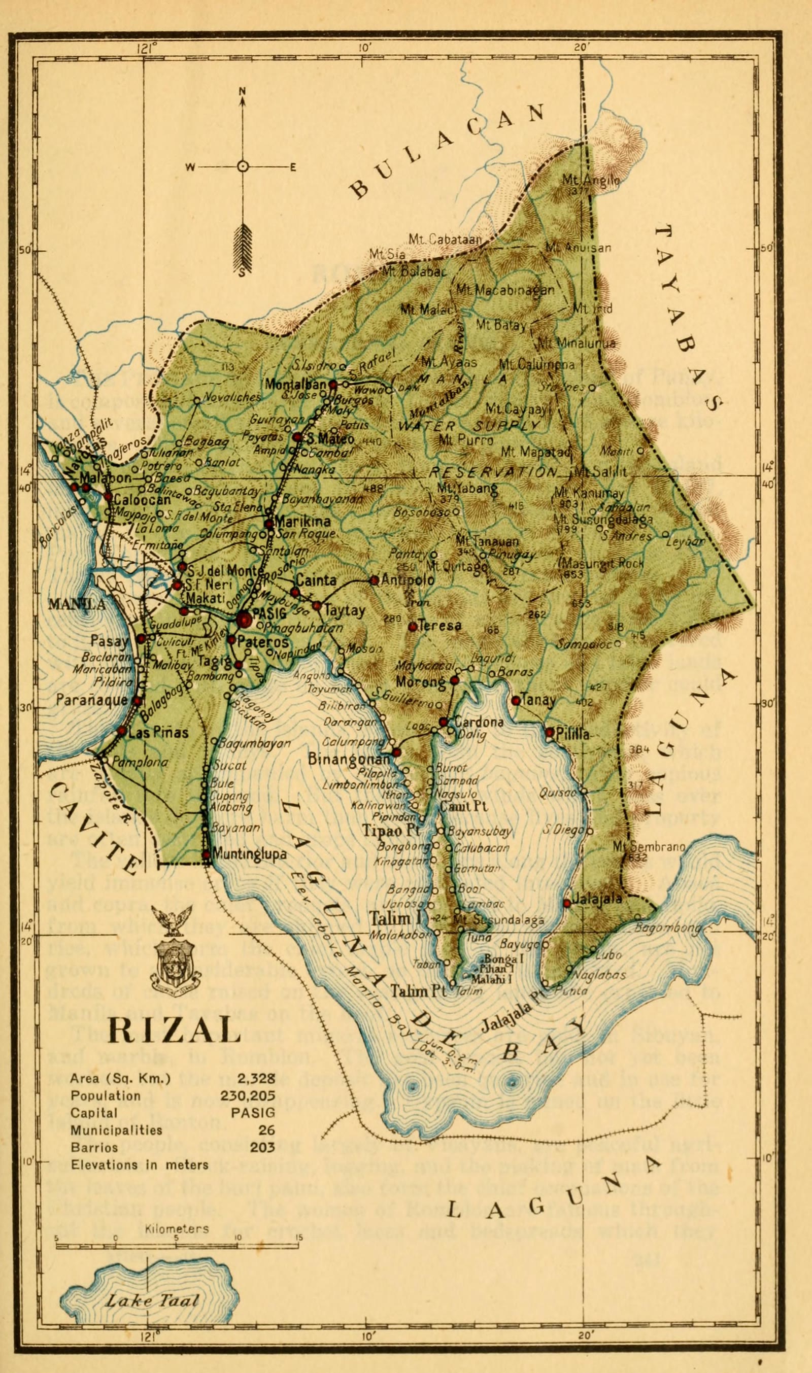
Rizal
Census of the Philippine Islands taken under the direction of the Philippine Legislature in the year 1918, Volume I, Geography, History, and Climatology: map of RIZAL
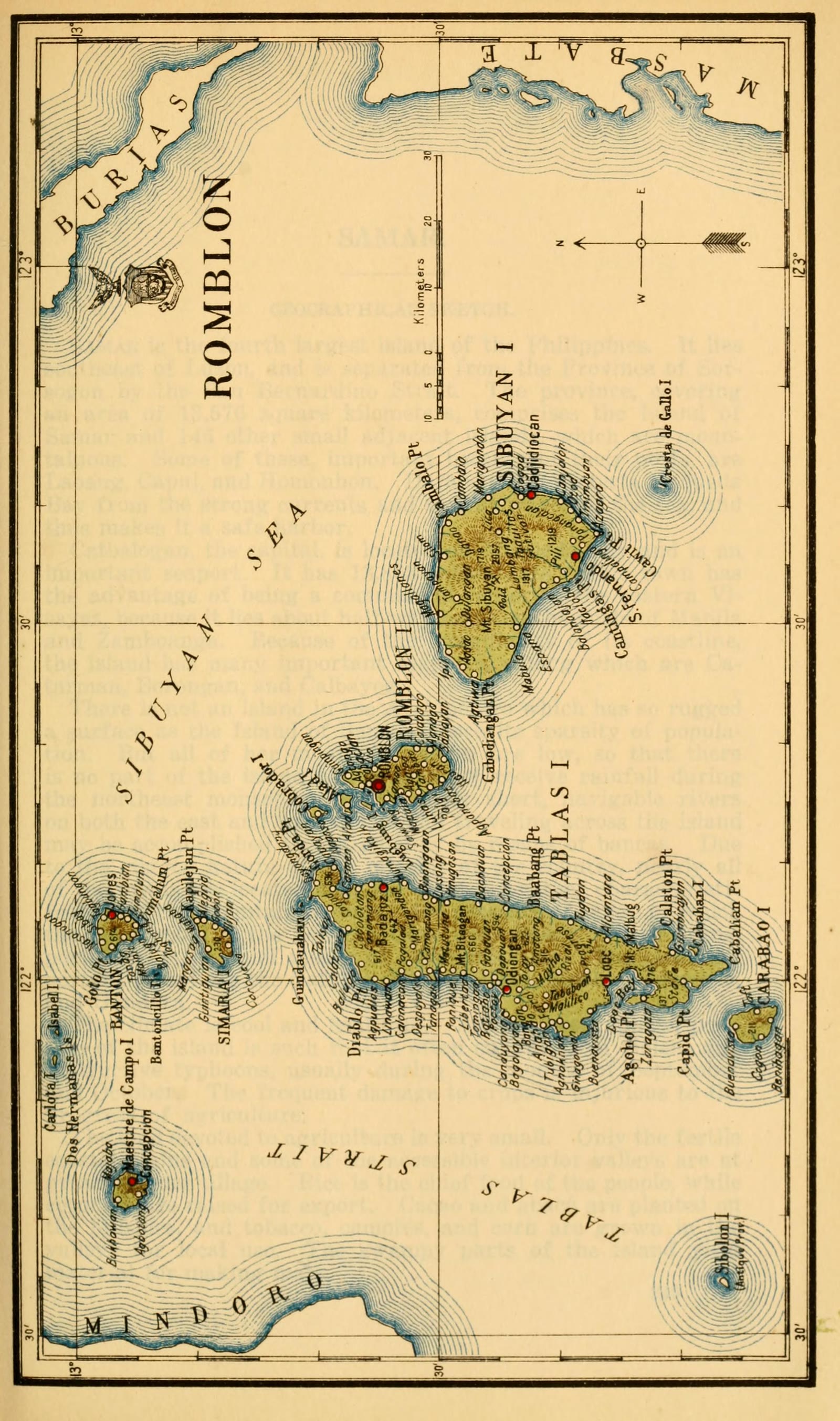
Romblon
Census of the Philippine Islands taken under the direction of the Philippine Legislature in the year 1918, Volume I, Geography, History, and Climatology: map of ROMBLON
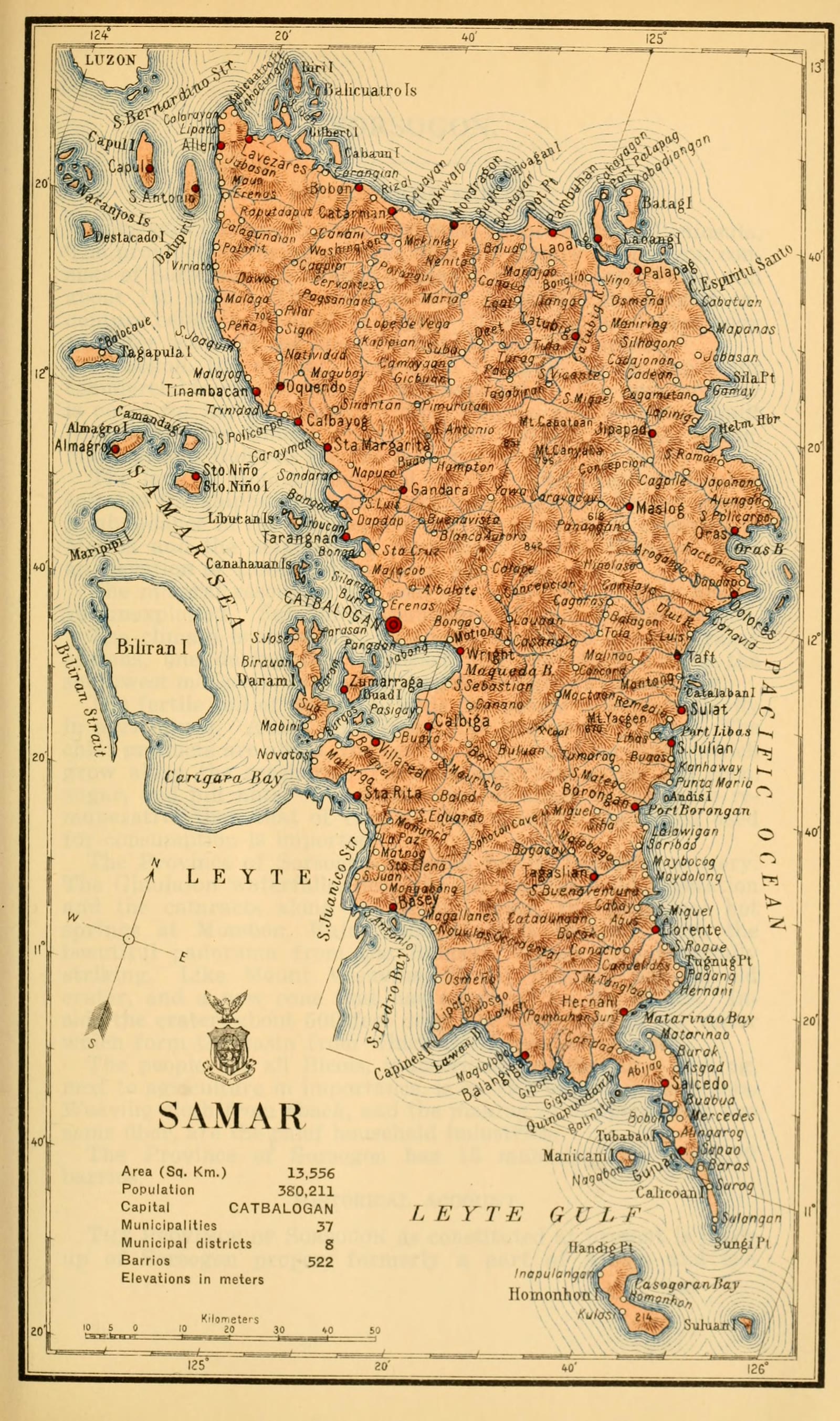
Samar
Census of the Philippine Islands taken under the direction of the Philippine Legislature in the year 1918, Volume I, Geography, History, and Climatology: map of SAMAR
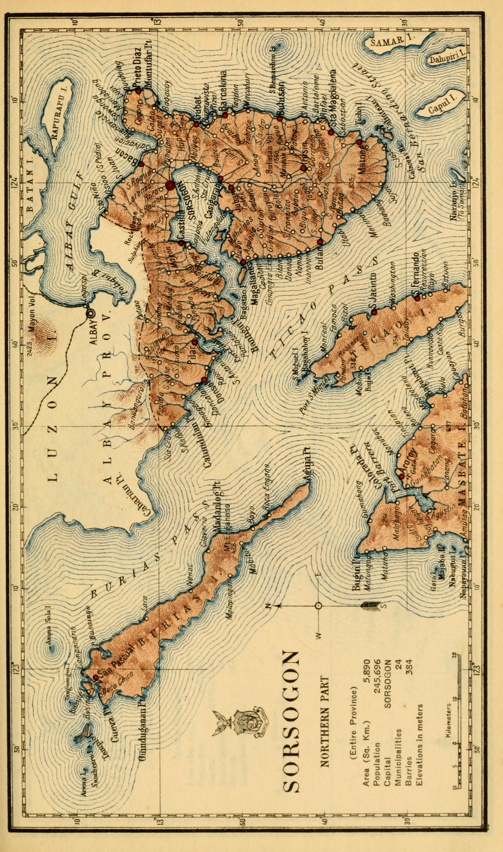
Sorsogon
Census of the Philippine Islands taken under the direction of the Philippine Legislature in the year 1918, Volume I, Geography, History, and Climatology: map of SORSOGON, Northern Part (Entire Province)
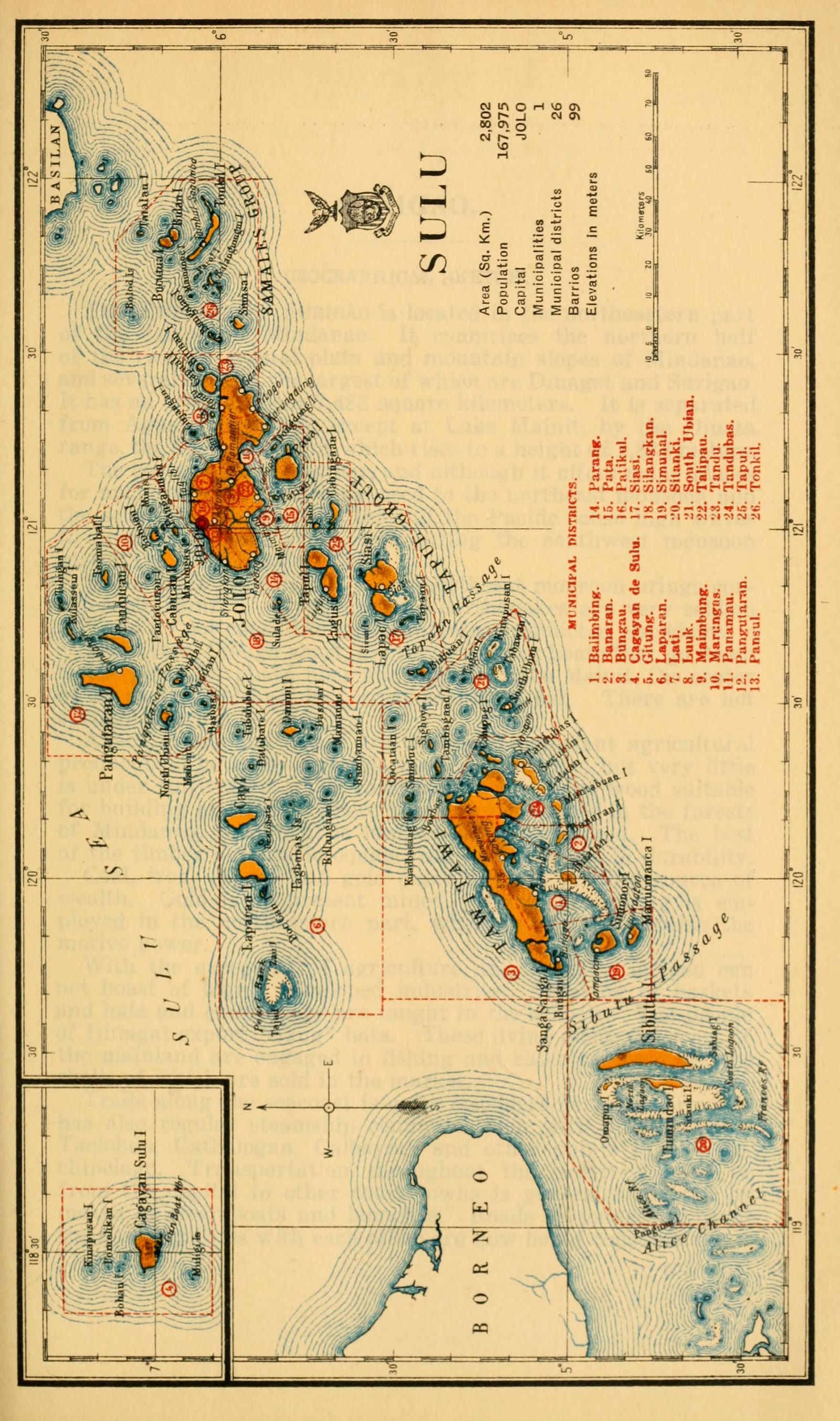
Sulu
Census of the Philippine Islands taken under the direction of the Philippine Legislature in the year 1918, Volume I, Geography, History, and Climatology: map of SULU
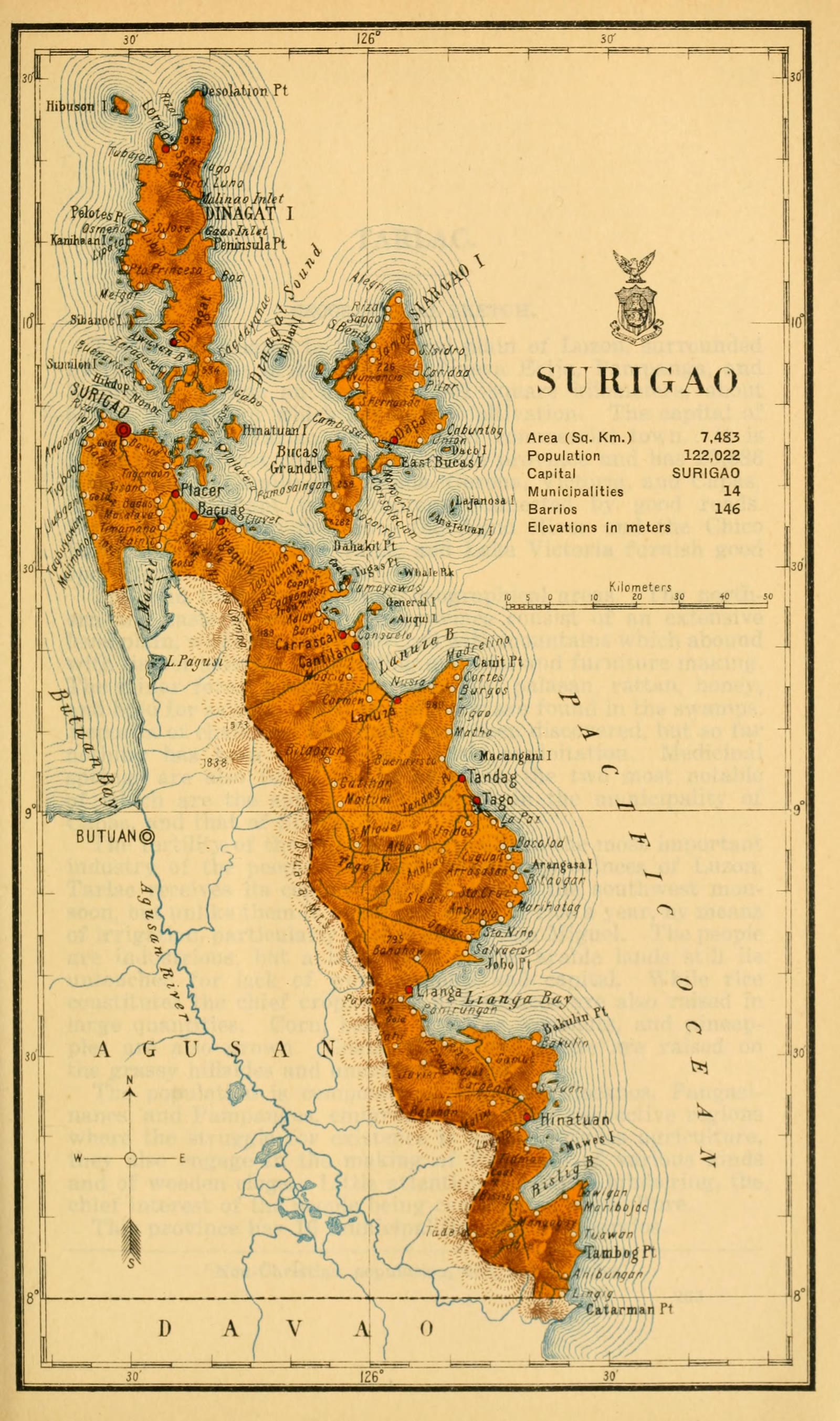
Surigao del Norte
Census of the Philippine Islands taken under the direction of the Philippine Legislature in the year 1918, Volume I, Geography, History, and Climatology: map of SURIGAO
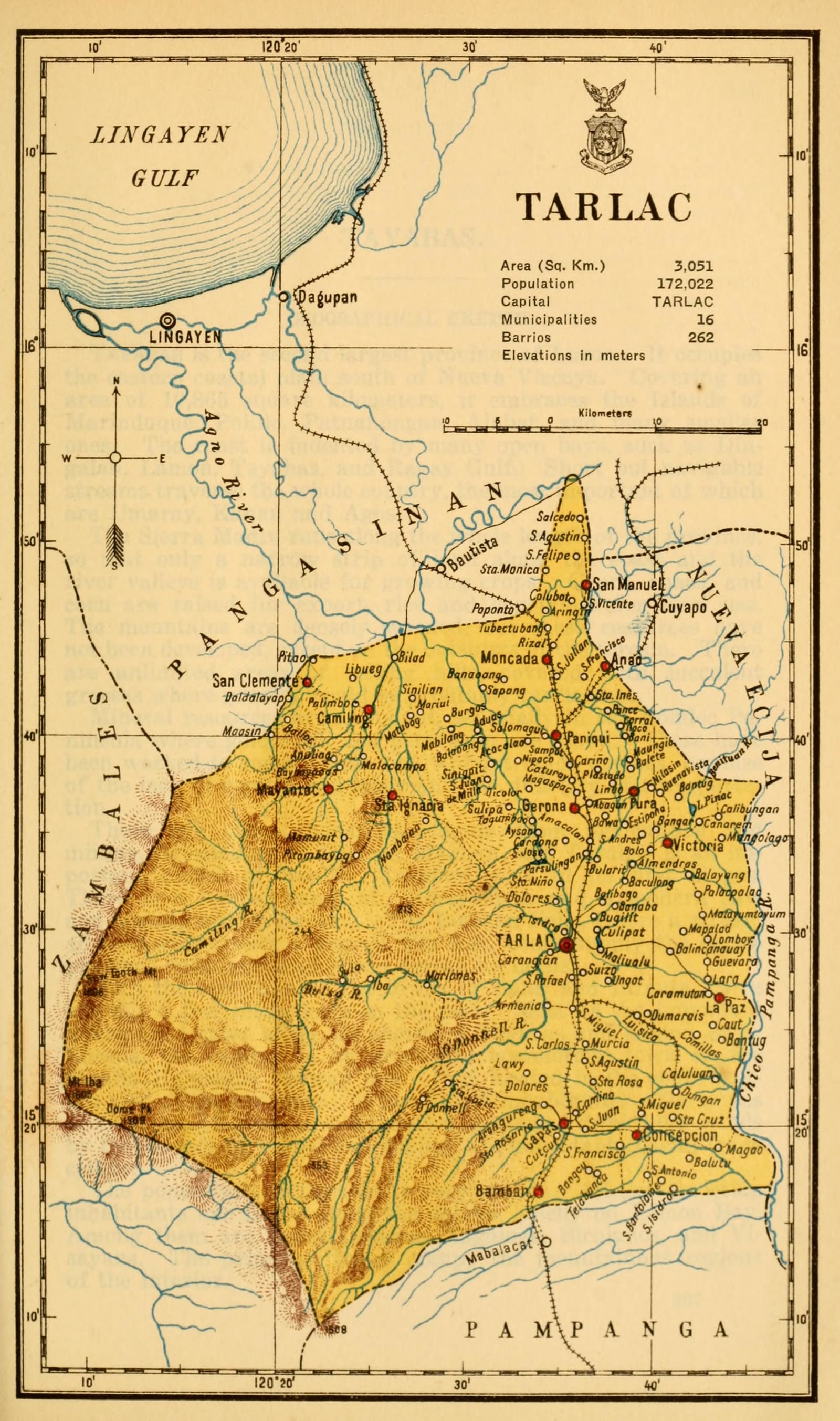
Tarlac
Census of the Philippine Islands taken under the direction of the Philippine Legislature in the year 1918, Volume I, Geography, History, and Climatology: map of TARLAC
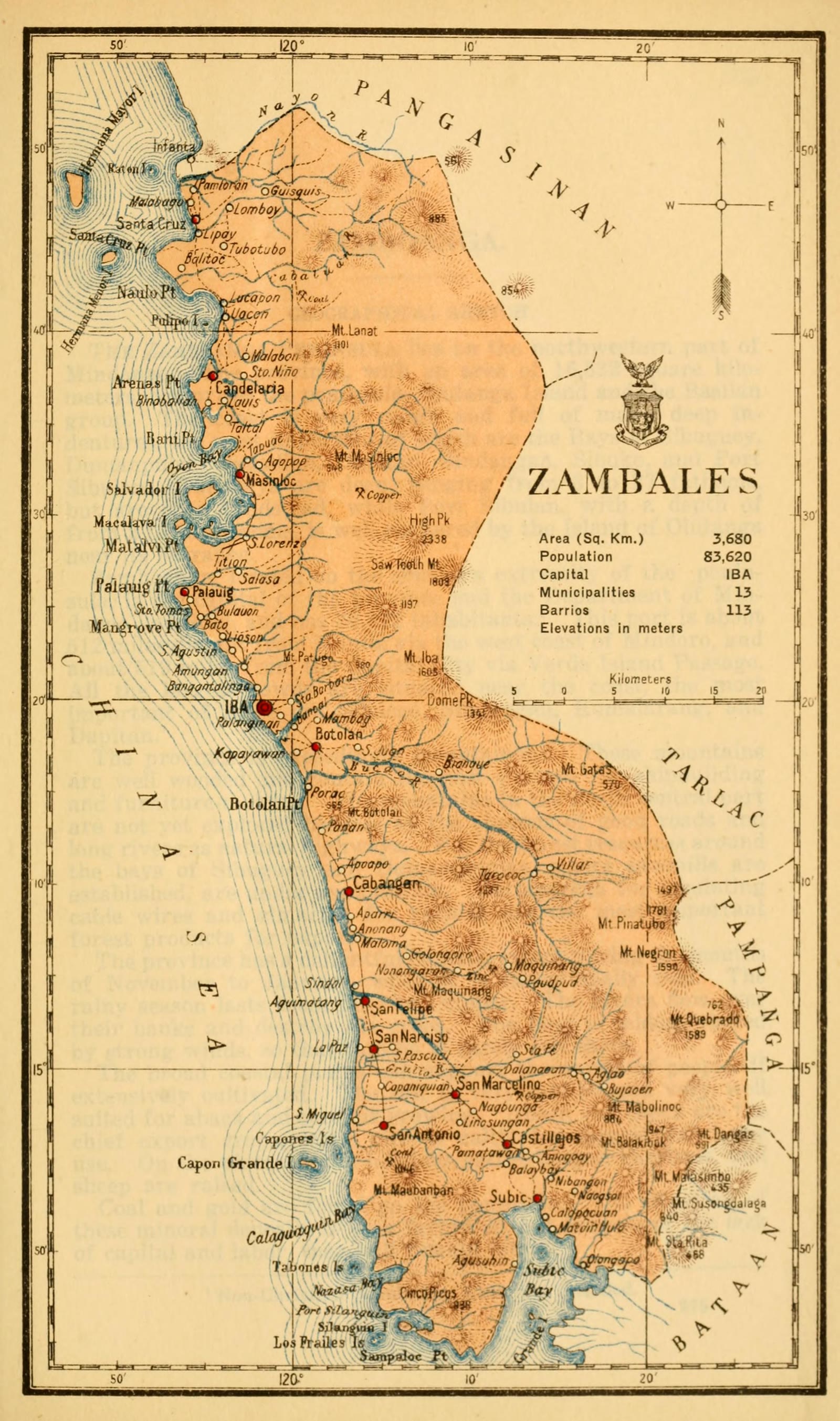
Zambales
Census of the Philippine Islands taken under the direction of the Philippine Legislature in the year 1918, Volume I, Geography, History, and Climatology: map of ZAMBALES
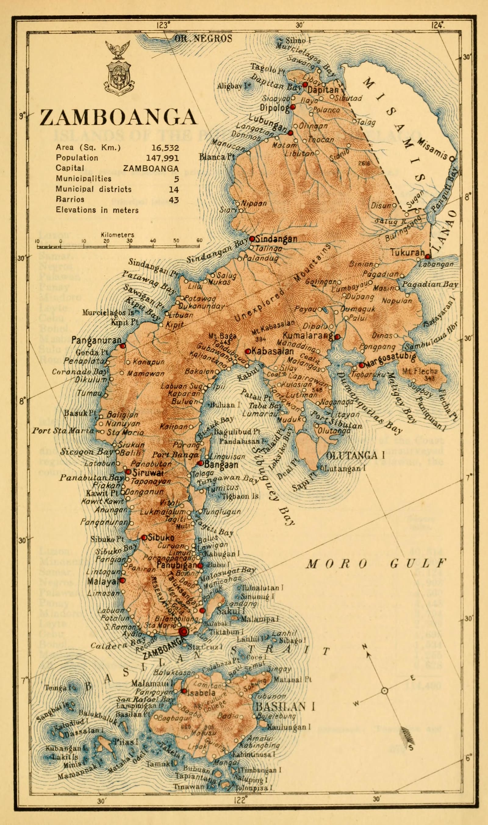
Zamboanga del Norte
Census of the Philippine Islands taken under the direction of the Philippine Legislature in the year 1918, Volume I, Geography, History, and Climatology: map of ZAMBOANGA
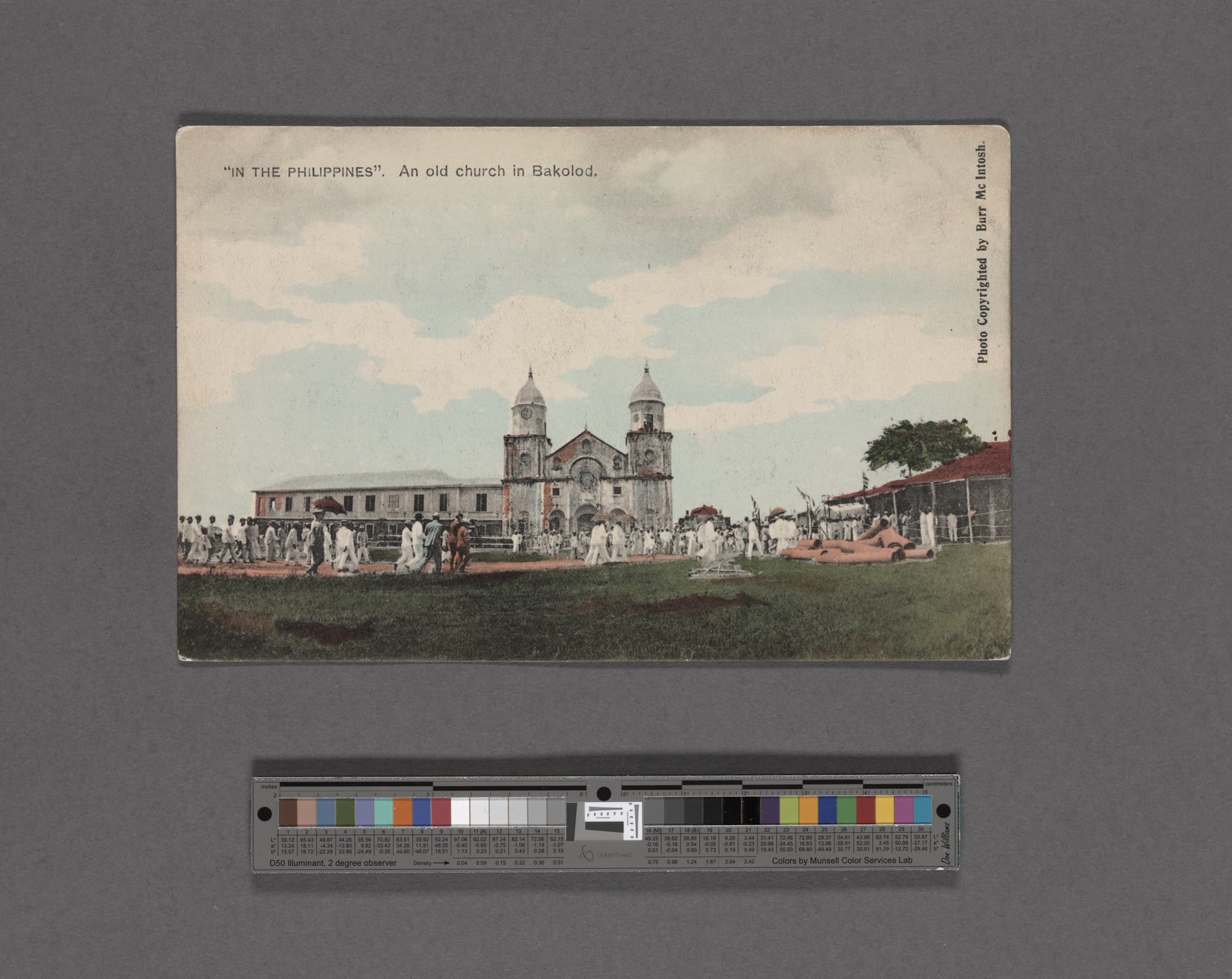
Bacolod City
An old church in Bakolod (NYPL Hades-2359655-4044420)
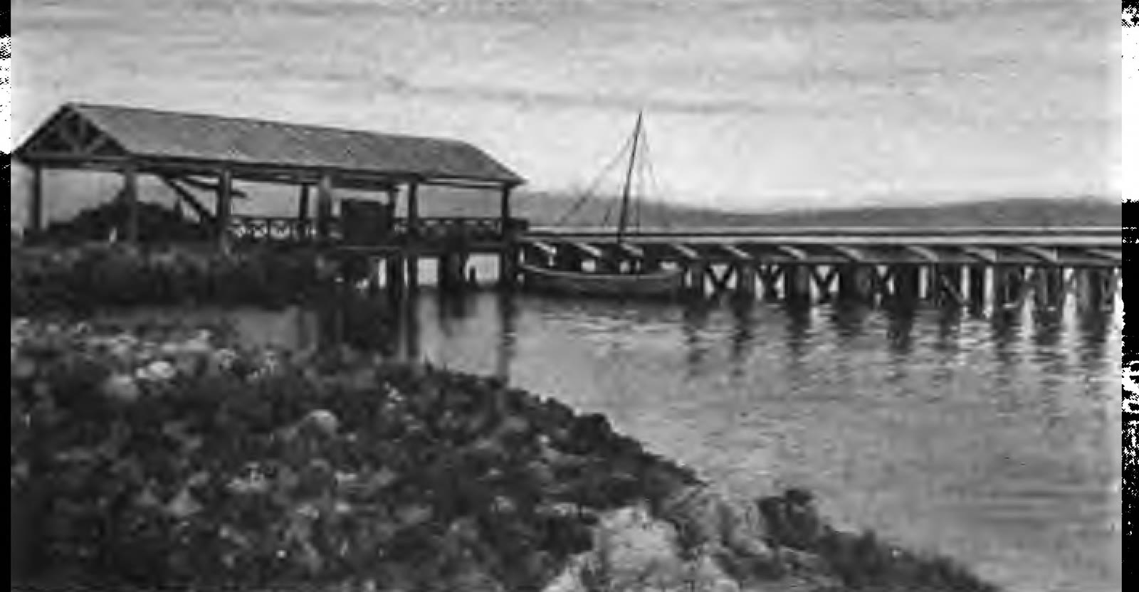
Cagayan De Oro City
Wharf at Cagayan (de Oro), here steamers from Manila and Cebu discharge and receive freight (c.1917)


Sources
Page updated October 9, 2026. Archive catalog release e205c7180a5b.
Who holds the pictures on this page, and their rights. Each picture's own page names its record.
- 1.University of Connecticut Libraries; scan by University of Connecticut Libraries via the Internet Archive. 41 pictures. Public domain.
- 2.Library of Congress. 1 picture. Public domain.
- 3.The Internet Archive. 3 pictures. Public domain.
- 4.Phillips Library at the Peabody Essex Museum, Vincent Starrett Collection, 1935-1938, undated. 2 pictures. No known restrictions.
- 5.The New York Public Library. 1 picture. Public domain.
Every holder, licence and author in the Archive: Data and credits.
See something wrong on this page? Write to hello@scene.ph with the page address. We check every report against the source.