Map · 1920 · Caraga
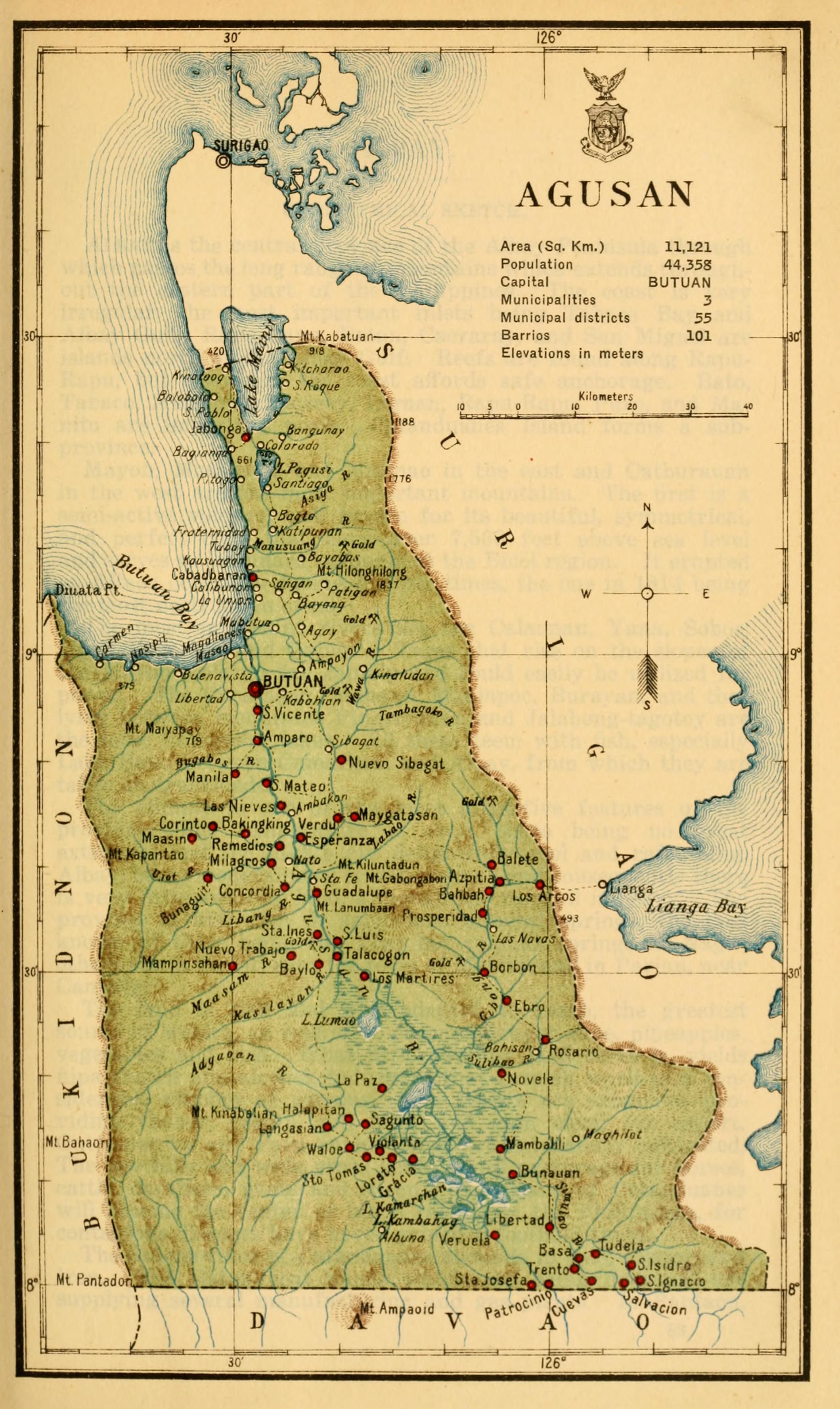
Census of the Philippine Islands taken under the direction of the Philippine Legislature in the year 1918, Volume I, Geography, History, and Climatology: map of AGUSAN

Open a larger copyThe full scan is on its record at the Internet Archive.
Its record
- Kind
- Map
- Made by
- Census Office of the Philippine Islands (Ignacio Villamor, Director)
- Date
- 1920 · The institution's record
- Held by
- University of Connecticut Libraries; scan by University of Connecticut Libraries via the Internet Archive
- Catalogue number
- archive.org item censusofphilippi01phil, page image n118; call number none
- Rights
- Public domain
- Credit
- Census Office of the Philippine Islands (Ignacio Villamor, Director), University of Connecticut Libraries; scan by University of Connecticut Libraries via the Internet Archive
- Named in it
- AGUSAN
- Scene archive number
- region-caraga-02
- The holder's rights statement
NOT_IN_COPYRIGHT
The region its land is in today
CaragaHow many people live there today, its towns, its map and its history.
More of Caraga

Sources
Page updated October 9, 2026. Archive catalog release e205c7180a5b.
The record this picture is shown from: its holder, its rights, and the page where the full scan is kept.
- 1.University of Connecticut Libraries; scan by University of Connecticut Libraries via the Internet Archive. Public domain. Open the source
Every holder, licence and author in the Archive: Data and credits.
See something wrong on this page? Write to hello@scene.ph with the page address. We check every report against the source.