Island groupIsland groupLuzon, the Visayas and Mindanao: how the country's regions are grouped to find them. An island group is not a level of government.More in the glossary
Luzon
Luzon is one of the three island groups of the Philippines. Its 8 regions had 64,162,977 people in the 2024 census, about 57 of every 100 Filipinos.
- Population: 2024 Census
- Places: PSGC 2Q 2026
- Checked by Scene: October 8, 2026
- Page updated: October 2, 2026
This is how the link shows on Facebook, Messenger, Viber, WhatsApp and X.
Or share on
- Share on Facebook (opens in a new tab)
- Share on WhatsApp (opens in a new tab)
- Share on Viber (opens the Viber app)
- Share on X (opens in a new tab)
- Share on Telegram (opens in a new tab)
- Share on Threads (opens in a new tab)
- Share on LINE (opens in a new tab)
- Share on LinkedIn (opens in a new tab)
- Share on Reddit (opens in a new tab)
- Share on Pinterest (opens in a new tab)
- Share on Bluesky (opens in a new tab)
- Share on Tumblr (opens in a new tab)
- Share by SMS (opens your messages app)
- Share by Email
Viber opens the Viber app on this device. Without it, copy the link above.
People · 2024 Census
- Under 3.8 million
- 3.8 million to 4.9 million
- 4.9 million to 5.2 million
- 5.2 million to 6.6 million
- 6.6 million and over
The same steps colour every map of regions in the Atlas, so a colour means the same range everywhere.
Density · people per km², 2024
- Under 130
- 130 to 280
- 280 to 340
- 340 to 570
- 570 and over
The same steps colour every map of regions in the Atlas, so a colour means the same range everywhere.
Growth a year · 2020–2024
- Fell by more than 1% a year
- Fell, by up to 1% a year
- Grew, by under 1% a year
- Grew by 1 to 2% a year
- Grew by 2% a year or more
Each place's yearly change between the 2020 and 2024 censuses, on the same steps as every map in the Atlas.
- Bicol Region
- Cagayan Valley
- CALABARZON
- Central Luzon
- Cordillera Administrative Region
- Ilocos Region
- Metro Manila
- MIMAROPA
- People, 2024 CensusSources
- 64,162,977
- RegionsSources
- 8
- ProvincesSources
- 38
- Cities and municipalitiesSources
- 771
- BarangaysSources
- 20,499
- Land area, 2019 masterlistSources
- 150,742.84 km²
Average density, 2024: about 426 people per km²Population densityHow crowded a place is on average: its people divided by its land area. 1,000 people per square kilometre is 10 people per hectare, a square of 100 by 100 metres.Explained by Scene: About 4 people per hectare if everyone were spread evenly across the land. In fact people live closer together in towns and farther apart in the countryside.More in the glossary[1, 2, 6]
Up from 52,362,999 people in 2010; growing 0.75% a year since 2020.
People
- 26CALABARZON16,933,234 people
- 22Metro Manila14,001,751 people
- 20Central Luzon12,989,074 people
- 10Bicol Region6,064,426 people
- 8Ilocos Region5,342,453 people
- 14The other 38,832,039 people
Counts from 2000 on are on today’s borders; earlier counts are as the place was then, so the line may step where a border moved.
Every count, census by census
| Census | Population | Growth since the census before | Households | People per household |
|---|---|---|---|---|
| 2024as of July 1, 2024 | 64,162,977[1, 2] | 0.75% a year | 17,287,051 | 3.7 |
| 2020as of May 1, 2020 | 62,196,942[1] | 1.68% a year | — | — |
| 2015as of August 1, 2015 | 57,470,097[1] | 1.79% a year | — | — |
| 2010as of May 1, 2010 | 52,362,999[1] | — | — | — |
| 2007as of August 1, 2007; as it was then | 49,799,965[10] | 2.10% a year | — | — |
| 2000as of May 1, 2000; on today’s borders | 42,822,878[10, 11] | 2.45% a year | — | — |
| 1995as of September 1, 1995; as it was then | 38,249,776[10] | 2.60% a year | — | — |
| 1990as of May 1, 1990; as it was then | 33,357,887[10] | 2.49% a year | — | — |
| 1980as of May 1, 1980; as it was then | 26,080,694[10] | 2.73% a year | — | — |
| 1975as of May 1, 1975; as it was then | 22,790,274[10] | 2.98% a year | — | — |
| 1970as of May 6, 1970; as it was then | 19,688,100[10] | 3.35% a year | — | — |
| 1960as of February 15, 1960; as it was then | 14,061,448[10] | — | — | — |
Regions
| [1, 6] | Share (2024) | |||
|---|---|---|---|---|
| Metro Manila | 14,001,751 | 21.82% | 0.91% a year | 620.61 km² |
| Cordillera Administrative Region | 1,808,985 | 2.82% | 0.15% a year | 21,116.05 km² |
| Ilocos Region | 5,342,453 | 8.33% | 0.19% a year | 12,830.62 km² |
| Cagayan Valley | 3,777,608 | 5.89% | 0.59% a year | 30,986.61 km² |
| Central Luzon | 12,989,074 | 20.24% | 1.08% a year | 22,648.03 km² |
| CALABARZON | 16,933,234 | 26.39% | 1.07% a year | 15,470.23 km² |
| MIMAROPA | 3,245,446 | 5.06% | 0.13% a year | 29,063.47 km² |
| Bicol Region | 6,064,426 | 9.45% | −0.07% a year | 18,007.22 km² |
Land & Environment
- Land areaLand areaThe land inside the place's official boundary. A square kilometre is a square 1 km on each side, about the size of 140 football fields.More in the glossary
- 150,742.84 km²[6]The official land areas of its 8 regions, added up by Scene.
- Average density, 2024Population densityHow crowded a place is on average: its people divided by its land area. 1,000 people per square kilometre is 10 people per hectare, a square of 100 by 100 metres.More in the glossary
- 426 people per km²[1, 2, 6]
- Lowest
- Sea level
- Average
- 323 m
- Highest
- 2,923 m
Heights from the Copernicus DEM, a 30 m model of the surface: it reads the tops of trees and roofs, not the bare ground, over the land inside the border, the sea left out. Produced using Copernicus WorldDEM-30 © DLR e.V. 2010-2014 and © Airbus Defence and Space GmbH 2014-2018 provided under COPERNICUS by the European Union and ESA; all rights reserved.
Water, coast and peaks
17,027.8 km of coastline[8]
Rivers[8]
- Cagayan River519.9 of 521.5 km
- Agno River279.2 km
- Chico River252.3 km
- Pampanga River217.7 of 218.3 km
- Abra River193.8 of 194.8 km
- Ilagan River151.3 of 183.1 km
- Mallig River140.5 km
- Apayao River138.3 km
The longest inside it: 1,627 in all.
Lakes[8]
- Laguna de Bay887.0 km²
- Taal Lake237.4 km²
- Naujan Lake83.4 km²
- Pantabangan Lakereservoir56.1 km²
- Lake Bato26.0 km²
- Angat Dam Reservoirreservoir19.7 km²
The largest: 47 in all.
Peaks[8]
- Mount Pulag2,928 m
- Mount Tabayoc2,820 m
- Mount Kalawitan2,714 m
- Mount Amuyao2,702 m
- Mount Kapiligan2,661 m
- Mount Panotoan2,657 m
The highest: 1,340 in all.
Named rivers, lakes and peaks as OpenStreetMap mapped them on 30 September 2026, and the coast within 150 m of the border. Map data © OpenStreetMap contributors, under the Open Database License.
Climate
Climate typeClimate typePAGASA sorts the country's climate into four types by when the rain falls. Type I has a dry season from November to April and a wet one for the rest of the year; Type II has no dry season, with the most rain from December to February; Type III has a short dry season; Type IV has rain spread through the year.More in the glossary
Type III[9]
No clear rainiest time of year, and a short dry season of one to three months, in December to February or in March to May.
Covers about 43 of every 100 parts of its land. Read by Scene off PAGASA's climate map, so approximate: the type that covers most of the place's land.
History & Identity
Stories from Luzon
Short films of this place, every line from a source listed under the film.

Old maps of Luzon
Each with the archive that holds it, its date and its rights, on its own page.
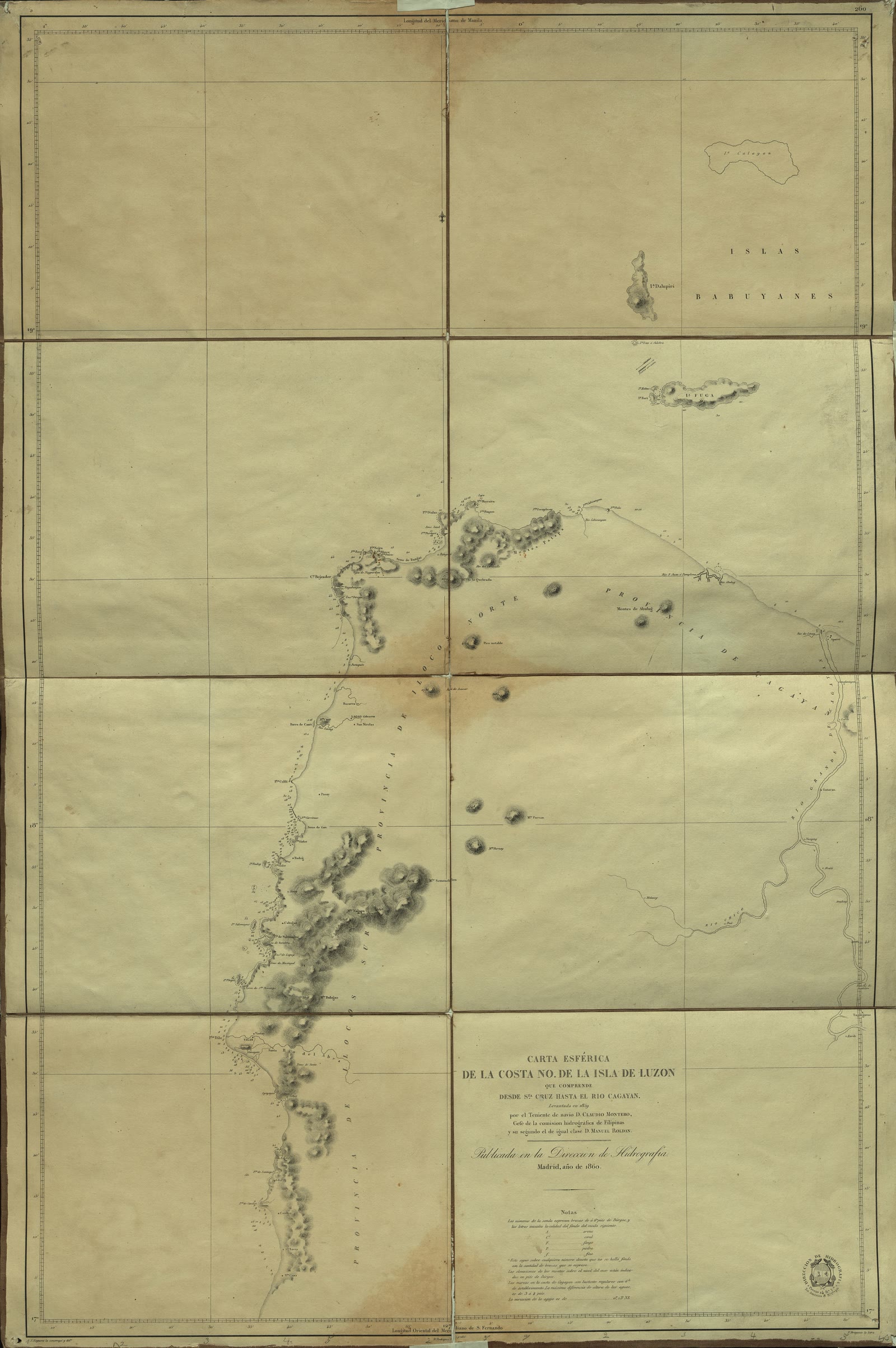
Carta esferica de la Costa NO de la Isla de Luzón que comprende desde Sta. Cruz hasta el Rio Cagayan
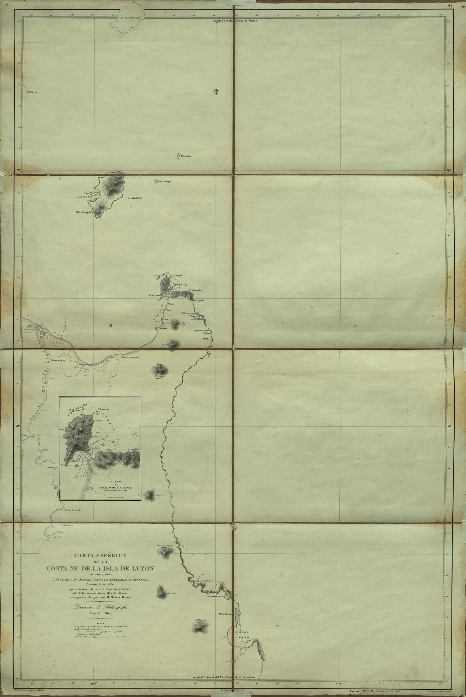
Carta Esférica de la costa NE. de la Isla de Luzón que comprende desde el Río Cagayan hasta la ensenada de Paranan
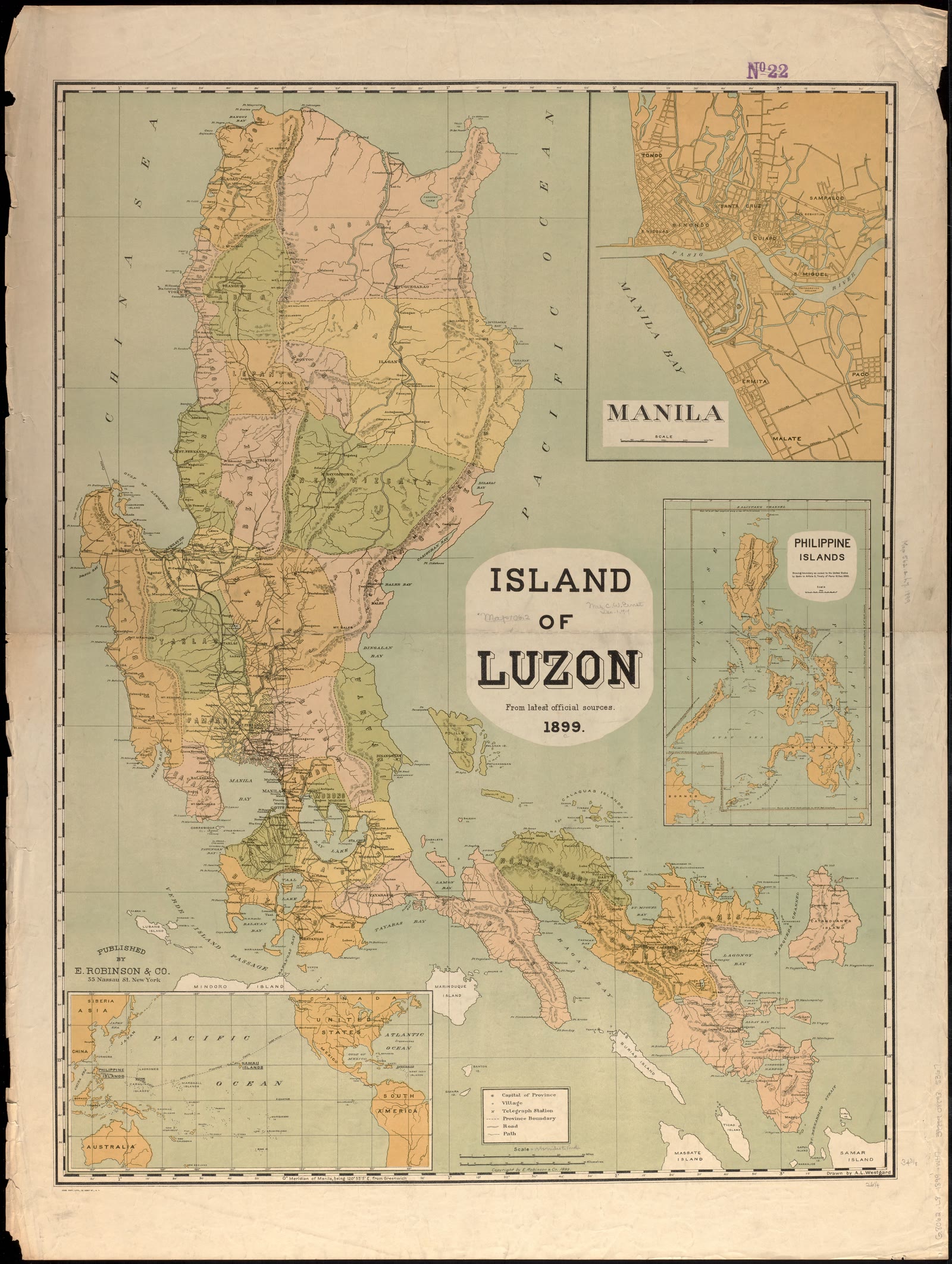
Island of Luzon : from the latest official sources


Nearby
Sources
- 1.Philippine Statistics Authority. Population and Annual Population Growth Rate of the Philippines and its Regions, Provinces, and Highly Urbanized Cities Based on the 2010, 2015, 2020 and 2024 Population Census (OpenSTAT table 0211A6DAPG0). Published August 7, 2026. Read by Scene October 2, 2026. CC BY (PSA Terms of Use). Open the source
- 2.Philippine Statistics Authority. Total Population, Household Population, Number of Households and Average Household Size by Region, Province, and Highly Urbanized City: Philippines, 2024 (OpenSTAT table 0191A6DTHP8). Published August 7, 2026. Read by Scene October 2, 2026. CC BY (PSA Terms of Use). Open the source
- 3.UN OCHA, from the PSA and NAMRIA. Philippines: Subnational Administrative Boundaries (COD-AB), barangay layer. Published February 13, 2025. Read by Scene September 25, 2026. CC BY-IGO 3.0. Open the source
- 4.OpenStreetMap contributors. Barangay boundaries from OpenStreetMap, where UN OCHA's layer has none. Published September 25, 2026. Read by Scene September 25, 2026. ODbL 1.0. Open the source
- 5.Philippine Statistics Authority. Philippine Standard Geographic Code (PSGC), 2nd Quarter 2026: Publication Datafile. Published June 30, 2026. Read by Scene September 24, 2026. CC BY (PSA Terms of Use). Open the source
- 6.Philippine Statistics Authority, from the Land Management Bureau (DENR). Population, Land Area, Population Density, and Percent Change in Population Density by Region, Province/Highly Urbanized City, and City/Municipality: 2015, 2020, and 2024 (OpenSTAT table 0221A6DLPD0). Published August 7, 2026. Read by Scene October 2, 2026. CC BY (PSA Terms of Use). Open the source
- 7.European Union and the European Space Agency (Copernicus), from DLR and Airbus Defence and Space (WorldDEM). Copernicus DEM GLO-30: global digital surface model at 30 m, one-degree tiles (2021 release). Published 2021. Read by Scene October 2, 2026. Copernicus DEM GLO-30 licence: free, any use including commercial, with the Copernicus notice. Open the source
- 8.OpenStreetMap contributors, extract by Geofabrik. Named rivers, lakes, reservoirs, peaks and the coastline of the Philippines in OpenStreetMap (Geofabrik extract, cut by osmium). Published September 30, 2026. Read by Scene October 2, 2026. ODbL 1.0. Open the source
- 9.Philippine Atmospheric, Geophysical and Astronomical Services Administration (PAGASA), Climatology and Agrometeorology Division. Climate Map of the Philippines (1951-2010), Modified Coronas Climate Classification. Published August 2014. Read by Scene October 2, 2026. A work of the Government of the Philippines: no copyright (RA 8293 s.176.1); PAGASA's approval is needed to use it for profit. Open the source
- 10.Philippine Statistics Authority. 2015 Census of Population, Statistical Tables, Table 1: Population Enumerated in Various Censuses by City/Municipality, 1960-2015 (one workbook for each province, highly urbanized city and region). Published 2017. Read by Scene October 2, 2026. CC BY (PSA Terms of Use). Open the source
- 11.Philippine Statistics Authority. 2020 Census of Population and Housing: Table A (Population and Annual Growth Rate for the Philippines and its Regions, Provinces and Highly Urbanized Cities) and Table B (Population and Annual Growth Rates by Province, City and Municipality, by Region). Published July 2021. Read by Scene October 2, 2026. CC BY (PSA Terms of Use). Open the source
Scene adds what the sources do not print themselves: growth rates, shares, barangay areas and densities, coordinates, neighbours and distances, each computed from the figures and borders above. How each is made.
See something wrong on this page? Write to hello@scene.ph with the page address. We check every report against the source.
Cite this page
Scene.ph. “Luzon.” Scene Atlas. Updated October 2, 2026. https://scene.ph/atlas/luzon