Province
Romblon
Romblon is a province in the MIMAROPA region of Luzon, Philippines. Its population was 302,824 in the 2024 census, and it has 17 municipalities.
- Population: 2024 Census
- Places: PSGC 2Q 2026
- Checked by Scene: October 8, 2026
- Page updated: October 8, 2026
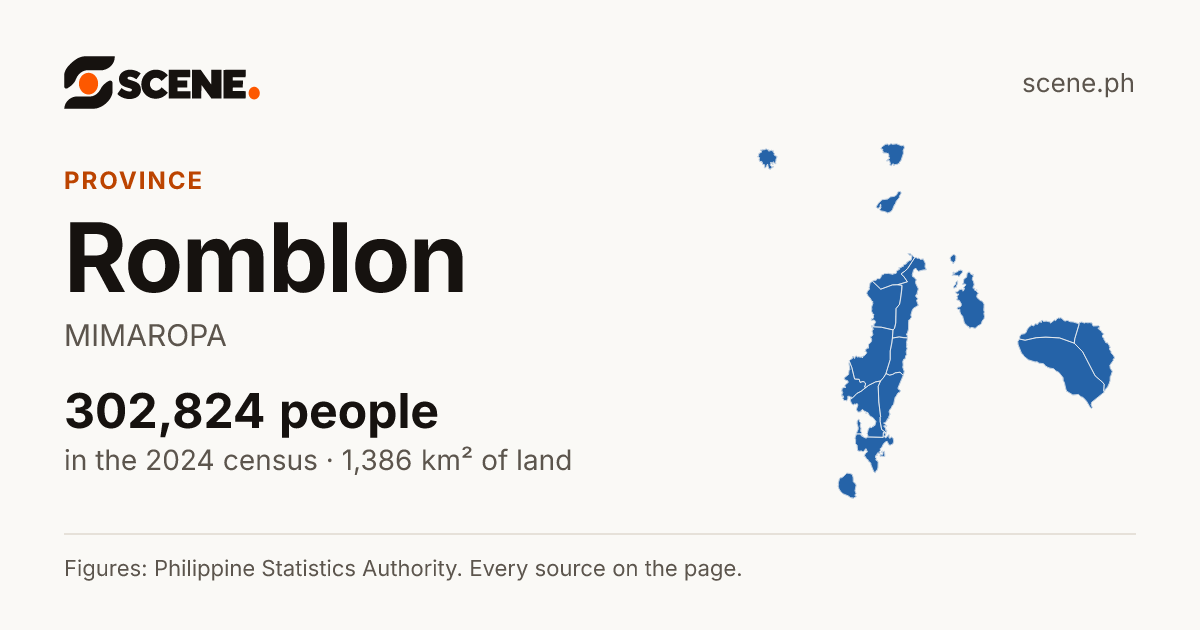
This is how the link shows on Facebook, Messenger, Viber, WhatsApp and X.
Or share on
- Share on Facebook (opens in a new tab)
- Share on WhatsApp (opens in a new tab)
- Share on Viber (opens the Viber app)
- Share on X (opens in a new tab)
- Share on Telegram (opens in a new tab)
- Share on Threads (opens in a new tab)
- Share on LINE (opens in a new tab)
- Share on LinkedIn (opens in a new tab)
- Share on Reddit (opens in a new tab)
- Share on Pinterest (opens in a new tab)
- Share on Bluesky (opens in a new tab)
- Share on Tumblr (opens in a new tab)
- Share by SMS (opens your messages app)
- Share by Email
Viber opens the Viber app on this device. Without it, copy the link above.

PeopleSources
302,824
people counted in the 2024 censusCensusA count of every person in the country, all on one day. The 2024 census counted people as they were on 1 July 2024.More in the glossary
Up 6.7% from 2010 to 2024Rank by peopleSources
4th
of the 5 provinces of MIMAROPA by population, 2024Rank and shareWorked out by Scene from the PSA's counts: where a place stands among the places listed with it, and how many of every 100 of its parent's people live in it.More in the glossary
About 9 of every 100 people in MIMAROPA lived in Romblon in 2024 (9.33%)Inside itSources
17
cities and municipalities
219 barangaysLandSources
1,385.70 km²
of land, 2019 masterlistLand areaThe land inside the place's official boundary. A square kilometre is a square 1 km on each side, about the size of 140 football fields.Explained by Scene: Romblon's land would fill a square about 37.2 km on each side. That is only a way to picture its size: its real shape is on the map.More in the glossary
Average density, 2024: 219 people per km²Population densityHow crowded a place is on average: its people divided by its land area. 1,000 people per square kilometre is 10 people per hectare, a square of 100 by 100 metres.Explained by Scene: About 2 people per hectare if everyone were spread evenly across the land. In fact people live closer together in towns and farther apart in the countryside.More in the glossaryHomesSources
81,117
households in 2024HouseholdA person living alone, or people who sleep in the same home and share their meals. A family may be one household or several.More in the glossary
3.7 people in each, on average, in 2024Town or countrySources
11.5%
About 12 of every 100 people lived in urban barangays in 2024Urban barangayThe PSA counts a barangay as urban when it has 5,000 people or more, or a big employer, or several businesses and public services close by. Every barangay in Metro Manila is urban.More in the glossary
- PSGC codePSGC codeThe code the Philippine Statistics Authority gives every place, so each one is known exactly, even when two share a name.More in the glossary
- 1705900000[4]Formerly 175900000
People
Counts from 2000 on are on today’s borders; earlier counts are as the place was then, so the line may step where a border moved.
- 1Palawan968,795
- 2Oriental Mindoro919,504
- 3Occidental Mindoro511,417
- 4Romblon302,824
- 5Marinduque226,522
- 16Odiongan48,133 people
- 13Romblon39,004 people
- 8San Agustin23,698 people
- 8San Fernando23,660 people
- 7Cajidiocan23,488 people
- 48The other 12144,841 people
- About 28 of every 100 are children under 15 (27.9%)
- About 63 of every 100 are of working age, 15 to 64 (63.4%)
- About 9 of every 100 are 65 or older (8.7%)
The figures by age
| Age | People | Men | Women |
|---|---|---|---|
| Under 5 | 22,946 | 11,874 | 11,072 |
| 5 - 9 | 28,629 | 14,801 | 13,828 |
| 10 - 14 | 32,570 | 17,004 | 15,566 |
| 15 - 19 | 31,214 | 16,407 | 14,807 |
| 20 - 24 | 26,086 | 13,566 | 12,520 |
| 25 - 29 | 21,066 | 10,867 | 10,199 |
| 30 - 34 | 20,585 | 10,421 | 10,164 |
| 35 - 39 | 18,522 | 9,475 | 9,047 |
| 40 - 44 | 16,863 | 8,708 | 8,155 |
| 45 - 49 | 15,361 | 7,928 | 7,433 |
| 50 - 54 | 14,945 | 7,687 | 7,258 |
| 55 - 59 | 14,246 | 7,020 | 7,226 |
| 60 - 64 | 12,527 | 6,151 | 6,376 |
| 65 - 69 | 9,938 | 4,514 | 5,424 |
| 70 - 74 | 6,587 | 2,753 | 3,834 |
| 75 - 79 | 4,571 | 1,552 | 3,019 |
| 80 - 84 | 3,085 | 954 | 2,131 |
| 85 and over | 2,180 | 516 | 1,664 |
Every figure, census by census
- People, 2024 CensusCensusA count of every person in the country, all on one day. The 2024 census counted people as they were on 1 July 2024.More in the glossary
- 302,824[1, 2]
- Households, 2024HouseholdA person living alone, or people who sleep in the same home and share their meals. A family may be one household or several.More in the glossary
- 81,117[1, 2]
- People in each household, 2024
- 3.7 on average[1, 2]
- Share of MIMAROPA, 2024Rank and shareWorked out by Scene from the PSA's counts: where a place stands among the places listed with it, and how many of every 100 of its parent's people live in it.More in the glossary
- 9.33%[1]
- In urban barangays, 2024Urban barangayThe PSA counts a barangay as urban when it has 5,000 people or more, or a big employer, or several businesses and public services close by. Every barangay in Metro Manila is urban.More in the glossary
- 11.5% (34,915 people)[6]
- Men and women, 2024
- 152,198 men, 149,723 women[5]People living in households
| Census | Population | Growth since the census before | Households | People per household |
|---|---|---|---|---|
| 2024as of July 1, 2024 | 302,824[1, 2] | −0.48% a year | 81,117 | 3.7 |
| 2020as of May 1, 2020 | 308,985[1] | 1.14% a year | — | — |
| 2015as of August 1, 2015 | 292,781[1] | 0.59% a year | — | — |
| 2010as of May 1, 2010 | 283,930[1] | — | — | — |
| 2007as of August 1, 2007; as it was then | 279,774[41] | 0.78% a year | — | — |
| 2000as of May 1, 2000; on today’s borders | 264,357[41, 42] | 1.67% a year | — | — |
| 1995as of September 1, 1995; as it was then | 244,654[41] | 1.36% a year | — | — |
| 1990as of May 1, 1990; as it was then | 227,621[41] | 1.65% a year | — | — |
| 1980as of May 1, 1980; as it was then | 193,174[41] | 1.17% a year | — | — |
| 1975as of May 1, 1975; as it was then | 182,209[41] | 1.75% a year | — | — |
| 1970as of May 6, 1970; as it was then | 167,082[41] | 2.36% a year | — | — |
| 1960as of February 15, 1960; as it was then | 131,658[41] | — | — | — |
Cities and municipalities
People · 2024 Census
- Under 20,000
- 20,000 to 31,000
- 31,000 to 45,000
- 45,000 to 76,000
- 76,000 and over
The same steps colour every map of cities and municipalities in the Atlas, so a colour means the same range everywhere.
Density · people per km², 2024
- Under 140
- 140 to 250
- 250 to 390
- 390 to 750
- 750 and over
The same steps colour every map of cities and municipalities in the Atlas, so a colour means the same range everywhere.
Growth a year · 2020–2024
- Fell by more than 1% a year
- Fell, by up to 1% a year
- Grew, by under 1% a year
- Grew by 1 to 2% a year
- Grew by 2% a year or more
Each place's yearly change between the 2020 and 2024 censuses, on the same steps as every map in the Atlas.
- Alcantara
- Banton
- Cajidiocan
- Calatrava
- Concepcion
- Corcuera
- Ferrol
- Looc
- Magdiwang
- Odiongan
- Romblon
- San Agustin
- San Andres
- San Fernando
- San Jose
- Santa Fe
- Santa Maria
| [1, 7] | Share (2024) | |||
|---|---|---|---|---|
| Alcantara | 16,417 | 5.42% | −1.07% a year | 62.70 km² |
| Banton | 5,848 | 1.93% | 0.46% a year | 31.41 km² |
| Cajidiocan | 23,488 | 7.76% | 0.24% a year | 151.83 km² |
| Calatrava | 11,254 | 3.72% | −0.19% a year | 45.28 km² |
| Concepcion | 3,427 | 1.13% | −0.92% a year | 20.16 km² |
| Corcuera | 9,021 | 2.98% | −2.70% a year | 20.87 km² |
| Ferrol | 7,826 | 2.58% | −0.54% a year | 58.08 km² |
| Looc | 21,964 | 7.25% | 0.18% a year | 114.58 km² |
| Magdiwang | 15,170 | 5.01% | −0.34% a year | 97.45 km² |
| Odiongan | 48,133 | 15.89% | −0.57% a year | 143.64 km² |
| Romblon | 39,004 | 12.88% | −0.93% a year | 92.10 km² |
| San Agustin | 23,698 | 7.83% | −0.42% a year | 100.15 km² |
| San Andres | 16,350 | 5.4% | 0.61% a year | 113.01 km² |
| San Fernando | 23,660 | 7.81% | −0.51% a year | 197.02 km² |
| San Jose | 11,626 | 3.84% | −0.27% a year | 28.40 km² |
| Santa Fe | 17,578 | 5.8% | −0.30% a year | 70.08 km² |
| Santa Maria | 8,360 | 2.76% | −1.72% a year | 38.94 km² |
Land & Environment
- Land areaLand areaThe land inside the place's official boundary. A square kilometre is a square 1 km on each side, about the size of 140 football fields.More in the glossary
- 1,385.70 km²[7]As listed in the 2019 Masterlist of Land Areas (LMB, DENR)
- Average density, 2024Population densityHow crowded a place is on average: its people divided by its land area. 1,000 people per square kilometre is 10 people per hectare, a square of 100 by 100 metres.More in the glossary
- 219 people per km²[7]
- Coordinates
- 12.33532° N, 122.01084° E[3]The point inside its border farthest from every edge, so it always falls within the place.
- Lowest
- Sea level
- Average
- 220 m
- Highest
- 2,036 m
Heights from the Copernicus DEM, a 30 m model of the surface: it reads the tops of trees and roofs, not the bare ground, over the land inside the border, the sea left out. Produced using Copernicus WorldDEM-30 © DLR e.V. 2010-2014 and © Airbus Defence and Space GmbH 2014-2018 provided under COPERNICUS by the European Union and ESA; all rights reserved.
Water, coast and peaks
537.7 km of coastline[38]
Rivers[38]
- Looc River21.3 of 21.4 km
- Cantingas River13.8 of 13.9 km
- Tampayan River13.6 of 13.9 km
- Taguilos River13.1 of 13.2 km
- Parpagoja River10.5 of 10.6 km
- España River9.5 km
- Cambajao River7.3 km
- Agbalit River7.0 km
The longest inside it: 28 in all.
Lakes[38]
- Lamao Lake0.05 km²
Peaks[38]
- Mount Guiting-Guiting2,023 m
- Mount Sibuyan1,952 m
- Manong Lee's Peak1,812 m
- Mayo's Peak1,526 m
- Rene's Peak1,493 m
- Kit's Peak1,492 m
The highest: 41 in all.
Named rivers, lakes and peaks as OpenStreetMap mapped them on 30 September 2026, and the coast within 150 m of the border. Map data © OpenStreetMap contributors, under the Open Database License.
Climate
Climate typeClimate typePAGASA sorts the country's climate into four types by when the rain falls. Type I has a dry season from November to April and a wet one for the rest of the year; Type II has no dry season, with the most rain from December to February; Type III has a short dry season; Type IV has rain spread through the year.More in the glossary
Type III[39]
No clear rainiest time of year, and a short dry season of one to three months, in December to February or in March to May.
Read by Scene off PAGASA's climate map, so approximate: the type that covers most of the place's land.
Rain each month Average temperature
The figures by month
| Month | Rain | Rainy days | Average | High | Low |
|---|---|---|---|---|---|
| January | 121 mm | 12 | 25.7 °C | 27.6 °C | 23.8 °C |
| February | 90 mm | 9 | 26.2 °C | 28.4 °C | 23.9 °C |
| March | 85 mm | 8 | 27.0 °C | 29.5 °C | 24.6 °C |
| April | 70 mm | 6 | 28.5 °C | 31.3 °C | 25.7 °C |
| May | 158 mm | 9 | 29.1 °C | 31.9 °C | 26.3 °C |
| June | 243 mm | 14 | 28.4 °C | 31.1 °C | 25.8 °C |
| July | 307 mm | 17 | 27.7 °C | 30.1 °C | 25.3 °C |
| August | 221 mm | 15 | 27.7 °C | 30.0 °C | 25.4 °C |
| September | 245 mm | 14 | 27.7 °C | 30.1 °C | 25.3 °C |
| October | 305 mm | 17 | 27.4 °C | 29.7 °C | 25.1 °C |
| November | 259 mm | 17 | 27.1 °C | 29.2 °C | 25.1 °C |
| December | 276 mm | 17 | 26.2 °C | 28.0 °C | 24.5 °C |
| The year | 2,379 mm | 155 | 27.4 °C | 29.7 °C | 25.1 °C |
A station's figures describe the place around it only roughly: inland and in the hills it may be cooler and wetter. The station stands 177 m above the sea.
Life & Economy
- Economy, 2025Gross domestic productThe value of all the goods and services made in a place in a year: the size of its economy. The PSA measures it for every region, province and highly urbanized city. Counted at 2018 prices, it leaves out the rise in prices, so one year can be set beside another.More in the glossary
- ₱42.5 billion[24]Its gross domestic product at current prices; ₱34.1 billion at 2018 prices.
- Growth, 2024–2025
- 3.3%[25]How much more it made than the year before, at 2018 prices.
- For each person, 2025
- ₱138,268[26]Its economy divided by its projected population, at current prices, as the PSA works it out.
- Poverty, 2023Poverty incidenceHow many of every 100 people live in families whose income is below the poverty line: what a person needs in a year for food and other basic needs, as the PSA sets it for each province. It is an estimate, from a survey or, for a town, a statistical model, so the PSA gives a range it is likely to fall in.More in the glossary
- 32.3% of people[27]Below the poverty line, by the PSA's survey.
- Income classIncome classThe Department of Finance sorts provinces, cities and municipalities into classes by their average yearly income over recent years: 1st class has the most. It measures the local government's income, not how well off its people are.More in the glossary
- 2nd class[4]
The PSA's survey puts it between 27.9% and 36.8%, with 95% confidence. The poverty line was ₱33,379 a person for the year.
Public places
- 120government offices
- 20hospitals and health centres
- 268schools
- 94places of worship
- 10markets
- 16stations and terminals
- 12parks
- 34beaches
- 11monuments and memorials
Counted from OpenStreetMap[3, 8]. Each town's page lists its own; this page lists the stations, parks, beaches and monuments.
Where a kind has more than 8, this page shows 6: first those with “Romblon” in their name, then one in each of its most populous cities and municipalities.
Stations and terminals16
- Romblon · Romblon
- Odiongan · Odiongan
- Bus and Jeepney Terminal Building · San Agustin
- Azagra Airstrip · San Fernando
- Cajidiocan · Cajidiocan
- Looc · Looc
10 more stations and terminals are listed on the pages of the cities and municipalities they stand in. See the 17 cities and municipalities of Romblon
Parks12
- Romblon Children's Park · Romblon
- Odiongan Children's Park · Odiongan
- Basketball Court · San Agustin
- Cajidiocan Freedom Park · Cajidiocan
- Mablaran Falls · San Andres
- Children's Playground · Calatrava
6 more parks are listed on the pages of the cities and municipalities they stand in. See the 17 cities and municipalities of Romblon
Beaches34
- Bonbon Beach · Romblon
- Gishelles Beach Haus · Looc
- Aglicay Beach · Alcantara
- Ambulong Beach · Corcuera
- Binucot Beach · Ferrol
- Balogo Beach · Banton
28 more beaches are listed on the pages of the cities and municipalities they stand in. See the 17 cities and municipalities of Romblon
Monuments and memorials11
- Jose Rizal Monument · Odiongan
- Dr. Jose Rizal · Romblon
- Hon. Armin R. Marin Monument · San Fernando
- Jose Rizal · Cajidiocan
- Labanan sa Karagatan ng Sibuyan · Alcantara
- Banton WW II Veterans · Banton
5 more monuments and memorials are listed on the pages of the cities and municipalities they stand in. See the 17 cities and municipalities of Romblon
As OpenStreetMap maps them on September 30, 2026. Map data © OpenStreetMap contributors, under the Open Database License.
Government & Leaders
A governor leads Romblon. Its local laws, called ordinances, are passed by the Sangguniang Panlalawigan (the provincial board), led by the vice governor. The governor, the vice governor and the board's elected members serve three-year terms, and none may serve more than three in a row.[21, 22]
- Legislative districtLegislative districtThe area that elects one member of the House of Representatives. A big province or city may have several.More in the glossary
- Lone district of Romblon[23]
Leaders
The governor and vice governor elected at each election since 2001, as COMELEC's lists of the elected name them, and those in office now, as the DILG's directory lists them.
2025–2028In office as of February 2026
2022–2025
2019–2022
2016–2019
2013–2016
2010–2013
2007–2010
2004–2007
2001–2004
| Term | Governor | Vice governor |
|---|---|---|
| 2025–2028In office as of February 2026 | Trina Alejandra Que Firmalo-Fabic[28] | Armando Manal Gutierez[28] |
| 2022–2025 | Jose Ruado Riano[29] | Armando Manal Gutierrez[29] |
| 2019–2022 | Jose Ruado Riano[30] | Felix Fondevilla Ylagan[30] |
| 2016–2019 | Eduardo Chang Firmalo[31] | Jose Ruado Riano[31] |
| 2013–2016 | Eduardo Chang Firmalo[32] | Jose Ruado Riano[32] |
| 2010–2013 | Eduardo Chang Firmalo[33] | Manuel Mendoza Madrid[33] |
| 2007–2010 | Natalio Fernandez Beltran III[34] | Alicia Capa Fetalvero[34] |
| 2004–2007 | Perpetuo Barredo Ylagan[35] | Samuel Rey Romero[35] |
| 2001–2004 | Eleandro Jesus F. Madrona[36] | Jose Cesar A. Fonte[36] |
History & Identity
Stories that tell of Romblon
Romblon is part of this Story, told from its own place.

And from Luzon, which Romblon is part of:

Old maps of Romblon
Each with the archive that holds it, its date and its rights, on its own page.


Romblon's fiesta and days
- Romblon Foundation DayLocal special day · Every 16 March · next Tuesday, 16 March 2027
- Created
- Made a province from the District of Romblon by Act No. 104, enacted 16 March 1901; annexed to Capiz in 1907; Act No. 2724, approved 7 December 1917, authorized the Governor-General to re-establish it as an independent province[9, 10, 11]
How it got its name
The province is named after Romblon Island, only the third largest of its islands but the seat of its government.[12]
Its story
Around 1650 the Recollect friar Pedro de San Agustín, known as Padre Capitán, oversaw the building of Fort Romblon to guard the town and its harbour against pirates.[13]
On 16 March 1901 the Philippine Commission made the District of Romblon a province, with Romblon town as its capital; it took in Romblon, Tablas, Sibuyan, Banton, Maestre de Campo, Simara and Carabao. In 1903 its eleven towns were merged into six.[9, 12, 14]
Romblon was annexed to Capiz as a sub-province from 15 July 1907. Act No. 2724 of 7 December 1917 authorized its re-establishment as a province, with the municipality of Romblon as its capital.[10, 11]
In 1940 Commonwealth Act No. 581 abolished its provincial government and the governments of its eleven towns, grouping them into four special municipalities: Tablas, Sibuyan, Romblon and Maghali. Republic Act No. 38 restored the province and its towns on 1 October 1946 and created the town of Santa Fe.[15, 16]
Under Japanese occupation the Free Panay Guerrilla Forces of Macario Peralta Jr. fought on in Panay and Romblon. On 24 October 1944 American carrier planes attacked a Japanese fleet in the Sibuyan Sea and sank the battleship Musashi, a loss that helped the Americans win at Leyte Gulf.[17, 18]
A law of 2009 made 16 March, the day Act No. 104 was enacted, Romblon Foundation Day and a provincial holiday. The province marked its 124th founding anniversary on 16 March 2025.[9, 19, 20]
Timeline
About 1650
Fort Romblon is built to guard the town and harbour against pirates.[13]
16 March 1901
Act No. 104 makes the District of Romblon a province, with Romblon as its capital.[9]
17 November 1903
Act No. 994 reduces its eleven towns to six.[14]
2 July 1907
Act No. 1665 annexes Romblon to Capiz as a sub-province, from 15 July 1907.[10]
7 December 1917
Act No. 2724 provides for Romblon to be re-established as a province.[11]
8 June 1940
Commonwealth Act No. 581 replaces the provincial and town governments with four special municipalities.[15]
24 October 1944
The Battle of the Sibuyan Sea: American planes sink the battleship Musashi.[18]
1 October 1946
Republic Act No. 38 restores the provincial government and the towns, and creates Santa Fe.[16]
11 June 2009
Republic Act No. 9642 makes 16 March Romblon Foundation Day.[19]
Nearby
How it compares
Romblon beside MIMAROPA, and where it stands among the provinces of MIMAROPA.
| Figure | Romblon | MIMAROPA | Rank among the provinces of MIMAROPA |
|---|---|---|---|
| People, 2024CensusA count of every person in the country, all on one day. The 2024 census counted people as they were on 1 July 2024.More in the glossary | 302,824[1, 2] | 3,245,446 | 4th of 5 |
| Growth a year, 2020–2024Growth a yearHow fast the number of people changed each year between two censuses. 1% a year means about 1 more person for every 100 people, each year.More in the glossary | −0.48% a year[1, 2]slower | 0.13% a year | 3rd of 5 |
| People per km², 2024Population densityHow crowded a place is on average: its people divided by its land area. 1,000 people per square kilometre is 10 people per hectare, a square of 100 by 100 metres.More in the glossary | 219[7]more crowded | 112 | 2nd of 5 |
| Land areaLand areaThe land inside the place's official boundary. A square kilometre is a square 1 km on each side, about the size of 140 football fields.More in the glossary | 1,385.70 km²[7] | 29,063.47 km² | 4th of 5 |
| People in each household, 2024HouseholdA person living alone, or people who sleep in the same home and share their meals. A family may be one household or several.More in the glossary | 3.7[1, 2]lower | 3.9 | not ranked |
| In urban barangays, 2024Urban barangayThe PSA counts a barangay as urban when it has 5,000 people or more, or a big employer, or several businesses and public services close by. Every barangay in Metro Manila is urban.More in the glossary | 11.5%[6]lower | 36% | not ranked |
The nearest provinces across the water[3]
- AklanWestern Visayas4.3 km south
- Oriental MindoroMIMAROPA19.9 km northwest
- AntiqueWestern Visayas22.8 km south
- MarinduqueMIMAROPA25.8 km north
Measured between the two borders where they come closest, on the Earth's surface, across the water. Not a boat or ferry route.
Sources
- 1.Philippine Statistics Authority. Population and Annual Population Growth Rate of the Philippines and its Regions, Provinces, and Highly Urbanized Cities Based on the 2010, 2015, 2020 and 2024 Population Census (OpenSTAT table 0211A6DAPG0). Published August 7, 2026. Read by Scene October 2, 2026. CC BY (PSA Terms of Use). Open the source
- 2.Philippine Statistics Authority. Total Population, Household Population, and Number of Households by Province, City, Municipality, and Barangay as of 01 July 2024: MIMAROPA Region (OpenSTAT table 0161A6DTHP5). Published August 3, 2026. Read by Scene October 2, 2026. CC BY (PSA Terms of Use). Open the source
- 3.UN OCHA, from the PSA and NAMRIA. Philippines: Subnational Administrative Boundaries (COD-AB), barangay layer. Published February 13, 2025. Read by Scene September 25, 2026. CC BY-IGO 3.0. Open the source
- 4.Philippine Statistics Authority. Philippine Standard Geographic Code (PSGC), 2nd Quarter 2026: Publication Datafile. Published June 30, 2026. Read by Scene September 24, 2026. CC BY (PSA Terms of Use). Open the source
- 5.Philippine Statistics Authority. Household Population by Age-Group Region, Province, and Highly Urbanized City: Philippines, 2024 Census of Population (OpenSTAT table 0201A6DPAG0). Published August 7, 2026. Read by Scene October 2, 2026. CC BY (PSA Terms of Use). Open the source
- 6.Philippine Statistics Authority. Total Population and Urban Population by Urban Classification and Region, Province, Highly Urbanized City, City/Municipality and Barangay: Philippines, 2024 (OpenSTAT table 0231A6DPUP0). Published August 7, 2026. Read by Scene October 2, 2026. CC BY (PSA Terms of Use). Open the source
- 7.Philippine Statistics Authority, from the Land Management Bureau (DENR). Population, Land Area, Population Density, and Percent Change in Population Density by Region, Province/Highly Urbanized City, and City/Municipality: 2015, 2020, and 2024 (OpenSTAT table 0221A6DLPD0). Published August 7, 2026. Read by Scene October 2, 2026. CC BY (PSA Terms of Use). Open the source
- 8.OpenStreetMap contributors. Named public places in OpenStreetMap: schools, hospitals and health centres, places of worship, government offices, markets, stations, parks, beaches and monuments, from Geofabrik's extract of the Philippines. Published September 30, 2026. Read by Scene October 2, 2026. ODbL 1.0. Open the source
- 9.United States Philippine Commission. Act No. 104: An Act Extending the Provisions of the Provincial Government Act to the Province of Romblon, as Therein Defined. Published March 16, 1901. Read by Scene October 2, 2026. Philippine government work, no copyright (Republic Act No. 8293, Section 176.1). Open the source
- 10.Philippine Commission. Act No. 1665: An Act to Annex the Province of Romblon to the Province of Capiz. Published July 2, 1907. Read by Scene October 2, 2026. Philippine government work, no copyright (Republic Act No. 8293, Section 176.1). Open the source
- 11.Philippine Legislature. Act No. 2724: An Act Authorizing the Separation of the Subprovince of Romblon from the Province of Capiz and the Reestablishment of the Former Province of Romblon, and for Other Purposes. Published December 7, 1917. Read by Scene October 2, 2026. Philippine government work, no copyright (Republic Act No. 8293, Section 176.1). Open the source
- 12.United States Bureau of Insular Affairs, War Department (Government Printing Office, Washington). A Pronouncing Gazetteer and Geographical Dictionary of the Philippine Islands. Published 1902. Read by Scene October 2, 2026. Public domain (a United States government work, published 1902), read in the Internet Archive's scan and its text. Open the source
- 13.National Historical Institute. Historical Markers: Regions I-IV and CAR. Published 1993. Read by Scene October 2, 2026. Philippine government work, no copyright (Republic Act No. 8293, Section 176.1). Open the source
- 14.Philippine Commission. Act No. 994: An Act Reducing the Eleven Municipalities of the Province of Romblon to Six. Published November 17, 1903. Read by Scene October 2, 2026. Philippine government work, no copyright (Republic Act No. 8293, Section 176.1). Open the source
- 15.National Assembly of the Commonwealth of the Philippines. Commonwealth Act No. 581: An Act Abolishing the Existing Municipal Governments and the Provincial Government of Romblon, and Creating Instead Four Special Municipalities. Published June 8, 1940. Read by Scene October 2, 2026. Philippine government work, no copyright (Republic Act No. 8293, Section 176.1). Open the source
- 16.Congress of the Philippines. Republic Act No. 38: An Act Repealing Commonwealth Act Numbered Five Hundred and Eighty-One, Entitled, "An Act Abolishing the Existing Municipal Governments and the Provincial Government of Romblon, and Creating Instead Four Special Municipalities," Restoring the Regular Provincial Government and Municipalities of the Province of Romblon, and Creating the Municipality of Santa Fe. Published October 1, 1946. Read by Scene October 2, 2026. Philippine government work, no copyright (Republic Act No. 8293, Section 176.1). Open the source
- 17.Office of the President of the Philippines. Proclamation No. 430, s. 1989: Declaring the Eighteenth Day of March of Every Year as Victory Day in the Islands of Panay and Romblon, Including the Cities of Iloilo and Roxas. Published July 21, 1989. Read by Scene October 2, 2026. Philippine government work, no copyright (Republic Act No. 8293, Section 176.1). Open the source
- 18.National Historical Commission of the Philippines. Panandang Pangkasaysayan 2007-2016. Published 2024. Read by Scene October 2, 2026. Philippine government work, no copyright (Republic Act No. 8293, Section 176.1). Open the source
- 19.Congress of the Philippines. Republic Act No. 9642: An Act Declaring March 16 of Every Year as Romblon Foundation Day and a Special Nonworking Public Holiday in the Province of Romblon. Published June 11, 2009. Read by Scene October 2, 2026. Philippine government work, no copyright (Republic Act No. 8293, Section 176.1). Open the source
- 20.Philippine Information Agency (report by Paul Jaysent F. Fos). Unity highlighted in Romblon's 124th Founding, 80th Victory Day celebration (as archived by the Internet Archive on 29 April 2025). Published March 20, 2025. Read by Scene October 2, 2026. Philippine government work, no copyright (Republic Act No. 8293, Section 176.1). Open the source
- 21.Congress of the Philippines. Republic Act No. 7160: the Local Government Code of 1991. Published October 10, 1991. Read by Scene October 2, 2026. Philippine government work, no copyright (Republic Act No. 8293, Section 176.1). Open the source
- 22.1986 Constitutional Commission. The 1987 Constitution of the Republic of the Philippines. Published February 2, 1987. Read by Scene October 2, 2026. Philippine government work, no copyright (Republic Act No. 8293, Section 176.1). Open the source
- 23.1986 Constitutional Commission (text from the Chan Robles Virtual Law Library). Ordinance appended to the 1987 Constitution, apportioning the seats of the House of Representatives. Published February 2, 1987. Read by Scene October 2, 2026. Philippine government work, no copyright (Republic Act No. 8293, Section 176.1). Open the source
- 24.Philippine Statistics Authority. Gross Domestic Product by Province and HUC (OpenSTAT table 0012A5FPPA0). Published August 28, 2026. Read by Scene October 2, 2026. CC BY (PSA Terms of Use). Open the source
- 25.Philippine Statistics Authority. Gross Domestic Product by Province and HUC, Growth Rates (OpenSTAT table 0032A5FPPA2). Published August 28, 2026. Read by Scene October 2, 2026. CC BY (PSA Terms of Use). Open the source
- 26.Philippine Statistics Authority. Per Capita Gross Domestic Product by Province and HUC (OpenSTAT table 0092A5FPPA8). Published August 28, 2026. Read by Scene October 2, 2026. CC BY (PSA Terms of Use). Open the source
- 27.Philippine Statistics Authority (PSA). Table 2a. Annual Per Capita Poverty Threshold and Poverty Incidence Among Population with Measures of Precision, by Region, Province and Highly Urbanized Cities: 2018, 2021, and 2023 (OpenSTAT table 0041F3DF02A). Published August 15, 2024. Read by Scene October 2, 2026. CC BY (PSA Terms of Use). Open the source
- 28.Department of the Interior and Local Government (DILG). Directory of LGU Elective Officials for Term 2025-2028 as of February 2026 (its sheet: Consolidated List of Officials for Election Terms (2025-2028)), released through the FOI portal. Published February 2026. Read by Scene October 2, 2026. A work of the Government of the Philippines: RA 8293, Section 176 (no copyright subsists in it; exploiting it for profit needs the agency's prior approval). Open the source
- 29.Commission on Elections (COMELEC), Records and Statistics Division, ERSD. List of Elected Provincial Candidates, May 9, 2022 National and Local Elections. Published December 23, 2025. Read by Scene October 2, 2026. Public domain: comelec.gov.ph says "All content is in the public domain unless otherwise stated." Each list carries COMELEC's data privacy notice (RA 10173).. Open the source
- 30.Commission on Elections (COMELEC), Records and Statistics Division, ERSD. List of Elected Provincial Candidates, May 13, 2019 National and Local Elections. Published December 23, 2025. Read by Scene October 2, 2026. Public domain: comelec.gov.ph says "All content is in the public domain unless otherwise stated." Each list carries COMELEC's data privacy notice (RA 10173).. Open the source
- 31.Commission on Elections (COMELEC), Records and Statistics Division, ERSD. List of Elected Provincial Candidates, May 9, 2016 National and Local Elections. Published January 12, 2026. Read by Scene October 2, 2026. Public domain: comelec.gov.ph says "All content is in the public domain unless otherwise stated." Each list carries COMELEC's data privacy notice (RA 10173).. Open the source
- 32.Commission on Elections (COMELEC), Records and Statistics Division, ERSD. List of Elected Provincial Candidates, May 13, 2013 National and Local Elections. Published January 12, 2026. Read by Scene October 2, 2026. Public domain: comelec.gov.ph says "All content is in the public domain unless otherwise stated." Each list carries COMELEC's data privacy notice (RA 10173).. Open the source
- 33.Commission on Elections (COMELEC), Records and Statistics Division, ERSD. List of Elected Provincial Candidates, May 10, 2010 National and Local Elections. Published January 10, 2026. Read by Scene October 2, 2026. Public domain: comelec.gov.ph says "All content is in the public domain unless otherwise stated." Each list carries COMELEC's data privacy notice (RA 10173).. Open the source
- 34.Commission on Elections (COMELEC), Records and Statistics Division, ERSD. List of Elected Provincial Candidates, May 14, 2007 National and Local Elections. Published January 14, 2026. Read by Scene October 2, 2026. Public domain: comelec.gov.ph says "All content is in the public domain unless otherwise stated." Each list carries COMELEC's data privacy notice (RA 10173).. Open the source
- 35.Commission on Elections (COMELEC), Records and Statistics Division, ERSD. List of Elected Provincial Candidates, May 10, 2004 National and Local Elections. Published January 8, 2026. Read by Scene October 2, 2026. Public domain: comelec.gov.ph says "All content is in the public domain unless otherwise stated." Each list carries COMELEC's data privacy notice (RA 10173).. Open the source
- 36.Commission on Elections (COMELEC), Records and Statistics Division, ERSD. List of Elected Provincial Candidates, May 14, 2001 National and Local Elections (its pages are headed "LIST OF ELECTED MEMBER, HOUSE OF REPRESENTATIVES"). Published January 8, 2026. Read by Scene October 2, 2026. Public domain: comelec.gov.ph says "All content is in the public domain unless otherwise stated." Each list carries COMELEC's data privacy notice (RA 10173).. Open the source
- 37.European Union and the European Space Agency (Copernicus), from DLR and Airbus Defence and Space (WorldDEM). Copernicus DEM GLO-30: global digital surface model at 30 m, one-degree tiles (2021 release). Published 2021. Read by Scene October 2, 2026. Copernicus DEM GLO-30 licence: free, any use including commercial, with the Copernicus notice. Open the source
- 38.OpenStreetMap contributors, extract by Geofabrik. Named rivers, lakes, reservoirs, peaks and the coastline of the Philippines in OpenStreetMap (Geofabrik extract, cut by osmium). Published September 30, 2026. Read by Scene October 2, 2026. ODbL 1.0. Open the source
- 39.Philippine Atmospheric, Geophysical and Astronomical Services Administration (PAGASA), Climatology and Agrometeorology Division. Climate Map of the Philippines (1951-2010), Modified Coronas Climate Classification. Published August 2014. Read by Scene October 2, 2026. A work of the Government of the Philippines: no copyright (RA 8293 s.176.1); PAGASA's approval is needed to use it for profit. Open the source
- 40.Philippine Atmospheric, Geophysical and Astronomical Services Administration (PAGASA), Climatology and Agrometeorology Division. Climatological Normals, 1991-2020, by synoptic station (one PDF each). Published January 2022. Read by Scene October 2, 2026. A work of the Government of the Philippines: no copyright (RA 8293 s.176.1); PAGASA's approval is needed to use it for profit. Open the source
- 41.Philippine Statistics Authority. 2015 Census of Population, Statistical Tables, Table 1: Population Enumerated in Various Censuses by City/Municipality, 1960-2015 (one workbook for each province, highly urbanized city and region). Published 2017. Read by Scene October 2, 2026. CC BY (PSA Terms of Use). Open the source
- 42.Philippine Statistics Authority. 2020 Census of Population and Housing: Table A (Population and Annual Growth Rate for the Philippines and its Regions, Provinces and Highly Urbanized Cities) and Table B (Population and Annual Growth Rates by Province, City and Municipality, by Region). Published July 2021. Read by Scene October 2, 2026. CC BY (PSA Terms of Use). Open the source
Scene adds what the sources do not print themselves: growth rates, shares, barangay areas and densities, coordinates, neighbours and distances, each computed from the figures and borders above. How each is made.
See something wrong on this page? Write to hello@scene.ph with the page address. We check every report against the source.
Cite this page
Scene.ph. “Romblon.” Scene Atlas. Updated October 8, 2026. https://scene.ph/atlas/romblon