Municipality
Mansalay
Mansalay is a municipality in Oriental Mindoro, MIMAROPA, Philippines. Its population was 60,597 in the 2024 census, and it has 17 barangays.
- Population: 2024 Census
- Places: PSGC 2Q 2026
- Checked by Scene: October 8, 2026
- Page updated: October 9, 2026
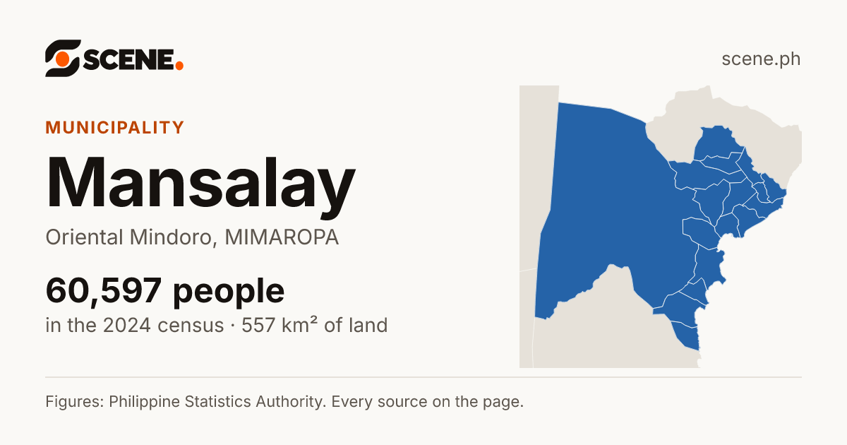
This is how the link shows on Facebook, Messenger, Viber, WhatsApp and X.
Or share on
- Share on Facebook (opens in a new tab)
- Share on WhatsApp (opens in a new tab)
- Share on Viber (opens the Viber app)
- Share on X (opens in a new tab)
- Share on Telegram (opens in a new tab)
- Share on Threads (opens in a new tab)
- Share on LINE (opens in a new tab)
- Share on LinkedIn (opens in a new tab)
- Share on Reddit (opens in a new tab)
- Share on Pinterest (opens in a new tab)
- Share on Bluesky (opens in a new tab)
- Share on Tumblr (opens in a new tab)
- Share by SMS (opens your messages app)
- Share by Email
Viber opens the Viber app on this device. Without it, copy the link above.
People · 2024 Census
- Under 690
- 690 to 1,100
- 1,100 to 1,800
- 1,800 to 3,100
- 3,100 and over
The same steps colour every map of barangays in the Atlas, so a colour means the same range everywhere.
Density · people per km², 2024
- Under 160
- 160 to 340
- 340 to 700
- 700 to 2,600
- 2,600 and over
The same steps colour every map of barangays in the Atlas, so a colour means the same range everywhere.
Growth a year · 2020–2024
- Fell by more than 1% a year
- Fell, by up to 1% a year
- Grew, by under 1% a year
- Grew by 1 to 2% a year
- Grew by 2% a year or more
Each place's yearly change between the 2020 and 2024 censuses, on the same steps as every map in the Atlas.
- B. Del Mundo
- Balugo
- Bonbon
- Budburan
- Cabalwa
- Don Pedro
- Maliwanag
- Manaul
- Panaytayan
- Poblacion
- Roma
- Santa Brigida
- Santa Maria
- Santa Teresita
- Villa Celestial
- Wasig
- Waygan
PeopleSources
60,597
people counted in the 2024 censusCensusA count of every person in the country, all on one day. The 2024 census counted people as they were on 1 July 2024.More in the glossary
Up 17.2% from 2010 to 2024Rank by peopleSources
5th
of the 15 cities and municipalities of Oriental Mindoro by population, 2024Rank and shareWorked out by Scene from the PSA's counts: where a place stands among the places listed with it, and how many of every 100 of its parent's people live in it.More in the glossary
About 7 of every 100 people in Oriental Mindoro lived in Mansalay in 2024 (6.59%)Inside itSources
17
barangays
LandSources
556.54 km²
of land, 2019 masterlistLand areaThe land inside the place's official boundary. A square kilometre is a square 1 km on each side, about the size of 140 football fields.Explained by Scene: Mansalay's land would fill a square about 23.6 km on each side. That is only a way to picture its size: its real shape is on the map.More in the glossary
Average density, 2024: 109 people per km²Population densityHow crowded a place is on average: its people divided by its land area. 1,000 people per square kilometre is 10 people per hectare, a square of 100 by 100 metres.Explained by Scene: About 1 person per hectare if everyone were spread evenly across the land. In fact people live closer together in towns and farther apart in the countryside.More in the glossaryHomesSources
14,383
households in 2024HouseholdA person living alone, or people who sleep in the same home and share their meals. A family may be one household or several.More in the glossary
4.2 people in each, on average, in 2024Town or countrySources
49.9%
About 50 of every 100 people lived in urban barangays in 2024Urban barangayThe PSA counts a barangay as urban when it has 5,000 people or more, or a big employer, or several businesses and public services close by. Every barangay in Metro Manila is urban.More in the glossary
- PSGC codePSGC codeThe code the Philippine Statistics Authority gives every place, so each one is known exactly, even when two share a name.More in the glossary
- 1705207000[4]Formerly 175207000
- ZIP code
- 5213[14, 15, 16]
People
Counts from 2000 on are on today’s borders; earlier counts are as the place was then, so the line may step where a border moved.
- 2Naujan109,122
- 3Pinamalayan90,420
- 4Bongabong77,540
- 5Mansalay60,597
- 6Roxas58,428
- 7Gloria52,296
- 8Victoria52,215
- Panaytayan11,73519 in 100
- B. Del Mundo8,65914 in 100
- Santa Teresita5,4219 in 100
- Poblacion4,4447 in 100
- Manaul3,7466 in 100
- Don Pedro3,4896 in 100
- Balugo2,9395 in 100
- Wasig2,5424 in 100
- Santa Brigida2,3934 in 100
- Santa Maria2,2764 in 100
- About 37 of every 100 are children under 15 (37.1%)
- About 59 of every 100 are of working age, 15 to 64 (58.7%)
- About 4 of every 100 are 65 or older (4.2%)
The figures by age
| Age | People | Men | Women |
|---|---|---|---|
| 0 - 4 | 7,178 | 3,659 | 3,519 |
| 5 - 9 | 7,561 | 3,859 | 3,702 |
| 10 - 14 | 7,187 | 3,685 | 3,502 |
| 15 - 19 | 6,586 | 3,370 | 3,216 |
| 20 - 24 | 5,586 | 2,874 | 2,712 |
| 25 - 29 | 4,578 | 2,425 | 2,153 |
| 30 - 34 | 3,764 | 1,952 | 1,812 |
| 35 - 39 | 3,309 | 1,721 | 1,588 |
| 40 - 44 | 2,943 | 1,552 | 1,391 |
| 45 - 49 | 2,552 | 1,308 | 1,244 |
| 50 - 54 | 2,112 | 1,049 | 1,063 |
| 55 - 59 | 1,817 | 945 | 872 |
| 60 - 64 | 1,431 | 679 | 752 |
| 65 - 69 | 994 | 483 | 511 |
| 70 - 74 | 647 | 278 | 369 |
| 75 - 79 | 395 | 164 | 231 |
| 80 years and over | 467 | 156 | 311 |
Every figure, census by census
- People, 2024 CensusCensusA count of every person in the country, all on one day. The 2024 census counted people as they were on 1 July 2024.More in the glossary
- 60,597[1, 2]
- Households, 2024HouseholdA person living alone, or people who sleep in the same home and share their meals. A family may be one household or several.More in the glossary
- 14,383[1, 2]
- People in each household, 2024
- 4.2 on average[1, 2]
- Share of Oriental Mindoro, 2024Rank and shareWorked out by Scene from the PSA's counts: where a place stands among the places listed with it, and how many of every 100 of its parent's people live in it.More in the glossary
- 6.59%[1]
- In urban barangays, 2024Urban barangayThe PSA counts a barangay as urban when it has 5,000 people or more, or a big employer, or several businesses and public services close by. Every barangay in Metro Manila is urban.More in the glossary
- 49.9% (30,259 people)[5]
- Men and women, 2020
- 30,159 men, 28,948 women[36]People living in households
| Census | Population | Growth since the census before | Households | People per household |
|---|---|---|---|---|
| 2024as of July 1, 2024 | 60,597[1, 2] | 0.60% a year | 14,383 | 4.2 |
| 2020as of May 1, 2020 | 59,114[1] | 1.71% a year | — | — |
| 2015as of August 1, 2015 | 54,533[1] | 1.02% a year | — | — |
| 2010as of May 1, 2010 | 51,705[1] | — | — | — |
| 2007as of August 1, 2007; as it was then | 43,974[34] | 1.65% a year | — | — |
| 2000as of May 1, 2000; on today’s borders | 39,041[34, 35] | 5.98% a year | — | — |
| 1995as of September 1, 1995; as it was then | 29,765[34] | 1.48% a year | — | — |
| 1990as of May 1, 1990; as it was then | 27,515[34] | 1.57% a year | — | — |
| 1980as of May 1, 1980; as it was then | 23,548[34] | 3.79% a year | — | — |
| 1975as of May 1, 1975; as it was then | 19,544[34] | 1.22% a year | — | — |
| 1970as of May 6, 1970; as it was then | 18,395[34] | 2.24% a year | — | — |
| 1960as of February 15, 1960; as it was then | 14,669[34] | — | — | — |
Barangays
| [2, 3, 5, 6, 7] | Share (2024) | Urban or rural | |||
|---|---|---|---|---|---|
| B. Del Mundo | 8,659 | 14.29% | 1.08% a year | about 7.00 km² | Urban |
| Balugo | 2,939 | 4.85% | 1.37% a year | about 17.64 km² | Rural |
| Bonbon | 2,007 | 3.31% | 1.35% a year | about 15.31 km² | Rural |
| Budburan | 1,615 | 2.67% | −0.47% a year | about 6.66 km² | Rural |
| Cabalwa | 1,487 | 2.45% | −1.16% a year | about 5.34 km² | Rural |
| Don Pedro | 3,489 | 5.76% | 0.61% a year | about 12.73 km² | Rural |
| Maliwanag | 1,815 | 3% | 0.19% a year | about 6.72 km² | Rural |
| Manaul | 3,746 | 6.18% | 0.87% a year | about 13.18 km² | Rural |
| Panaytayan | 11,735 | 19.37% | −0.55% a year | about 316.15 km² | Urban |
| Poblacion | 4,444 | 7.33% | 0.77% a year | about 5.72 km² | Urban |
| Roma | 2,060 | 3.4% | 0.09% a year | about 5.43 km² | Rural |
| Santa Brigida | 2,393 | 3.95% | −0.59% a year | about 4.96 km² | Rural |
| Santa Maria | 2,276 | 3.76% | 1.57% a year | about 8.69 km² | Rural |
| Santa Teresita | 5,421 | 8.95% | 0.17% a year | about 10.37 km² | Urban |
| Villa Celestial | 1,856 | 3.06% | 1.01% a year | about 2.63 km² | Rural |
| Wasig | 2,542 | 4.19% | 3.26% a year | about 6.29 km² | Rural |
| Waygan | 2,113 | 3.49% | 3.93% a year | about 12.33 km² | Rural |
Areas are approximate: each is measured inside the barangay's border on UN OCHA's map, which is a guide, not the legal boundary.
Land & Environment
- Land areaLand areaThe land inside the place's official boundary. A square kilometre is a square 1 km on each side, about the size of 140 football fields.More in the glossary
- 556.54 km²[6]As listed in the 2019 Masterlist of Land Areas (LMB, DENR)
- Average density, 2024Population densityHow crowded a place is on average: its people divided by its land area. 1,000 people per square kilometre is 10 people per hectare, a square of 100 by 100 metres.More in the glossary
- 109 people per km²[6]
- Coordinates
- 12.55934° N, 121.31811° E[3]The point inside its border farthest from every edge, so it always falls within the place.
- Lowest
- Sea level
- Average
- 386 m
- Highest
- 1,344 m
Heights from the Copernicus DEM, a 30 m model of the surface: it reads the tops of trees and roofs, not the bare ground, over the land inside the border, the sea left out. Produced using Copernicus WorldDEM-30 © DLR e.V. 2010-2014 and © Airbus Defence and Space GmbH 2014-2018 provided under COPERNICUS by the European Union and ESA; all rights reserved.
Water, coast and peaks
30.7 km of coastline[31]
Rivers[31]
- Bugsanga River9.6 of 65.1 km
- Cagaray2.1 of 14.5 km
- Budburan River1.9 of 6.3 km
Peaks[31]
- Mount Na-apug924 m
- Mount Yagaw842 m
- Mount Agsingheight not mapped
- Mount Darayawheight not mapped
- Mount Mawanheight not mapped
- Turok-Batoheight not mapped
Named rivers, lakes and peaks as OpenStreetMap mapped them on 30 September 2026, and the coast within 150 m of the border. Map data © OpenStreetMap contributors, under the Open Database License.
Climate
Climate typeClimate typePAGASA sorts the country's climate into four types by when the rain falls. Type I has a dry season from November to April and a wet one for the rest of the year; Type II has no dry season, with the most rain from December to February; Type III has a short dry season; Type IV has rain spread through the year.More in the glossary
Type III[32]
No clear rainiest time of year, and a short dry season of one to three months, in December to February or in March to May.
Covers about 71 of every 100 parts of its land. Read by Scene off PAGASA's climate map, so approximate: the type that covers most of the place's land.
Rain each month Average temperature
The figures by month
| Month | Rain | Rainy days | Average | High | Low |
|---|---|---|---|---|---|
| January | 13 mm | 3 | 27.2 °C | 32.5 °C | 21.9 °C |
| February | 12 mm | 2 | 27.9 °C | 33.0 °C | 22.9 °C |
| March | 12 mm | 2 | 28.9 °C | 34.0 °C | 23.8 °C |
| April | 32 mm | 3 | 29.6 °C | 34.9 °C | 24.3 °C |
| May | 166 mm | 9 | 29.4 °C | 34.1 °C | 24.6 °C |
| June | 326 mm | 15 | 28.4 °C | 32.5 °C | 24.4 °C |
| July | 507 mm | 20 | 27.5 °C | 31.0 °C | 23.9 °C |
| August | 469 mm | 20 | 27.5 °C | 31.0 °C | 23.9 °C |
| September | 436 mm | 18 | 27.3 °C | 30.9 °C | 23.8 °C |
| October | 244 mm | 13 | 27.7 °C | 31.7 °C | 23.6 °C |
| November | 97 mm | 7 | 28.2 °C | 32.8 °C | 23.7 °C |
| December | 75 mm | 5 | 28.1 °C | 32.6 °C | 23.6 °C |
| The year | 2,389 mm | 117 | 28.1 °C | 32.6 °C | 23.7 °C |
A station's figures describe the place around it only roughly: inland and in the hills it may be cooler and wetter. The station stands 3 m above the sea.
Life & Economy
- Poverty, 2021Poverty incidenceHow many of every 100 people live in families whose income is below the poverty line: what a person needs in a year for food and other basic needs, as the PSA sets it for each province. It is an estimate, from a survey or, for a town, a statistical model, so the PSA gives a range it is likely to fall in.More in the glossary
- 33.5% of people[19]Below the poverty line, by the PSA's estimate for every town.
- Income classIncome classThe Department of Finance sorts provinces, cities and municipalities into classes by their average yearly income over recent years: 1st class has the most. It measures the local government's income, not how well off its people are.More in the glossary
- 1st class[4]
The PSA's model for every town puts it between 28.6% and 38.3%, with 90% confidence.
Public places
- 35schools
- 4places of worship
- 1station or terminal
- 1beach
Counted from OpenStreetMap[3, 8]. Schools, places of worship, barangay halls and places known only by a common name, such as a chapel, are listed on each barangay's page.
Stations and terminals1
Beaches1
As OpenStreetMap maps them on September 30, 2026. Map data © OpenStreetMap contributors, under the Open Database License.
Government & Leaders
A mayor leads Mansalay. Its local laws, called ordinances, are passed by the Sangguniang Bayan (the municipal council), led by the vice mayor. The mayor, the vice mayor and the council's elected members serve three-year terms, and none may serve more than three in a row.[12, 13]
- Legislative districtLegislative districtThe area that elects one member of the House of Representatives. A big province or city may have several.More in the glossary
- 2nd district of Oriental Mindoro[17, 18]
Leaders
The mayor and vice mayor elected at each election since 2001, as COMELEC's lists of the elected name them, and those in office now, as the DILG's directory lists them.
2025–2028In office as of February 2026
2022–2025
2019–2022
2016–2019
2013–2016
2010–2013
2007–2010
2004–2007
2001–2004
| Term | Mayor | Vice mayor |
|---|---|---|
| 2025–2028In office as of February 2026 | Ferdinand Maulion Maliwanag[20] | Jose Ildefonso Maulion Maliwanag[20] |
| 2022–2025 | Ferdinand Maulion Maliwanag[21] | Shernan Fajutnao Gamol[21] |
| 2019–2022 | Ferdinand Maulion Maliwanag[22] | Lynette Gallano Postma[22] |
| 2016–2019 | Jose Ildefonso Maulion Maliwanag[23] | Lynette Gallano Postma[23] |
| 2013–2016 | Jose Ildefonso Maulion Maliwanag[24] | Armando Gaite Samarita[24] |
| 2010–2013 | Jose Ildefonso Maulion Maliwanag[25] | Renato Tabor De Lara[25] |
| 2007–2010 | Celestino Alvarez Papasin[26] | Renato Tabor De Lara[26] |
| 2004–2007 | Celestino Papasin[27] | Renato De Lara[27] |
| 2001–2004 | Teresita M. Maliwanag[28] | Sergio R. Napa[28] |
Before 2001
The heads of Mansalay before COMELEC's lists begin, newest first, as the local government's own page lists them, with the office as that page writes it ("Not given" where it names no single office). "From" a year: the page gives only when the term began.
| Years | Name | Office |
|---|---|---|
| 1994–1998 | Celestino Papasin[29] | Not given |
| 1989–1993 | Sergio F. Maliwanag[29] | Not given |
| 1988–1989 | Fernando Faustino[29] | Not given |
| 1986–1988 | Fausto Sangil[29] | Not given |
| 1964–1986 | Sergio F. Maliwanag[29] | Not given |
| 1960–1964 | Gerardo P. Cobarrubias[29] | Not given |
| 1956–1960 | Eleuterio A. Presto[29] | Not given |
| 1952–1956 | Marciana V. Merino[29] | Not given |
| 1919 | Teotimo Cusi[29] | Not given |
History & Identity
Stories from MIMAROPA
Mansalay has no Story of its own yet. This one is about MIMAROPA, which Mansalay is part of.

Mansalay's fiesta and days
- Mansalay town fiestaTown fiesta · Santa Catalina · Every 26 November · next Thursday, 26 November 2026
How it got its name
Local traditionThe provincial history page says the name comes from a Mangyan phrase meaning "I don't know".[9]
Its story
The provincial history page says that in Spanish times Mansalay was under the jurisdiction of Mangarin.[9]
Act No. 1280 merged Mansalay and Mangarin into Bulalacao, effective 1 February 1905.[10]
The provincial history page says that after the war the people returned from the interior and settled the present town, which they first called Pookan.[9]
Executive Order No. 181 of 15 October 1948 took a barrio and twelve sitios from Mansalay to form the municipality of Roxas, effective 15 November 1948.[11]
Nearby
How it compares
Mansalay beside Oriental Mindoro, and where it stands among the cities and municipalities of Oriental Mindoro.
| Figure | Mansalay | Oriental Mindoro | Rank among the cities and municipalities of Oriental Mindoro |
|---|---|---|---|
| People, 2024CensusA count of every person in the country, all on one day. The 2024 census counted people as they were on 1 July 2024.More in the glossary | 60,597[1, 2] | 919,504 | 5th of 15 |
| Growth a year, 2020–2024Growth a yearHow fast the number of people changed each year between two censuses. 1% a year means about 1 more person for every 100 people, each year.More in the glossary | 0.60% a year[1, 2]faster | 0.29% a year | 5th of 15 |
| People per km², 2024Population densityHow crowded a place is on average: its people divided by its land area. 1,000 people per square kilometre is 10 people per hectare, a square of 100 by 100 metres.More in the glossary | 109[6]less crowded | 209 | 14th of 15 |
| Land areaLand areaThe land inside the place's official boundary. A square kilometre is a square 1 km on each side, about the size of 140 football fields.More in the glossary | 556.54 km²[6] | 4,407.03 km² | 1st of 15 |
| People in each household, 2024HouseholdA person living alone, or people who sleep in the same home and share their meals. A family may be one household or several.More in the glossary | 4.2[1, 2]higher | 3.9 | not ranked |
| In urban barangays, 2024Urban barangayThe PSA counts a barangay as urban when it has 5,000 people or more, or a big employer, or several businesses and public services close by. Every barangay in Metro Manila is urban.More in the glossary | 49.9%[5]higher | 24.7% | not ranked |
Sources
- 1.Philippine Statistics Authority. Population and Annual Population Growth Rate of the Philippines and its Regions, Provinces, and Highly Urbanized Cities Based on the 2010, 2015, 2020 and 2024 Population Census (OpenSTAT table 0211A6DAPG0). Published August 7, 2026. Read by Scene October 2, 2026. CC BY (PSA Terms of Use). Open the source
- 2.Philippine Statistics Authority. Total Population, Household Population, and Number of Households by Province, City, Municipality, and Barangay as of 01 July 2024: MIMAROPA Region (OpenSTAT table 0161A6DTHP5). Published August 3, 2026. Read by Scene October 2, 2026. CC BY (PSA Terms of Use). Open the source
- 3.UN OCHA, from the PSA and NAMRIA. Philippines: Subnational Administrative Boundaries (COD-AB), barangay layer. Published February 13, 2025. Read by Scene September 25, 2026. CC BY-IGO 3.0. Open the source
- 4.Philippine Statistics Authority. Philippine Standard Geographic Code (PSGC), 2nd Quarter 2026: Publication Datafile. Published June 30, 2026. Read by Scene September 24, 2026. CC BY (PSA Terms of Use). Open the source
- 5.Philippine Statistics Authority. Total Population and Urban Population by Urban Classification and Region, Province, Highly Urbanized City, City/Municipality and Barangay: Philippines, 2024 (OpenSTAT table 0231A6DPUP0). Published August 7, 2026. Read by Scene October 2, 2026. CC BY (PSA Terms of Use). Open the source
- 6.Philippine Statistics Authority, from the Land Management Bureau (DENR). Population, Land Area, Population Density, and Percent Change in Population Density by Region, Province/Highly Urbanized City, and City/Municipality: 2015, 2020, and 2024 (OpenSTAT table 0221A6DLPD0). Published August 7, 2026. Read by Scene October 2, 2026. CC BY (PSA Terms of Use). Open the source
- 7.Philippine Statistics Authority. Philippine Standard Geographic Code (PSGC), 4th Quarter 2022: Publication Datafile, with the 2015 and 2020 census counts (the PSA's file, as the Internet Archive keeps it). Published December 31, 2022. Read by Scene October 2, 2026. CC BY (PSA Terms of Use). Open the source
- 8.OpenStreetMap contributors. Named public places in OpenStreetMap: schools, hospitals and health centres, places of worship, government offices, markets, stations, parks, beaches and monuments, from Geofabrik's extract of the Philippines. Published September 30, 2026. Read by Scene October 2, 2026. ODbL 1.0. Open the source
- 9.Provincial Planning and Development Office, Province of Oriental Mindoro. History of City/Municipalities in Oriental Mindoro. Read by Scene October 3, 2026. Philippine government work, no copyright (Republic Act No. 8293, Section 176.1). Open the source
- 10.The Lawphil Project. Act No. 1280, January 4, 1905. Published January 4, 1905. Read by Scene October 3, 2026. Philippine government work, no copyright (Republic Act No. 8293, Section 176.1). Open the source
- 11.Lawphil Project (Arellano Law Foundation). Executive Order No. 181 (1948): Organizing a Portion of Mansalay into the Municipality of Roxas. Published 1948. Read by Scene October 3, 2026. Philippine government work, no copyright (Republic Act No. 8293, Section 176.1). Open the source
- 12.Congress of the Philippines. Republic Act No. 7160: the Local Government Code of 1991. Published October 10, 1991. Read by Scene October 2, 2026. Philippine government work, no copyright (Republic Act No. 8293, Section 176.1). Open the source
- 13.1986 Constitutional Commission. The 1987 Constitution of the Republic of the Philippines. Published February 2, 1987. Read by Scene October 2, 2026. Philippine government work, no copyright (Republic Act No. 8293, Section 176.1). Open the source
- 14.Philippine Postal Corporation (PHLPost). ZIP Code Locator. Read by Scene October 2, 2026. Philippine government work, no copyright (Republic Act No. 8293, Section 176.1; a government-owned corporation's work is the Government's, Section 171.9). Open the source
- 15.Philippine Postal Corporation (PHLPost). ZIP Code Locator, as the Internet Archive captured it on 2022-05-21 (its SHA-1 matches the Archive's index). Published May 21, 2022. Read by Scene October 2, 2026. Philippine government work, no copyright (Republic Act No. 8293, Section 176.1; a government-owned corporation's work is the Government's, Section 171.9). Open the source
- 16.Philippine Postal Corporation (PHLPost). Philippine ZIP Codes (the directory "ZipCode 2019.pdf", made 2019-12-02), as the Internet Archive keeps it (its SHA-1 matches the Archive's index). Published December 2, 2019. Read by Scene October 2, 2026. Philippine government work, no copyright (Republic Act No. 8293, Section 176.1; a government-owned corporation's work is the Government's, Section 171.9). Open the source
- 17.1986 Constitutional Commission (text from the Chan Robles Virtual Law Library). Ordinance appended to the 1987 Constitution, apportioning the seats of the House of Representatives. Published February 2, 1987. Read by Scene October 2, 2026. Philippine government work, no copyright (Republic Act No. 8293, Section 176.1). Open the source
- 18.Commission on Elections (COMELEC). 2025 National and Local Elections: results, certificates of canvass of every province, city and municipality. Published May 2025. Read by Scene October 2, 2026. Philippine government work, no copyright (Republic Act No. 8293, Section 176.1). Open the source
- 19.Philippine Statistics Authority. Municipal and City Level Small Area Poverty Estimates; 2018 and 2021 (the PSA's workbook "2018 - 2021 SAE_with PSGC_noHUC.xlsx", sheet "2018-2021_NoHUC", as the Internet Archive keeps it). Published April 2, 2024. Read by Scene October 2, 2026. CC BY (PSA Terms of Use). Open the source
- 20.Department of the Interior and Local Government (DILG). Directory of LGU Elective Officials for Term 2025-2028 as of February 2026 (its sheet: Consolidated List of Officials for Election Terms (2025-2028)), released through the FOI portal. Published February 2026. Read by Scene October 2, 2026. A work of the Government of the Philippines: RA 8293, Section 176 (no copyright subsists in it; exploiting it for profit needs the agency's prior approval). Open the source
- 21.Commission on Elections (COMELEC), Records and Statistics Division, ERSD. List of Elected City/Municipal Candidates, May 9, 2022 National and Local Elections. Published December 23, 2025. Read by Scene October 2, 2026. Public domain: comelec.gov.ph says "All content is in the public domain unless otherwise stated." Each list carries COMELEC's data privacy notice (RA 10173).. Open the source
- 22.Commission on Elections (COMELEC), Records and Statistics Division, ERSD. List of Elected City/Municipal Candidates, May 13, 2019 National and Local Elections. Published December 23, 2025. Read by Scene October 2, 2026. Public domain: comelec.gov.ph says "All content is in the public domain unless otherwise stated." Each list carries COMELEC's data privacy notice (RA 10173).. Open the source
- 23.Commission on Elections (COMELEC), Records and Statistics Division, ERSD. List of Elected City/Municipal Candidates, May 9, 2016 National and Local Elections (its pages are headed "LIST OF ELECED CITY/MUNICIPAL CANDIDATES"). Published January 12, 2026. Read by Scene October 2, 2026. Public domain: comelec.gov.ph says "All content is in the public domain unless otherwise stated." Each list carries COMELEC's data privacy notice (RA 10173).. Open the source
- 24.Commission on Elections (COMELEC), Records and Statistics Division, ERSD. List of Elected City/Municipal Candidates, May 13, 2013 National and Local Elections. Published January 12, 2026. Read by Scene October 2, 2026. Public domain: comelec.gov.ph says "All content is in the public domain unless otherwise stated." Each list carries COMELEC's data privacy notice (RA 10173).. Open the source
- 25.Commission on Elections (COMELEC), Records and Statistics Division, ERSD. List of Elected City/Municipal Candidates, May 10, 2010 National and Local Elections. Published January 8, 2026. Read by Scene October 2, 2026. Public domain: comelec.gov.ph says "All content is in the public domain unless otherwise stated." Each list carries COMELEC's data privacy notice (RA 10173).. Open the source
- 26.Commission on Elections (COMELEC), Records and Statistics Division, ERSD. List of Elected City/Municipal Candidates, May 14, 2007 National and Local Elections. Published January 14, 2026. Read by Scene October 2, 2026. Public domain: comelec.gov.ph says "All content is in the public domain unless otherwise stated." Each list carries COMELEC's data privacy notice (RA 10173).. Open the source
- 27.Commission on Elections (COMELEC), Records and Statistics Division, ERSD. List of Elected City/Municipal Candidates, May 10, 2004 National and Local Elections (its pages are headed "LIST OF CITY/MUNICIPAL CANDIDATES"). Published January 14, 2026. Read by Scene October 2, 2026. Public domain: comelec.gov.ph says "All content is in the public domain unless otherwise stated." Each list carries COMELEC's data privacy notice (RA 10173).. Open the source
- 28.Commission on Elections (COMELEC), Records and Statistics Division, ERSD. List of Elected City/Municipal Candidates, May 14, 2001 National and Local Elections. Published January 8, 2026. Read by Scene October 2, 2026. Public domain: comelec.gov.ph says "All content is in the public domain unless otherwise stated." Each list carries COMELEC's data privacy notice (RA 10173).. Open the source
- 29.ppdo.ormindoro.gov.ph. History of City/Municipalities in Oriental Mindoro. Read by Scene October 3, 2026. Philippine government work, no copyright (Republic Act No. 8293, Section 176.1). Open the source
- 30.European Union and the European Space Agency (Copernicus), from DLR and Airbus Defence and Space (WorldDEM). Copernicus DEM GLO-30: global digital surface model at 30 m, one-degree tiles (2021 release). Published 2021. Read by Scene October 2, 2026. Copernicus DEM GLO-30 licence: free, any use including commercial, with the Copernicus notice. Open the source
- 31.OpenStreetMap contributors, extract by Geofabrik. Named rivers, lakes, reservoirs, peaks and the coastline of the Philippines in OpenStreetMap (Geofabrik extract, cut by osmium). Published September 30, 2026. Read by Scene October 2, 2026. ODbL 1.0. Open the source
- 32.Philippine Atmospheric, Geophysical and Astronomical Services Administration (PAGASA), Climatology and Agrometeorology Division. Climate Map of the Philippines (1951-2010), Modified Coronas Climate Classification. Published August 2014. Read by Scene October 2, 2026. A work of the Government of the Philippines: no copyright (RA 8293 s.176.1); PAGASA's approval is needed to use it for profit. Open the source
- 33.Philippine Atmospheric, Geophysical and Astronomical Services Administration (PAGASA), Climatology and Agrometeorology Division. Climatological Normals, 1991-2020, by synoptic station (one PDF each). Published January 2022. Read by Scene October 2, 2026. A work of the Government of the Philippines: no copyright (RA 8293 s.176.1); PAGASA's approval is needed to use it for profit. Open the source
- 34.Philippine Statistics Authority. 2015 Census of Population, Statistical Tables, Table 1: Population Enumerated in Various Censuses by City/Municipality, 1960-2015 (one workbook for each province, highly urbanized city and region). Published 2017. Read by Scene October 2, 2026. CC BY (PSA Terms of Use). Open the source
- 35.Philippine Statistics Authority. 2020 Census of Population and Housing: Table A (Population and Annual Growth Rate for the Philippines and its Regions, Provinces and Highly Urbanized Cities) and Table B (Population and Annual Growth Rates by Province, City and Municipality, by Region). Published July 2021. Read by Scene October 2, 2026. CC BY (PSA Terms of Use). Open the source
- 36.Philippine Statistics Authority. 2020 Census of Population and Housing: Household Population by Age Group and Sex, for the Philippines and its regions, provinces, cities and municipalities (revised file, psa.gov.ph/system/files/phcd/2022-12/). Published December 2022. Read by Scene October 8, 2026. CC BY (PSA Terms of Use). Open the source
Scene adds what the sources do not print themselves: growth rates, shares, barangay areas and densities, coordinates, neighbours and distances, each computed from the figures and borders above. How each is made.
See something wrong on this page? Write to hello@scene.ph with the page address. We check every report against the source.
Cite this page
Scene.ph. “Mansalay, Oriental Mindoro.” Scene Atlas. Updated October 9, 2026. https://scene.ph/atlas/oriental-mindoro/mansalay