The Atlas
Barangays
The barangay is the smallest local government: where the government's plans and services reach the community, and where neighbours settle disputes.[1] A punong barangay, often called the kapitan, leads it with seven elected kagawad and the chairperson of the Sangguniang Kabataan.[1]
A barangay is created by law or by an ordinance of its province or city, and only when its voters approve it in a plebiscite. It needs at least 2,000 people, or 5,000 in Metro Manila and the highly urbanized cities.[1]
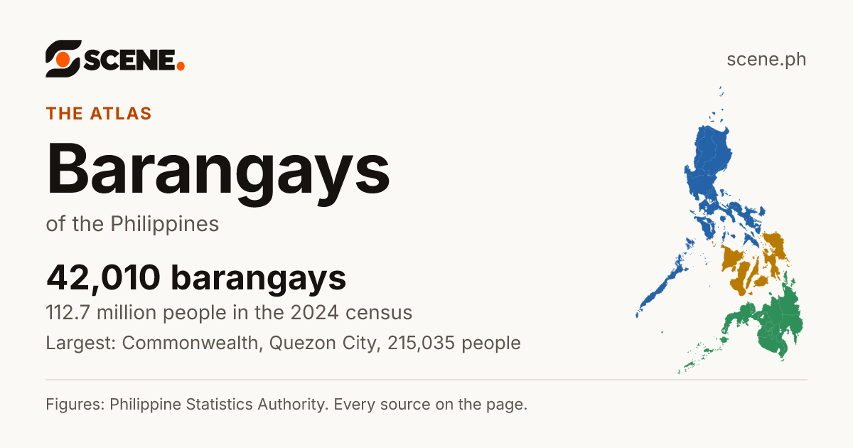
This is how the link shows on Facebook, Messenger, Viber, WhatsApp and X.
Or share on
- Share on Facebook (opens in a new tab)
- Share on WhatsApp (opens in a new tab)
- Share on Viber (opens the Viber app)
- Share on X (opens in a new tab)
- Share on Telegram (opens in a new tab)
- Share on Threads (opens in a new tab)
- Share on LINE (opens in a new tab)
- Share on LinkedIn (opens in a new tab)
- Share on Reddit (opens in a new tab)
- Share on Pinterest (opens in a new tab)
- Share on Bluesky (opens in a new tab)
- Share on Tumblr (opens in a new tab)
- Share by SMS (opens your messages app)
- Share by Email
Viber opens the Viber app on this device. Without it, copy the link above.

At a glance
- People, 2024CensusA count of every person in the country, all on one day. The 2024 census counted people as they were on 1 July 2024.More in the glossary
- 112,727,776[3]
- Of the 112,729,484 the census counted, 1,708 were in embassies abroad, in no region.
- Urban or ruralUrban barangayThe PSA counts a barangay as urban when it has 5,000 people or more, or a big employer, or several businesses and public services close by. Every barangay in Metro Manila is urban.More in the glossary
- 8,209 urban[4]
- 33,801 rural, as the PSA classes each barangay.
- Largest by landLand areaThe land inside the place's official boundary. A square kilometre is a square 1 km on each side, about the size of 140 football fields.More in the glossary
- Lapi[6]
- Peñablanca, Cagayan
- about 833.28 km²
- Fastest growing, 5,000 people or moreGrowth a yearHow fast the number of people changed each year between two censuses. 1% a year means about 1 more person for every 100 people, each year.More in the glossary
- Cogon Ramos[7, 8]
- Cebu City, Cebu
- 36.65% a year, 2020 to 2024
- Fewer people than in 2020Growth a yearHow fast the number of people changed each year between two censuses. 1% a year means about 1 more person for every 100 people, each year.More in the glossary
- 14,075 barangays[8]
- Of those with 5,000 people or more, the steepest fall: Mayapa, −13.70% a year.
Sort: Most people
Each row is a barangay, with its 2024 census figures. Choose a column heading or a sort button to order the list, and choose it again to turn the order round. Narrow it with the menus.
42,010 barangays, 11,501 to 11,550 shown, most people first.
| Rank | Name | People, 2024 | People per km² | Area | Growth, 2020–2024 | Urban or rural |
|---|---|---|---|---|---|---|
| 11,501 | MaugatTanauan City, Batangas | 2,445 | about 889 | about 2.75 km² | 1.12% a year | Rural |
| 11,502 | Santo RosarioSto. Tomas, Pampanga | 2,445 | about 1,881 | about 1.30 km² | −1.84% a year | Rural |
| 11,503 | SimsimanPahamuddin, Special Geographic Area | 2,445 | about 505 | about 4.84 km² | −0.59% a year | Rural |
| 11,504 | BalengaengDavao City, Davao del Sur | 2,444 | about 550 | about 4.44 km² | 0.54% a year | Rural |
| 11,505 | KorosoyanBarira, Maguindanao del Norte | 2,444 | about 759 | about 3.22 km² | 4.08% a year | Rural |
| 11,506 | LalakhanSanta Maria, Bulacan | 2,444 | about 5,018 | about 0.487 km² | 1.27% a year | Urban |
| 11,507 | San IsidroMacabebe, Pampanga | 2,444 | about 3,552 | about 0.688 km² | 0.32% a year | Rural |
| 11,508 | TalapasPagagawan, Maguindanao del Sur | 2,444 | about 97 | about 25.20 km² | 5.36% a year | Rural |
| 11,509 | Barangay 730Manila | 2,443 | about 53,929 | about 0.0453 km² | 11.72% a year | Urban |
| 11,510 | Barangay 881Manila | 2,443 | about 55,904 | about 0.0437 km² | 1.19% a year | Urban |
| 11,511 | BayasEstancia, Iloilo | 2,443 | about 3,407 | about 0.717 km² | −1.63% a year | Rural |
| 11,512 | CaiganganBuenavista, Marinduque | 2,443 | about 766 | about 3.19 km² | −1.60% a year | Rural |
| 11,513 | KauswaganLoreto, Agusan del Sur | 2,443 | about 95 | about 25.83 km² | 3.08% a year | Rural |
| 11,514 | NamillanganAlfonso Lista, Ifugao | 2,443 | about 134 | about 18.27 km² | 0.32% a year | Rural |
| 11,515 | San RoqueAlaminos, Laguna | 2,443 | about 1,076 | about 2.27 km² | 1.64% a year | Rural |
| 11,516 | GibgosCaramoan, Camarines Sur | 2,442 | about 380 | about 6.43 km² | 0.97% a year | Rural |
| 11,517 | KaligtasanBongabong, Oriental Mindoro | 2,442 | about 409 | about 5.97 km² | −0.66% a year | Rural |
| 11,518 | PinamaniquianLigao City, Albay | 2,442 | about 848 | about 2.88 km² | 3.19% a year | Rural |
| 11,519 | PoblacionSanta Fe, Romblon | 2,442 | about 620 | about 3.94 km² | −1.08% a year | Rural |
| 11,520 | Binakayan-KanluranKawit, Cavite | 2,441 | about 4,223 | about 0.578 km² | −0.78% a year | Rural |
| 11,521 | BMA-BalagtasSan Rafael, Bulacan | 2,441 | about 782 | about 3.12 km² | 1.83% a year | Rural |
| 11,522 | Del CarmenLubao, Pampanga | 2,441 | about 897 | about 2.72 km² | 1.31% a year | Rural |
| 11,523 | KudenTalitay, Maguindanao del Norte | 2,441 | about 467 | about 5.23 km² | 3.89% a year | Rural |
| 11,524 | New BantayanAsuncion, Davao del Norte | 2,441 | about 286 | about 8.53 km² | 0.19% a year | Rural |
| 11,525 | San MartinProsperidad, Agusan del Sur | 2,441 | about 49 | about 49.97 km² | 0.66% a year | Rural |
| 11,526 | TeresitaSanto Niño, South Cotabato | 2,441 | about 350 | about 6.97 km² | 0.39% a year | Rural |
| 11,527 | TibagCalapan City, Oriental Mindoro | 2,441 | about 16,605 | about 0.147 km² | 0.27% a year | Rural |
| 11,528 | AsinanBugallon, Pangasinan | 2,440 | about 2,542 | about 0.96 km² | 4.11% a year | Rural |
| 11,529 | Barangay 127Caloocan City | 2,440 | about 47,287 | about 0.0516 km² | 0.60% a year | Urban |
| 11,530 | CabitenMankayan, Benguet | 2,440 | about 131 | about 18.57 km² | 3.34% a year | Urban |
| 11,531 | Del Carmen-Del RosarioMinalabac, Camarines Sur | 2,440 | about 533 | about 4.58 km² | −1.60% a year | Rural |
| 11,532 | DidtarasLambayong, Sultan Kudarat | 2,440 | about 431 | about 5.66 km² | −1.12% a year | Rural |
| 11,533 | KibongcogSan Fernando, Bukidnon | 2,440 | about 45 | about 54.30 km² | 1.63% a year | Rural |
| 11,534 | Natappian EastSolana, Cagayan | 2,440 | about 1,196 | about 2.04 km² | 0.10% a year | Rural |
| 11,535 | PagedaTalitay, Maguindanao del Norte | 2,440 | about 534 | about 4.57 km² | 5.18% a year | Rural |
| 11,536 | PanikihanGumaca, Quezon | 2,440 | about 526 | about 4.64 km² | 1.13% a year | Rural |
| 11,537 | PinantaoParang, Maguindanao del Norte | 2,440 | about 147 | about 16.63 km² | 0.94% a year | Rural |
| 11,538 | San FranciscoMainit, Surigao del Norte | 2,440 | about 529 | about 4.61 km² | 1.96% a year | Rural |
| 11,539 | Sumo-sumoTago, Surigao del Sur | 2,440 | about 295 | about 8.26 km² | −0.34% a year | Rural |
| 11,540 | Zone 7 Pob.Bangued, Abra | 2,440 | about 3,526 | about 0.692 km² | −5.56% a year | Urban |
| 11,541 | BalnateMagsaysay, Davao del Sur | 2,439 | about 369 | about 6.61 km² | 14.03% a year | Rural |
| 11,542 | Barangay 772Manila | 2,439 | about 77,429 | about 0.0315 km² | 0.13% a year | Urban |
| 11,543 | DoyongSan Carlos City, Pangasinan | 2,439 | about 2,917 | about 0.836 km² | 1.29% a year | Rural |
| 11,544 | JonopMalinao, Albay | 2,439 | about 881 | about 2.77 km² | 0.98% a year | Rural |
| 11,545 | LanitonBasud, Camarines Norte | 2,439 | about 619 | about 3.94 km² | 6.33% a year | Rural |
| 11,546 | MudanGlan, Sarangani | 2,439 | about 146 | about 16.68 km² | 0.70% a year | Rural |
| 11,547 | NamboonganSanto Tomas, La Union | 2,439 | about 1,297 | about 1.88 km² | −0.24% a year | Rural |
| 11,548 | Nica-anLibungan, Cotabato | 2,439 | about 360 | about 6.77 km² | 4.52% a year | Rural |
| 11,549 | RiveraSan Juan City | 2,439 | about 37,697 | about 0.0647 km² | 0.58% a year | Urban |
| 11,550 | Barangay 4Indang, Cavite | 2,438 | about 3,858 | about 0.632 km² | 0.67% a year | Urban |
How it fits
A barangay is the smallest unit of government, led by a punong barangay (the kapitan) and a council of kagawad. Every city and municipality is made up of barangays.
Sources
The list shows each place's own figures: people from the PSA's 2024 census, growth from its 2020 census, land areas from the Land Management Bureau's 2019 masterlist. A barangay's area is measured inside its border on UN OCHA's map and is approximate, and a barangay shows no growth where its border changed after 2020. Every figure's source is on its place's page; how Scene works out the rest.
- 1.Congress of the Philippines. Republic Act No. 7160: the Local Government Code of 1991. Published October 10, 1991. Read by Scene October 2, 2026. Philippine government work, no copyright (Republic Act No. 8293, Section 176.1). Open the source
- 2.Philippine Statistics Authority. Philippine Standard Geographic Code (PSGC), 2nd Quarter 2026: Publication Datafile. Published June 30, 2026. Read by Scene September 24, 2026. CC BY (PSA Terms of Use). Open the source
- 3.Philippine Statistics Authority. Population and Annual Population Growth Rate of the Philippines and its Regions, Provinces, and Highly Urbanized Cities Based on the 2010, 2015, 2020 and 2024 Population Census (OpenSTAT table 0211A6DAPG0). Published August 7, 2026. Read by Scene October 2, 2026. CC BY (PSA Terms of Use). Open the source
- 4.Philippine Statistics Authority. Total Population and Urban Population by Urban Classification and Region, Province, Highly Urbanized City, City/Municipality and Barangay: Philippines, 2024 (OpenSTAT table 0231A6DPUP0). Published August 7, 2026. Read by Scene October 2, 2026. CC BY (PSA Terms of Use). Open the source
- 5.Philippine Statistics Authority. Total Population, Household Population, and Number of Households by Province, City, Municipality, and Barangay as of 01 July 2024 : National Captial Region (NCR) (OpenSTAT table 0171A6DTHP6). Published August 5, 2026. Read by Scene October 2, 2026. CC BY (PSA Terms of Use). Open the source
- 6.UN OCHA, from the PSA and NAMRIA. Philippines: Subnational Administrative Boundaries (COD-AB), barangay layer. Published February 13, 2025. Read by Scene September 25, 2026. CC BY-IGO 3.0. Open the source
- 7.Philippine Statistics Authority. Total Population, Household Population, and Number of Households by Province, City, Municipality, and Barangay as of 01 July 2024: Central Visayas (OpenSTAT table 0071A6DTPH6). Published August 5, 2026. Read by Scene October 2, 2026. CC BY (PSA Terms of Use). Open the source
- 8.Philippine Statistics Authority. Philippine Standard Geographic Code (PSGC), 4th Quarter 2022: Publication Datafile, with the 2015 and 2020 census counts (the PSA's file, as the Internet Archive keeps it). Published December 31, 2022. Read by Scene October 2, 2026. CC BY (PSA Terms of Use). Open the source
Scene adds what the sources do not print themselves: growth rates, shares, barangay areas and densities, coordinates, neighbours and distances, each computed from the figures and borders above. How each is made.
See something wrong on this page? Write to hello@scene.ph with the page address. We check every report against the source.