Old maps of the land now in MIMAROPA
4 maps, made 1900, from the American era. Each with the archive that holds it, its date and its rights.
Pictures, oldest first
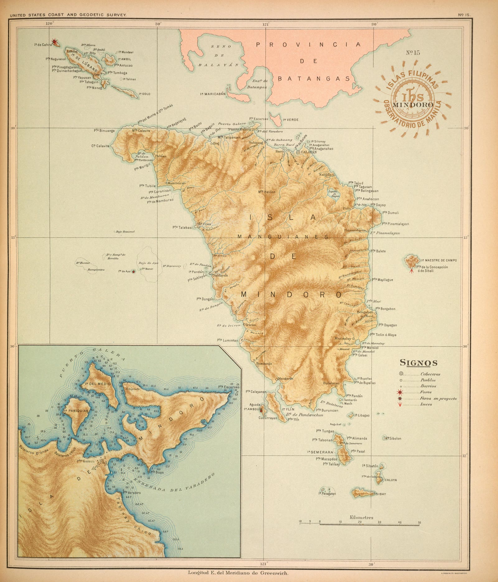
Atlas of the Philippine Islands (Atlas de Filipinas), No. 15: Isla de Mindoro [The island of Mindoro]
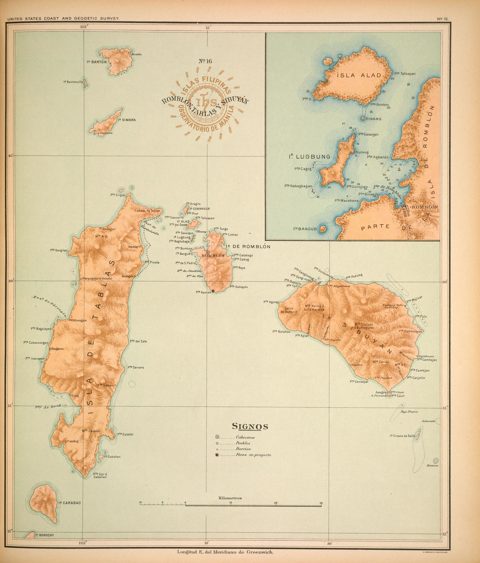
Atlas of the Philippine Islands (Atlas de Filipinas), No. 16: Islas de Sibuyán, Romblón y Tablas [The islands of Sibuyan, Romblon, and Tablas]
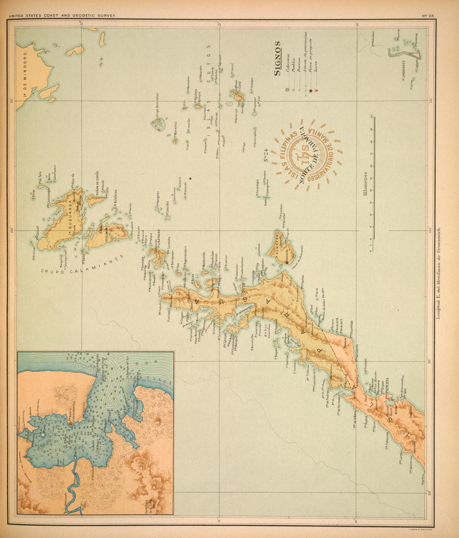
Atlas of the Philippine Islands (Atlas de Filipinas), No. 24: Isla de Paragua ó Palawan Norte [The island of Paragua, or North Palawan]
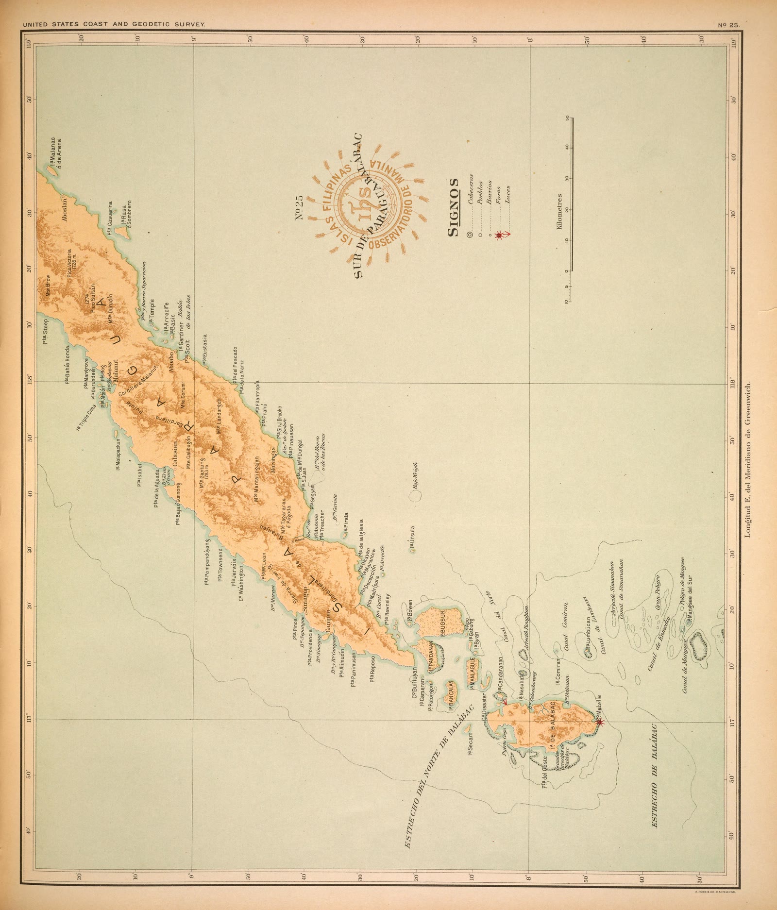
Atlas of the Philippine Islands (Atlas de Filipinas), No. 25: Isla de Paragua ó Palawan Sur [The island of Paragua, or South Palawan]


Sources
Page updated October 9, 2026. Archive catalog release e205c7180a5b.
Who holds the pictures on this page, and their rights. Each picture's own page names its record.
- 1.Smithsonian Libraries; scan by Smithsonian Libraries via the Internet Archive. 4 pictures. No known restrictions.
Every holder, licence and author in the Archive: Data and credits.
See something wrong on this page? Write to hello@scene.ph with the page address. We check every report against the source.