Old maps of the land now in Central Visayas
3 maps, made 1862 to 1900, from the Spanish era, the American era. Each with the archive that holds it, its date and its rights.
Central Visayas in the Atlas today
Pictures, oldest first
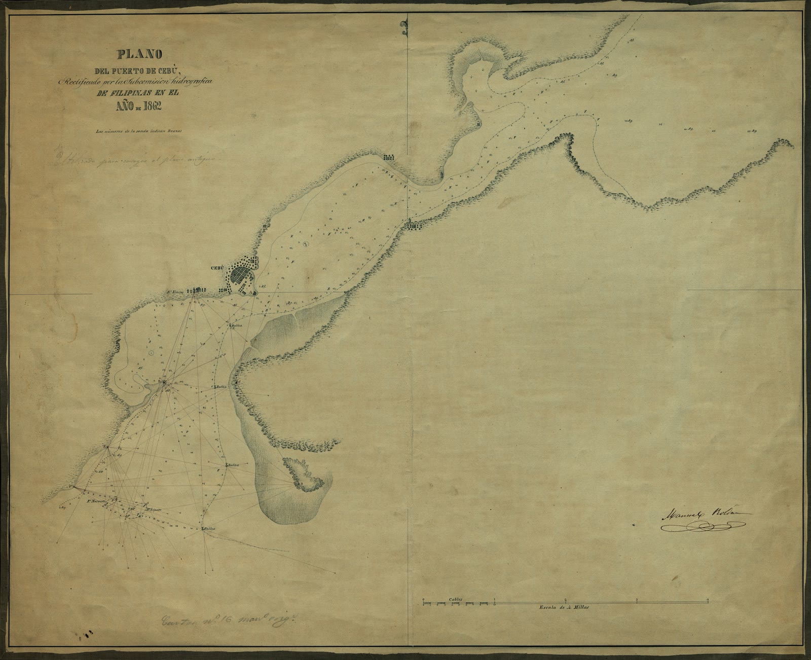
Plano del Puerto de Cebú
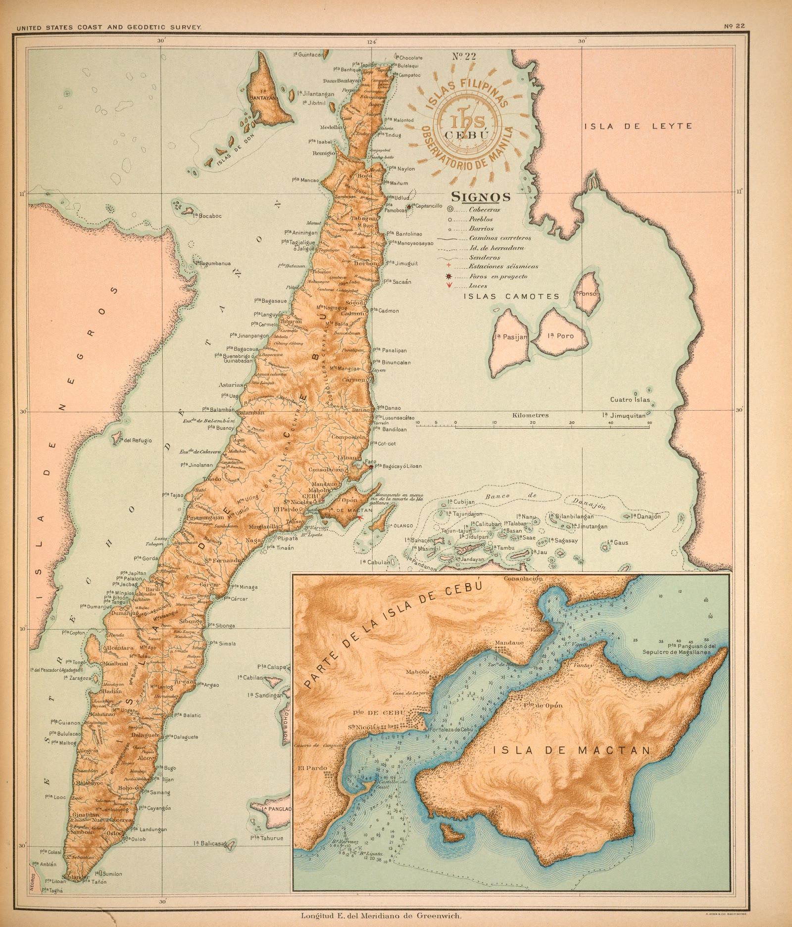
Atlas of the Philippine Islands (Atlas de Filipinas), No. 22: Isla de Cebú [The island of Cebu]
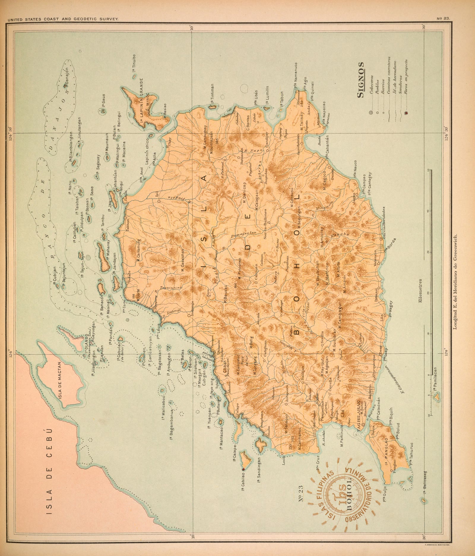
Atlas of the Philippine Islands (Atlas de Filipinas), No. 23: Isla de Bohol [The island of Bohol]


Sources
Page updated October 9, 2026. Archive catalog release e205c7180a5b.
Who holds the pictures on this page, and their rights. Each picture's own page names its record.
- 1.Archivo Histórico de la Armada Juan Sebastián de Elcano / Biblioteca Virtual de Defensa (Ministerio de Defensa, Spain). 1 picture. Creative Commons Attribution.
- 2.Smithsonian Libraries; scan by Smithsonian Libraries via the Internet Archive. 2 pictures. No known restrictions.
Every holder, licence and author in the Archive: Data and credits.
See something wrong on this page? Write to hello@scene.ph with the page address. We check every report against the source.